The CPR built the N&S Railroad to connect the mining regions of the Slocan and Sandon area to the main line from Revelstoke to Nakusp.
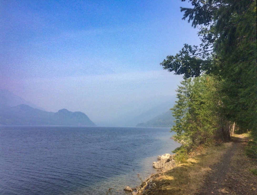
North of Nelson long stunning Slocan Lake is the home of two more joined rail trails. The Nakusp & Slocan Rail Trail connects the charming waterfront towns of Nakusp and New Denver, passing peaceful Summit Lake as it winds its way between towering mountains. Starting in New Denver, the Galena Rail Trail climbs along a bumpy abandoned mining trail to Three Forks and features a memorable cable car over a rushing creek below.
HISTORY
The railway route was built during the mining boom in the Kootenays during the 1890s. A major silver find on Payne Mountain immediately grew into the city of Sandon (now a ghost town) and the CPR wanted to connect the region with their mainline. The Great Northern Railway, its big competitor in the area, was backing the Kaslo and Slocan Railway (K&S) that was building a 3 ft (914 mm) narrow gauge railway from Kaslo on Kootenay Lake west to Sandon.
The railway received its charter from the provincial government in 1892 and was immediately leased by the CPR. By October 1894, the railway had been completed from Nakusp, along Slocan Lake and up the valley to Three Forks. When the K&S connected to Sandon in 1895, which was growing into a bigger community in the area, the CPR decided to extend the line to Sandon by a 7 km (4.3 mi) extension.
The N&S and the K&S were aggressively competitive for the ore produced by the mines in the area. At one point, K&S demolished the CPR depot after it was built on contested land. In 1912, with the mining slowing down, the CPR bought K&S and built a new line up Carpenter Creek to the pass and a connection with the grade of the K&S. The narrow gauge K&S was rebuilt to 4 ft 8 1⁄2 in (1,435 mm) (standard gauge) and the entire line to Kaslo was operated as part of the CPR.
The N&S also served as a connection between the CPR’s C&K railway connecting to Nelson, the smelter at Trail and other points. Before the southern mainline was completed, the N&S was the bypass route, rather than using boats up the entire length of the Arrow Lakes, which was often blocked by ice and low water.
Decreasing traffic, high maintenance costs, and railway deregulation led to services being cut back and eventually abandoned during the latter part of the 20th century. The line between New Denver and Kaslo was severed in the 1950s due to mudslides, and the rails were removed from Kaslo in the 1970s. The last rail car ferry on Slocan Lake was closed in 1988.
Parts of the line have been converted to a multi-use rail trail, known as the Slocan Valley Rail Trail.
GALENA TRAIL – 12.8km
The original railway from New Denver ended at Three Forks and relied on the mines in Sandon to transport their ore to this trailhead. But when the Kaslo & Slocan Railway built their line to Sandon in 1895, the CPR was forced also to extend their line up one of the steepest railway grades ever built. The CPR and the N&S line provided service to the mines of Sandon until 1955.
Km 0 Three Forks. Where the three creeks come together. The trailhead is 50m up the road from Highway 31A. The trail starts with a 300m downhill trail to the rail grade.
Km 1.8 Alamo. The Alamo Concentrator employed 200 people at its height, processing ore from the local mines. Remains of the concentrator, the hydroelectric plant, and the community cover the hillside.
Km 1.9 Carpenter Creek. A 21m bridge was once here but has been replaced by a bike-carrying cable car crossing the creek.
Km 4.3 Frame Trestle. A single track and a small bridge bypass this missing trestle.
Km 4.6 Capella Creek. A new bridge was built on top of the original trestle.
Km 6 End of abandoned section 1957.
Km 6.7 Denver Siding Road. Trailhead is 200m down the road. Parking area.
Km 6.8 Highway 31A
Km 7.8 Highway 6
Trailhead
Km 12.2 Darosa Drive. The official end of the Galena Trail. Parking area, outhouse at km 12.
Km 12.4 Wilson Creek
Km 12.8 Roseberry.
ROSEBERRY to NAKUSP – 45kms
Km 19.6 Water Tank.
Km 21.7 Hills
Km 22.1 Road
Km 22.5 Dumont Spur
Km 23.3 Arthur Creek. Pile Trestle
Km 38.8 Summit Lake. Had a wye for the days of steam engines.
Km 45.4 Trestle
Km 46.7 Box Lake
Km 48.9 Highway 6
Km 56.1 Nakusp
Km 58.6 Old Nakusp
The Nakusp & Slocan (N&S) Railway and Galena Trail combine to create a continuous rail trail between Nakusp (in the northwest) and Three Forks east of New Denver. The northwestern portion from Summit Lake to Nakusp is reported to be well maintained by the Nakusp and Area Community Trails Society. The section between Summit Lake and Rosebery has some overgrowth and is subject to water issues in spring and early summer. Expect motorized use on these sections.
The popular 14-15 km Galena Trail, starting at Rosebery west of New Denver to Three Forks, is a designated non-motorized greenway and is well managed by the Regional District. It features a cable car that allows users to cross Carpenter Creek near Three Forks.