
LOUISIANA (New Orleans, Baton Rouge, Shreveport, Lafayette)
Because of the high incidence of coveid 19 in New Orleans. the only part of Louisiana I saw was the far northwest corner.
Haughton Cross (Church of the Cross), Haughton. In the NM:” Religious Monuments” series, this is the tallest cross in the US at 100 feet, 1 foot below the allowed limit of 200 feet the limit allowed because of aircraft. It is quite skinny and is anchored to the earth in the center of a giant Star of David, as if impaling it.
The Central Assembly of God – Church of the Cross began with 21 charter members on Aug. 10, 1961. It outgrew its facilities at 2101 US Hwy. 80, expanding to its current location at 700 US Hwy. 80 and shepherding more than 1,000 believers. The cross monument was erected in 2009.

Shreveport (pop 190,000)
Shreveport ranks third in population in Louisiana after New Orleans and Baton Rouge. Shreveport extends along the west bank of the Red River (most notably at Wright Island, the Charles and Marie Hamel Memorial Park, and Bagley Island).
Shreveport was founded in 1836 by the Shreve Town Company, a corporation established to develop a town at the juncture of the newly navigable Red River and the Texas Trail, an overland route into the newly independent Republic of Texas. The city grew throughout the 20th century and, after the discovery of oil in Louisiana, became a national center for the oil industry. With economic problems the city struggled with a declining population, poverty, drugs and violent crime but the city began efforts to revitalize its infrastructure to end its population decline, revive the economy through diversification, and lower crime.
Shreveport is the educational, commercial and cultural center of the Ark-La-Tex region, where Arkansas, Louisiana, and Texas meet.
After Louisiana, I continued in Texarkana and onto Arkansas.
Monumental Earthworks of Poverty Point
This prehistoric earthwork constructed by the Poverty Point culture in present-day northeastern Louisiana though evidence of the Poverty Point culture extended 100 miles (160 km) across the Mississippi Delta and south to the Gulf Coast. The Poverty Point site has been designated as a U.S. National Monument, a U.S. National Historic Landmark, and UNESCO World Heritage Site.
The site is 15.5 miles (24.9 km) from the current flow of the Mississippi River, and is situated on the edge of Macon Ridge, near the village of Epps in West Carroll Parish, Louisiana.
The Poverty Point site contains earthen ridges and mounds built by indigenous people between 1700 and 1100 BC during the Late Archaic period in North America. Archaeologists have proposed a variety of possible functions for the site including as a settlement, a trading center, and/or a ceremonial religious complex.
The 402-acre (163 ha) property contains “the largest and most complex Late Archaic earthwork occupation and ceremonial site yet found in North America”. Euroamericans described the site in the 19th century. Poverty Point has been the focus of professional archaeological excavations since the 1950s. The earthworks are named after a 19th century plantation on the property.
NOMAD MANIA Louisiana (New Orleans, Baton Rouge, Shreveport, Lafayette)
World Heritage Sites: Monumental Earthworks of Poverty Point
Sights: French Quarter, New Orleans
Borders: United States of America 48 states (sea border/port)
XL: Mississippi Delta
Museums:
Bossier City: Mardi Gras Museum
Carville: National Hansen’s Disease Museum
Kentwood: Britney Spears Museum
Lake Providence: Louisiana State Cotton Museum
House Museums/Plantations
Darrow: Houmas House Plantation and Gardens
Destrehan Plantation
Edgard: Whitney Plantation Historic District
Ferriday: Jerry Lee Lewis Museum
Garyville: San Francisco Plantation House
Melrose: Melrose Plantation
Natchez: Oakland Plantation
Terrebonne: Southdown Plantation
Vacherie: Laura Plantation
Vacherie: Oak Alley Plantation
Vacherie: St. Joseph Plantation
Wallace: Evergreen Plantation
Modern Architecture Buildings: Lake Charles: L’Auberge du Lac Resort
Religious Monuments: Haughton: Haughton Cross (Church of the Cross)
The Dark Side: Angola: State Penitentiary Museum
Villages and Small Towns
COVINGTON
ST. MARTINVILLE
NATCHITOCHES
Festivals: Natchitoches Christmas Festival, Louisiana
Aquariums: National Fish Hatchery and Aquarium
Cities of the Americas
LAFAYETTE
BATON ROUGE
Airports: Baton Rouge (BTR)
Museums: Louisiana Museum of Natural History
House Museums/Plantations: Magnolia Mound Plantation House
Botanical Gardens: Burden Museum & Gardens
Maritime/Ship Museums: USS Kidd
Open-Air Museums: Rural Life Museum
NEW ORLEANS World Cities and Popular Towns
Airports: New Orleans (MSY)
Railway, Metro, Funiculars, Cable Cars: New Orleans Streetcars
Museums:
New Orleans Jazz Museum at the Old U.S. Mint
New Orleans Museum of Art
Ogden Museum of Southern Art
The National WWII Museum
Religious Temples: St. Louis Cathedral
Modern Architecture Buildings: Piazza d’Italia
Entertainment/Things to do: Live jazz in the French Quarter
Zoos: Audubon Zoo
Festivals
New Orleans Jazz and Heritage Festival
New Orleans Mardi Gras
Hospitality Legends
Antoine’s Restaurant
Hotel Monteleone
Lafitte’s Blacksmith Shop Bar
Le Pavillion Hotel
The Dark Side
Metairie Cemetery
Museum of Death
SHREVEPORT
Aquariums: Shreveport Aquarium
++++++++++++++++++
ARKANSAS (Little Rock, Fort Smith)
Arkansas’ name is from the Osage language. The state’s diverse geography ranges from the mountainous regions of the Ozark and the Ouachita Mountains, which make up the U.S. Interior Highlands, to the densely forested land in the south known as the Arkansas Timberlands, to the eastern lowlands along the Mississippi River and the Arkansas Delta.
The capital and most populous city is Little Rock, located in the central portion of the state, a hub for transportation, business, culture, and government. The northwestern corner of the state, such as the Fayetteville–Springdale–Rogers Metropolitan Area and Fort Smith metropolitan area, is a population, education, and economic center.
The Territory of Arkansas was admitted to the Union as the 25th state on June 15, 1836. Much of the Delta had been developed for cotton plantations, and the state landowners largely depended on enslaved African Americans as workers. In 1861, Arkansas seceded from the United States and joined the Confederate States of America during the Civil War. On returning to the Union in 1868, the state continued to suffer due to its reliance on the large-scale plantation economy. Cotton continued as the leading commodity crop, although the cotton market declined. Because farmers and businessmen did not diversify and there was little industrial investment, the state fell behind in terms of its economy and opportunities for residents.
White rural interests dominated the state’s politics by disenfranchisement of African Americans and by refusal to reapportion the legislature.
Following World War II, Arkansas began to diversity its economy. In the 21st century, its economy is based on service industries, aircraft, poultry, steel, and tourism, along with important commodity crops of cotton, soybeans and rice.
Crater of Diamonds State Park, Murfreesboro.
HOT SPRINGS
Hot Springs National Park
Garvan Woodland Gardens.
LITTLE ROCK (pop 198,000, metropolitan 740,000)
Little Rock is the capital and most populous city. The city was incorporated in 1831, on the south bank of the Arkansas River close to the state’s geographic center. The city derives its name from a rock formation along the river, named the “Little Rock”
Little Rock is a cultural, economic, government, and transportation center within Arkansas and the South. Several cultural institutions are in Little Rock, such as the Arkansas Arts Center, the Arkansas Repertory Theatre, and the Arkansas Symphony Orchestra, in addition to hiking, boating, and other outdoor recreational opportunities. State government is a large employer, with many offices downtown.
Old State House
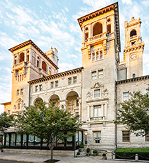
Capital Hotel. In the NM “Hospitality Legends” series, The Capital Hotel is a historic hotel. It is a four-story brick building with an elaborately decorated Victorian front facade. Its ground level window bays are articulated by Corinthian pilasters, and the tall second and third floor windows are set in round-arch openings with Ionic pilasters between. The fourth floor windows are set in segmented-arch openings with smaller Corinthian pilasters. The hotel was, when it opened in 1877, the grandest in the city, and the building is still a local landmark.

Big Dam Bridge. Opened in 2006, it spans the Arkansas River and Murray Lock and Dam between Little Rock’s Murray Park, while the northern end is at Cook’s Landing Park in North Little Rock. Little Rock and is open only to pedestrian and bicycle traffic. At 4,226 feet (1288 m) in length it is the longest pedestrian/bicycle bridge in North America that has never been used by trains or motor vehicles.

HOT SPRINGS NATIONAL PARK
Garvan Woodland Gardens
TEXARKANA
NOMAD MANIA Arkansas (Little Rock, Fort Smith)
Airports: Bantonville (XNA)
Museums
Bentonville: Crystal Bridges Museum of American Art
Bentonville: Museum of Native American History
Piggott: Hemingway-Pfeiffer Museum and Educational Center
House Museums/Plantations: Dyess: Johnny Cash Boyhood Home
World of Nature: Crater of Diamonds State Park, Murfreesboro (Sight)
Waterfalls: Mirror Lake Waterfall
Caves: Blanchard Springs Caverns
Railway Museums: Pine Bluff: Arkansas Railroad Museum
TEXARKANA
Sight: United States Post Office and Courthouse, Texarkana
XL: Texarkana (Texas/Arkansas border)
Cities of the Americas
FORT SMITH
Museums: Museum of History
LITTLE ROCK
Sights: Old State House
Airports: Little Rock (LIT)
Railway, Metro, Funiculars, Cable Cars
Little Rock: Metro Streetcar (River Rail Streetcar)
Metro Streetcar, Little Rock
Museums
Arkansas Museum of Discovery
MacArthur Museum of American Military History
Zoos: Little Rock Zoo
Hospitality Legends: Capital Hotel
Pedestrian Bridges: Big Dam Bridge
Maritime/Ship Museums: Arkansas Inland Maritime Museum
Villages and Small Towns
BATESVILLE
EUREKA SPRINGS
Religious Temples: Thorncrown Chapel
Hospitality Legends: Crescent Hotel
HOT SPRINGS NATIONAL PARK (Sight)
Museums: Hot Springs: Gangster Museum of America
Botanical Gardens: Hot Springs: Garvan Woodland Gardens
FAYETTEVILLE*
Botanical Gardens: Fayetteville: Botanical Garden of the Ozarks
Aviation Museums: Fayetteville: Arkansas Air & Military Museum
++++++++++++++++++++++++++++++++++++++++++++++++++++++++++++++
GEORGIA NORTH (Atlanta, Macon, Augusta, Athens)
ATLANTA
BAPS Shri Swaminarayan Mandir
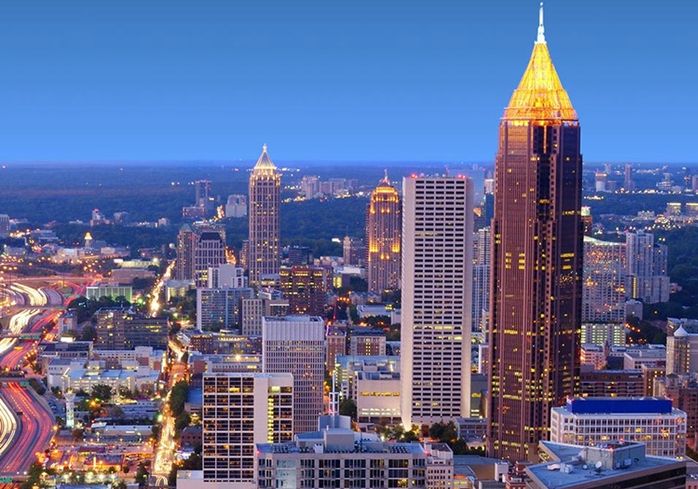
Bank of America Plaza. In the NM “Modern Architecture Buildings” series, this skyscraper is 311.8 m (1,023 ft), the 21st tallest building in the U.S., the tallest building in Georgia, and the tallest building in any U.S. state capital. It has 55 stories of office space and was completed in 1992.
Designed in the Postmodern style reminiscent of Art Deco, lts imposing presence is heightened by the dark color of its exterior. It soars into the sky with vertical lines that reinforce its height. The inhabited part of the building actually ends abruptly with a flat roof. On top of this is built a pyramid of girders, which are gilded and blaze at night (the building is known to Atlanta locals as the Pencil Building because of the way it glows at night. There is a 90 ft (27 m) obelisk-like spire, most covered in 23 karat (96 percent) gold leaf.
AUGUSTA (pop 199,000)
The city lies across the Savannah River from South Carolina at the head of its navigable portion. Georgia’s second-largest city after Atlanta.
Augusta was established in 1736 and is named for Princess Augusta of Saxe-Gotha (1719–1772), the bride of Frederick, Prince of Wales and the mother of the British monarch George III. During the American Civil War, Augusta housed the principal Confederate powder works. Augusta’s warm climate made it a major resort town of the Eastern United States in the early and mid-20th century. Internationally, Augusta is best known for hosting The Masters golf tournament each spring. The Masters brings over 200,000 visitors from across the world to the Augusta National Golf Club. Membership at Augusta National is widely considered to be the most exclusive in the sport of golf across the world.
NOMAD MANIA Georgia North (Atlanta, Macon, Augusta, Athens)
Sights: Stone Mountain Park
Museums
Cartersville: Booth Western Art Museum
Decatur: Waffle House Museum
Jonesboro: Road to Tara Museum
Marietta: Marietta Gone With The Wind Museum
House Museums/Plantations: Roswell: Archibald Smith Plantation Home
Entertainment/Things to do: Six Flags Over Georgia, Cobb County
Zoos: Pine Mountain: Day Butterfly Center
Theme Parks: Austell: Six Flags Over Georgia
Waterfalls: Amicalola Falls
Caves: Ellison’s Cave (Fantastic Cave Pit)
Aviation Museums: Warner Robins: Museum of Aviation Georgia
Villages and Small Towns
Dahlonega
Madison
Cities of the Americas
ATHENS
Museums: Art Museum of Georgia
Botanical Gardens: State Botanical Gardens of Georgia
ATLANTA World Cities and Popular Towns
Airports: Atlanta (ATL)
Railway, Metro, Funiculars, Cable Cars
Atlanta Streetcar
MARTA, Atlanta
Museums
Center for Civil and Human Rights
Fernbank Museum of Natural History
High Museum of Art
Martin Luther King Jr. National Historic Site
Museum of Design
House Museums/Plantations: Margaret Mitchell House
Religious Temples: BAPS Shri Swaminarayan Mandir
Modern Architecture Buildings: Bank of America Plaza
Festivals
Shaky Knees Music Festival
Imagine Music Festival, Atlanta
Zoos: Zoo Atlanta
Botanical Gardens: Atlanta Botanical Gardens
Aquariums: Georgia Aquarium
Aviation Museums
Delta Flight Museum
National Museum of Commercial Aviation
Railway Museums: Southeastern Railway Museum
Markets: Sweet Auburn Curb Market
AUGUSTA
Museums
Augusta Museum of History
Morris Museum of Art
National Science Center Fort Discovery
MACON
House Museums/Plantations: Allman Brothers Band Museum at the Big House
Festivals: International Cherry Blossom Festival
++++++++++++++++++++++++++++++++++++++++++++++++++++++++++++++
SOUTH CAROLINA (Columbia, Charleston, Greenville, Myrtle Beach)
South Carolina is the easternmost state of the Deep South. It is bordered to the north by North Carolina, to the southeast by the Atlantic Ocean, and to the southwest by Georgia across the Savannah River.
South Carolina became the eighth state to ratify the U.S. Constitution on May 23, 1788. It also became the first state to vote in favour of secession from the Union on December 20, 1860. After the American Civil War, it was readmitted into the United States on June 25, 1868. South Carolina is the 40th most extensive and 23rd most populous U.S. state.
South Carolina is named in honour of King Charles I of England, who first formed the English colony, with Carolus being Latin for “Charles”.
COLUMBIA (pop 134,000, metropolitan 768,000))
It is the capital and second largest city in South Carolina, The name Columbia is a poetic term used for the United States, originating from the name of Christopher Columbus. The city is located approximately 13 miles (21 km) northwest of the geographic center of South Carolina. It lies at the confluence of the Saluda River and the Broad River, which merge at Columbia to form the Congaree River.
Columbia is home to the University of South Carolina, the state’s flagship university and the largest in the state, and is also the site of Fort Jackson, the largest United States Army installation for Basic Combat Training. In 1860, the city was the location of the South Carolina Secession Convention, which marked the departure of the first state from the Union in the events leading up to the Civil War.
Riverbanks Zoo and Garden
Riverbanks Botanical Garden, West Columbia.
John D. Long Lake is an 80-acre (32 ha) manmade lake in Union County. It is in the NM “Dark Side” series because of the number of deaths that have occurred at the fishing pier/boat ramp. It is used for fishing, with largemouth bass, bluegill, shellcracker (redear sunfish), and catfish in the lake.
The lake is located about 3 miles (4.8 km) west of Lockhart, the nearest town, and about 7 miles (11 km) northeast of Union, the nearest city. The shores are mostly wooded, with poplars, black gum trees, and loblolly pines prevailing; cedar trees were planted in the 2010s. Hughes Creek both feeds and drains the lake, running south into it and southwards out of it to the Broad River. The elevation is 440 feet (130 m), and the depth exceeds 80 feet (24 m). Access to the western end of the lake, where the fishing pier and boat ramp is located, is via Black Bottom Road which connects to Highway 9. Access to the eastern end is from John D. Long Lake Road which connects to Highway 49. This gives out on a small parkland near the dam, where the boat ramp was formerly located.
The lake was created in the 1970s on the initiative of South Carolina state senator John David Long III and named for his father, John David Long, also a South Carolina state senator, and Ku Klux Klan and Confederate flag champion. An earthen dam was built at a pasture on Hughes Creek to fill it.
Nine people have died at the lake’s old boat ramp. In 1994, Susan Smith drowned her two sons there, in a case which attracted national attention. Granite memorials were raised to the boys, and many visitors came. In 1996 seven died when their car rolled down the boat ramp into the lake, after which the memorials were moved and the boat ramp dug up and grassed over.
In 2013, the lake was closed for two years, the bass were stunned and relocated, the lake drained, trees cut and planted, 635.7 short tons of gravel laid down to create spawning grounds for bluegill and shellcracker and the lake was refilled.
NOMAD MANIA South Carolina (Columbia, Charleston, Greenville, Myrtle Beach)
Islands
HILTON HEAD
Museums: Coastal Discovery Museum
JOHNS
Villages and Small Towns
Anderson
Beaufort
Walterboro
House Museums/Plantations
McClellanville: Hampton Plantation House
Mt Pleasant: Boone Hall Plantation
Religious Monuments: Lake City: Lake City Cross
Maritime/Ship Museums
Georgetown: South Carolina Maritime Museum
Mt. Pleasant: Patriots Point Naval & Maritime Museum
Railway Museums: Winnsboro: Railway Museum
The Dark Side: Union: John D. Long Lake
Bizzarium: Bishopville: Button King Museum
MYRTLE BEACH*
Airports: Myrtle Beach (MYR)
Museums:Myrtle Beach: Civil War Museum
Beaches: Myrtle Beach (beach!)
Cities of the Americas
CHARLESTON
Sights
Charleston historic district, Charleston
Airports: Charleston (CHS)
Museums
Charleston Museum
Halsey Institite of Contemporary Art
Old Slave Mart
North Charleston: Fire Museum
House Museums/Plantations
Drayton Hall
Magnolia Plantation and Gardens
McLeod Plantation
Middleton Place
Castles, Palaces, Forts: Fort Sumter (Sight)
Aquariums: South Carolina Aquarium
Theme Parks: Carowinds
Hospitality Legends: Francis Marion Hotel
Markets: Charleston: Old City Market
COLUMBIA
Airports: Columbia (CAE)
Zoos: Riverbanks Zoo and Garden
Botanical Gardens: West Columbia: Riverbanks Botanical Garden
GREENVILLE/SPARTANBURG
Airports: Greenville–Spartanburg (GSP)
Museums: South Carolina State Museum
Museums: Children’s Museum of the Upstate
Pedestrian Bridges:Greenville: Liberty Bridge at Falls Park on the Reedy
Vehicle Museums: Greenville: BMW Zentrum Museum
+++++++++++++++++++++++++++++++++++++++++++++++++++++++++
NORTH CAROLINA (Charlotte, Raleigh, Greensboro, Durham)
North Carolina is the 28th largest and 9th-most populous of the 50 United States. It is bordered by Virginia to the north, the Atlantic Ocean to the east, Georgia and South Carolina to the south, and Tennessee to the west. Raleigh is the state’s capitol. state’s capital and Charlotte is its largest city. The Raleigh metropolitan area is the second-largest metropolitan area in the state, with an estimated population of 1,362,540 in 2018, and is home to the largest research park in the United States, Research Triangle Park.
North Carolina was established as a royal colony in 1729 and is one of the original Thirteen Colonies. North Carolina is named in honor of King Charles I of England who first formed the English colony, with Carolus being Latin for “Charles”. In 1789, North Carolina became the 12th state to ratify the United States Constitution. In the run-up to the American Civil War, North Carolina declared its secession from the Union on May 20, 1861, becoming the last of eleven states to join the Confederate States.
On December 17, 1903, Orville and Wilbur Wright successfully piloted the world’s first controlled, sustained flight of a powered, heavier-than-air aircraft at Kill Devil Hills in North Carolina’s Outer Banks.
North Carolina is defined by a wide range of elevations and landscapes. From west to east, North Carolina’s elevation descends from the Appalachian Mountains to the Piedmont and Atlantic coastal plain
Mount Mitchell at 6,684 feet (2,037 m) is the highest-point in North America east of the Mississippi River. Most of the state falls in the humid subtropical climate zone with the western, mountainous part of the state has a subtropical highland climate.
McAdenville (pop 651 2010)
Known as Christmas Town USA, this small town is a suburb of Charlotte. A Christmas tradition in the town for many years has been the decorating of the entire town in Christmas lights – 375 lit trees, over 200 wreaths attached to city light poles and buildings in the town are covered in Christmas lights and some form of decoration. The lights attract 600,000 vehicles from all over the country and is one of the biggest light shows in the US. Begun in 1956 by the largest employer and land owner in the town, many trees More than visit each year. The lights are entirely maintained by volunteers from the community, and no admission is charged.
Charlotte (pop 873,000, metropolitan 2,730,000)
The most populous city in North Carolina, between 2004 and 2014, Charlotte was ranked as the country’s fastest-growing metro area, with 888,000 new residents. Charlotte is home to the corporate headquarters of Bank of America, Truist Financial, and the east coast operations of Wells Fargo, which along with other financial institutions has made it the second-largest banking center in the United States since 1995.
It is located several miles east of the Catawba River and southeast of Lake Norman, the largest man-made lake in North Carolina. Among Charlotte’s many notable attractions, some of the most popular include the Carolina Panthers (NFL), the Charlotte Hornets (NBA), the NASCAR All-Star Race, the Wells Fargo Championship, the NASCAR Hall of Fame, the Charlotte Ballet, Children’s Theatre of Charlotte, Carowinds amusement park, and the U.S. National Whitewater Center.
Charlotte has a humid subtropical climate.
NOMAD MANIA North Carolina (Charlotte, Raleigh, Greensboro, Durham)
World Heritage Sites: Great Smoky Mountains National Park
Railway, Metro, Funiculars, Cable Cars: Great Smoky Mountains Railroad
World of Nature: Tennessee/North Carolina: Great Smoky Mountains
Tentative WHS: Moravian Church Settlements
Museums
Chapel Hill: Ackland Art Museum
Randolph: Mint Museum
Wilson: Imagination Station Science & History Museum
House Museums/Plantation
Creswell: Somerset Place
Huntersville: Latta Place
Kenansville: Liberty Hall
Mount Airy: Andy Griffith Museum
Smithfield: Ava Gardner Museum
Windsor: Historic Hope Plantation
Castles, Palaces, Forts
Atlantic Beach: Fort Macon
New Bern: Tryon Palace
World of Nature
Nantahala National Forest
Chimney Rock State Park (Sight)
Festivals:
Black Mountain: LEAF Festival
Clemmons: North Carolina Wine Festival
Entertainment/Things to do: Morehead Planetarium & Science Center, Chapel Hill
Botanical Gardens: Chapel Hill: North Carolina Botanical Garden
Aquariums: Fort Fisher Aquarium
Lighthouses: Currituck Beach Light
Waterfalls: Corbin Creek Falls
Hospitality Legends: Pinehurst: Pinehurst Resort
Monuments: Kitty Hawk: Wright Brothers’ National Memorial
Religious Monuments: Lake Junaluska: Junaluska Cross (Inspiration Point)
Pedestrian Bridges: Linville: Mile High Swinging Bridge (Grandfather Mountain)
Maritime/Ship Museums: Southport: North Carolina Maritime Museum at Southport
XL
CAPE HATTERAS
Lighthouses: Buxton: Cape Hatteras Lighthouse
Maritime/Ship Museums: Hatteras: Graveyard of the Atlantic Museum
PAMLICO SOUND
Villages and Small Towns
BLOWING ROCK
GREENVILLE
WINSTON-SALEMBEAUFORT
Maritime/Ship Museums: North Carolina Maritime Museum
McADENVILLE
Cities of the Americas
GREENSBORO/HIGH POINT
Airports: Greensboro (GSO)
ASHEVILLE
Airports: Asheville (AVL)
House Museums/Plantations: Biltmore Estates
CHARLOTTE World Cities and Popular Towns
Airports: Charlotte (CLT)
Railway, Metro, Funiculars, Cable Cars: Lynx Blue and Gold Lines
House Museums/Plantations: Rosedale
Theme Parks: Carowinds
Aviation Museums: Carolinas Aviation Museum
DURHAM
Museums: Museum of Life and Science
Entertainment/Things to do: Xtreme Kombat Paintball, Durham County
FAYETTEVILLE
Museums: Airborne and Special Operations Museum
Entertainment/Things to do: Omni Family Amusement Center, Fayetteville
RALEIGH/CARY
Airports: Raleigh/Durham (RDU)
Museums
North Carolina Museum of Art
North Carolina Museum of History
North Carolina Museum of Natural Sciences
WILMINGTON
House Museums/Plantations: Poplar Grove Plantation
Maritime/Ship Museums: U.S.S. North Carolina
++++++++++++++++++++++++++++++++++++++++++++++++++++++++++++++
WEST VIRGINIA (Charleston, Morgantown, Parkersburg)
CHARLESTON
NOMAD MANIA United States – West Virginia (Charleston, Morgantown, Parkersburg)
XL: West Virginia Northern panhandle (Moundsville)
Railway, Metro, Funiculars, Cable Cars: Pipestem State Park aerial cableway
Museums
Madison: Coal Heritage Museum
Parkersburg: Parkersburg Art Center
Point Pleasant: Mothman Museum
Weston: Museum of American Glass
House Museums/Plantations
Grafton: Anna Jarvis Museum
Martinsburg: Belle Boyd House
Martinsburg: General Adam Stephen House
Rivers: Ohio River
Botanical Gardens: Cheat Lake: West Virginia Botanic Garden
Bizzarium: Unger: Farnham Colossi
Cities of the Americas
CHARLESTON
Museums; West Virginia State Museum
Villages and Small Towns
BERKELEY SPRINGS
Castles, Palaces, Forts: Berkeley Castle
ELKINS
LEWISBURG
Museums: North House Museum
HUNTINGTON*
Museums
Museum of Art
Museum of Radio and Technology
Open-Air Museums: Heritage Farm Museum and Village
++++++++++++++++++++++++++++++++++++++++++++++++++++++++++++++
VIRGINIA (Richmond, Arlington, Norfolk, Roanoke, Harrisonburg)
Officially the Commonwealth of Virginia, is located between the Atlantic Coast and the Appalachian Mountains. The geography and climate of the Commonwealth are shaped by the Blue Ridge Mountains and the Chesapeake Bay, which provide habitat for much of its flora and fauna. The capital of the Commonwealth is Richmond; Virginia Beach is the most populous city, and Fairfax County is the most populous political subdivision. The Commonwealth’s estimated population as of 2019 is over 8.54 million.
The area’s history begins with several indigenous groups, including the Powhatan. In 1607 the London Company established the Colony of Virginia as the first permanent English colony in the New World. Virginia’s state nickname, the Old Dominion, is a reference to this status. Slave labor and the land acquired from displaced Native American tribes each played a significant role in the colony’s early politics and plantation economy. Virginia was one of the 13 Colonies in the American Revolution. In the American Civil War, Virginia’s Secession Convention resolved to join the Confederacy, and Virginia’s First Wheeling Convention resolved to remain in the Union; that led to the creation of West Virginia.
The Virginia General Assembly is the oldest continuous law-making body in the New World. The state government is unique in how it treats cities and counties equally, manages local roads, and prohibits its governors from serving consecutive terms. Virginia’s economy has many sectors: agriculture in the Shenandoah Valley; federal agencies in Northern Virginia, including the headquarters of the U.S. Department of Defence and Central Intelligence Agency (CIA); and military facilities in Hampton Roads, the site of the region’s main seaport.
George Washington and Jefferson National Forest. One of the largest areas of public land in the Eastern United States. They cover 1.8 million acres (7,300 km2) of land in the Appalachian Mountains of Virginia, West Virginia, and Kentucky. The border between the two forests roughly follows the James River. The combined forest is administered from its headquarters in Roanoke.
The northern portion of the Blue Ridge Parkway runs through the Forest. Over 2,000 miles (3,000 km) of hiking trails, including 330 miles of the Appalachian Trail (from the southern end of Shenandoah National Park through the forest and along the Blue Ridge Parkway. Features include Virginia’s highest point, Mount Rogers, Elliott Knob, one of the last remaining fire lookout towers, and Whitetop Mountain. Approximately 230,000 acres (930 km2) of old-growth forests. The ghost town of Lignite, Virginia lies within the forest. The deepest gorge east of the Mississippi River, Breaks Interstate Park, is located in the forest.
The black bear is relatively common, enough so that there is a short hunting season to control overpopulation. The George Washington National Forest is a popular destination for trail runners.
ROANOKE (pop 98,000 2010)
Bisected by the Roanoke River, Roanoke is the commercial and cultural hub of much of Southwest Virginia and portions of Southern West Virginia. Its location in the Blue Ridge Mountains, in the middle of the Roanoke Valley between Maryland and Tennessee, made it the transportation hub of western Virginia and contributed to its rapid growth.
The town was first called Big Lick in 1852, named for a large outcropping of salt which drew wildlife.
During colonial times, Roanoke was an important hub of trails and roads. The Great Indian Warpath which later merged into the colonial Great Wagon Road, one of the most heavily traveled roads of 18th-century America, ran from Philadelphia through the Shenandoah Valley to Roanoke, where the Roanoke River passed through the Blue Ridge. . At Roanoke Gap, another branch of the Great Wagon Road, the Wilderness Road, continued southwest to Tennessee.
CHARLOTTESVILLE
Monticello and the University of Virginia in Charlottesville, World Heritage Site 1987. Thomas Jefferson, third president, philosopher, scientist, historian, and author of the Declaration of the Independence, helped establish the foundations of self-government and individual freedom we know today. Jefferson’s words—the Declaration and his more than 19,000 letters—and his architecture—including Monticello and the University of Virginia— provide a lens for scholars and visitors today to view the beginnings of early America.
Monticello is the only U.S. presidential and private home on the UNESCO World Heritage List. The designation’s details Thomas Jefferson’s architectural ingenuity and use of neo-classical elements in creating both Monticello and the University of Virginia. A self-taught architect, Jefferson referred to Monticello as his “essay in architecture,” and construction continued on the mountaintop for forty years. The final product is a unique blend of beauty and function that combines the best elements of the ancient and old worlds with a fresh American perspective. Jefferson designed Monticello after ancient and Renaissance models, and in particular after the work of Italian architect Andrea Palladio. In location—a frontier mountaintop—and in design—a Renaissance villa—Monticello was intentionally a far cry from the other American homes of its day.

University of Virginia. Thomas Jefferson founded the University of Virginia in 1819. He considered the founding of the University to be one of his greatest achievements and what he called “the Hobby of my old age.” Jefferson designed the Academical Village, a terraced green space surrounded by residential and academic buildings, gardens, and the majestic center-point—the Rotunda. The most recognizable symbol of the University, the Rotunda stands at the north end of the Lawn and is half the height and width of the Pantheon in Rome, which was the primary inspiration for the building. 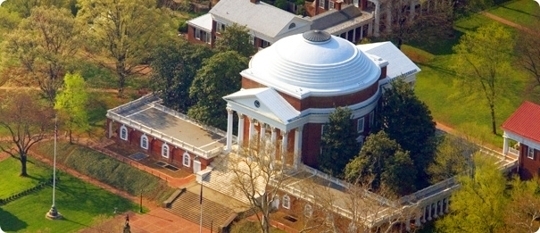
THOMAS JEFFERSON BUILDINGS Tentative WHS(30/01/2008)
These two buildings, both notable architectural works by Thomas Jefferson, are a joint extension to the World Heritage listing that includes Monticello and the University of Virginia. They represent Jefferson’s eclectic Classicism architecture with which Jefferson was concerned: domestic, educational, and governmental.
Poplar Forest, Bedford County. Poplar Forest is a rural retreat designed by Jefferson, the finishing details of which were largely executed for him by his slave John Hemings beginning before Jefferson retired from the U.S. presidency in 1809. At the historic core of the property and set just south of the remains of a grove of poplars that gave the place its name is a 2-story brick house built in a perfect octagon around a central cube. It is one of America’s first octagonal houses, drawing on Roman Classical details derived from Palladio and aspects of French late 18th century architecture, such as floor-to-ceiling windows and the use of skylights. Also surviving from Jefferson’s era are designed landscape features, including mounds flanking the house (“pavilions”) and a sunken lawn. The landscaping was inspired by English gardens. Each side of the octagon is 7 meters (22 feet); the cube at the center measures about 6 meters (20 feet) on each side. The service wing to the east was added in 1814.
Virginia State Capitol, Richmond. The Virginia State Capitol was constructed in 1785-98 on the Capitol Square Site in Richmond selected by Jefferson in 1780 when he was Governor of Virginia during the American Revolution. The Roman temple form of the original Jeffersonian central portion of the building is an enlarged version of the Maison Carrée at Nimes, France, which Jefferson visited during his service as American Minister to France. The interior plan was modeled on the earlier Virginia colonial capitol in Williamsburg. Flanking wings set back from the original building were constructed in 1904-06. The State Capitol continues to serve its historic use.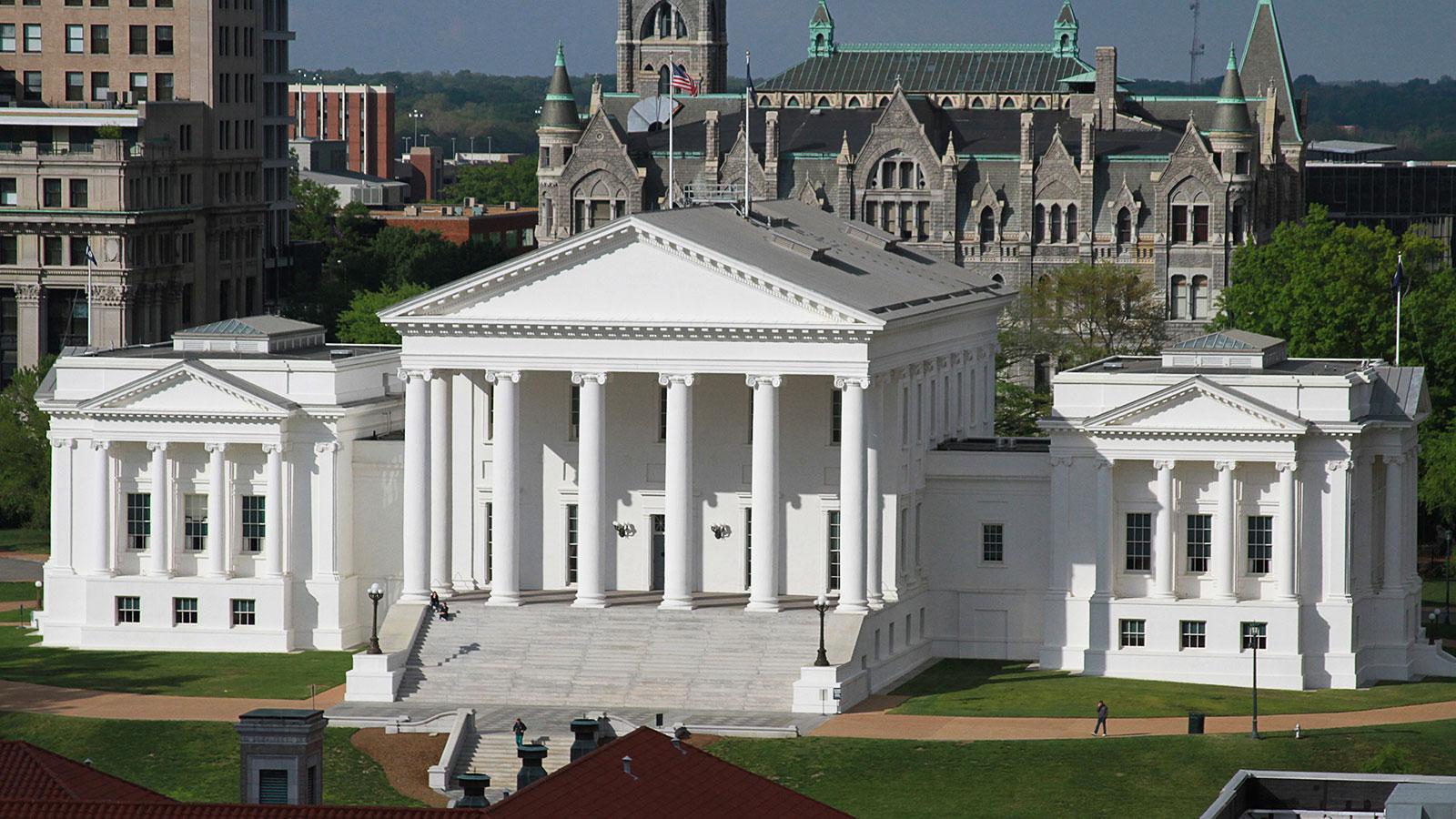
RICHMOND
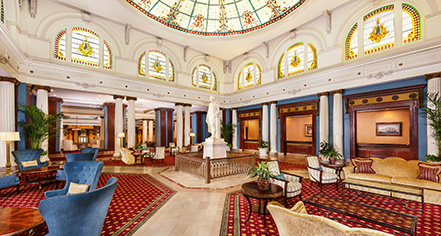
The Jefferson Hotel is a luxury hotel that opened in 1895. On site is “Lemaire”, a restaurant named after Etienne Lemaire, who served as maitre d’hotel to Thomas Jefferson from 1794 through the end of his presidency. Tobacco baron Lewis Ginter planned the development of the hotel as a premier property in the city. In 1901, there was a wire fire that destroyed three-fifths of the hotel. There were no casualties; however, the statue of Thomas Jefferson was almost destroyed. In March 1944, another fire occurred. Six people were killed during the fire.
Patrons have included thirteen United States presidents, writers, and celebrities, including Henry James, Charles Lindbergh, The Rolling Stones, Dolly Parton, Elvis Presley, and Anthony Hopkins.
In the check-in lobby, known as the Palm Court, nine original stained glass Tiffany windows with the hotel’s monogram remain. The three stained glass windows above the front desk and the stained glass dome are reproductions.
Alligators in the lobby. The alligators at the Jefferson became world-famous. Old Pompey, the last alligator living in the marble pools of the Jefferson’s Palm Court, survived until 1948. Bronze statues of the alligators now decorate the hotel. Its restaurant, Lemaire, has a theme of alligator motifs.
Monument Avenue is an avenue in Richmond with a tree-lined grassy mall dividing the east- and westbound traffic, punctuated by statues memorializing Virginian Confederate veterans of the American Civil War, including Robert E. Lee, J.E.B. Stuart, Jefferson Davis, Thomas “Stonewall” Jackson, and Matthew Fontaine Maury. There is also a monument to Arthur Ashe, a Richmond native and international tennis star who was African-American. The first monument, a statue of Robert E. Lee, was erected in 1890. Between 1900 and 1925, Monument Avenue greatly expanded with architecturally significant houses, churches and apartment buildings.
At various times (such as Robert E. Lee’s birthday and Confederate History Month) the Sons of Confederate Veterans gather along Monument Avenue in period military costumes.
In 2007, the American Planning Association named Monument Avenue one of the 10 Great Streets in the country.

 If you drive far enough down Monument Avenue past the statues of Confederate leaders General Robert E. Lee and President Jefferson Davis, you’ll find a bronze of native son Arthur Ashe, the tennis legend and activist, holding books and a racket. A few miles to the east is the Virginia Civil Rights Memorial, not far from a statue of Abraham Lincoln. This is how the former Confederate capital has dealt with the weight of history: not by removing troubling monuments, but by adding to them. It’s a different approach than the one taken by many Southern cities and towns, which have been roiled by the push to remove monuments to Confederate leaders and prominent slaveholders. From St. Louis to Orlando, from New Orleans to Charlottesville, Va., the prospect of the statues’ coming down has led to angry, sometimes violent protests among those who see them as vital to their heritage and others who see them as emblems of hate.
Yet in Richmond, which has no shortage of public memorials to defenders of white supremacy, there has been comparatively little outcry. The reason, say many residents and historians, is that the city has been working for decades to reinterpret its past, updating older tributes with much-needed context while adding new ones to the canon.
Part of it is representation. Unlike many other Southern cities, Richmond elected its first black city-council member in the 1940s and had a black mayor and a majority-black city council by the 1970s. “Once you have that in place,” says Civil War historian Kevin Levin, “you begin to shift or shape the public discussion about what kind of history you’re going to commemorate.”
Richmond was never going to pave over its Confederate past; Civil War tourism is too valuable to the local economy. But the civic discussion that began decades ago resulted in addition rather than subtraction. In 2003, seven years after the city erected the monument to Ashe, officials installed the memorial to Lincoln. Later, the Richmond Slavery Reconciliation Statue went up near Shockoe Bottom, a former slave market. On July 15 the city will unveil a statue of Maggie Walker, the first black woman to charter a bank.
T. Tyler Potterfield Memorial Bridge. Crossing the James River in Richmond, the 1,600 foot long, 10-foot wide bridge connects Brown’s Island to the James River Parks System on the Manchester side of the river, a frayed district undergoing dramatic transformation. It was originally constructed as a dam in 1901 by the Virginia Electric and Power Company (VEPCO) as a 31.5 ft (9.6 m) tall structure to divert water into the Haxall Canal where it was received by the 12th Street Power Station until its decommissioning in 1968. The bridge has been renamed after a senior planner in the Richmond Department of Planning and Development Review who was the project manager for the bridge’s redevelopment into a pedestrian bridge. Few places claim Richmond’s rich mix of old manufacturing and hydroelectric plants, railroad trestles, bridges, canal remnants and hundreds of acres of forest all connected by a wild river that’s both welcoming enough for rock hopping and rough enough for audacious kayakers. The lack of even the slightest curve or décor respects its underpinnings, an industrial-age relic.
The deck was placed over the existing piers and structures, but required new augmented metal framework. The bridge was reopened in 2016 after a $11.3 million renovation for pedestrians and cyclists. The “Three Days in April 1865” installation recounts on metal decking how the former Capital of the Confederate States of America fell and many of its people fled while fire consumed the city. 
James River begins in the Appalachian Mountains and flows 348 miles (560 km) to Chesapeake Bay. The river length extends to 444 miles (715 km) if one includes the Jackson River, the longer of its two source tributaries. It is the longest river in Virginia and the 12th longest river in the United States that remains entirely within a single state. Jamestown and Williamsburg, Virginia’s first colonial capitals, and Richmond, Virginia’s current capital, lie on the James River.
NEWPORT NEWS
Airports: Newport News (PHF)
Maritime/Ship Museum: Nauticus and USS Wisconsin BB-64
NORFOLK/CHESAPEAKE
Airports: Norfolk (ORF)
Railway, Metro, Funiculars, Cable Cars: The Tide
Museums: Chrystler Museum of Art
Botanical Gardens: Norfolk Botanical Garden
Maritime/Ship Museums: Nauticus and USS Wisconsin BB-64
VIRGINIA BEACH
Hospitality Legends: The Cavelier Hote
WILLIAMSBURG
Colonial Williamsburg Historic Area
Governor’s Palace
Jamestown Settlement
ARLINGTON
Monuments
Arlington: Tomb of the Unknown Soldier
United States Marine Corps War Memorial
Mount Vernon (30/01/2008)
++++++++++++++++++++++++++++++
United States – Virginia (Richmond, Arlington, Norfolk, Roanoke, Harrisonburg)
World Heritage Sites: Monticello and the University of Virginia in Charlottesville
Tentative WHS
Mount Vernon (30/01/2008)
Thomas Jefferson Buildings (30/01/2008)
XL
Chesapeake Bay southern islands (Bloodsworth, Smith, Tangier)
Cumberland Gap (Virginia/Kentucky/Tennessee)
Virginia Eastern Shore (Accomack and Northampton counties)
Airports
Washington DC – Dulles (IAD)
Washington DC – Reagan National (DCA)
Museums
Tangier Island: Tangier History Museum & Interpretive Cultural Center
Triangle: National Museum of the Marine Corps
Winchester: Museum of the Shenandoah Valley
Yorktown: American Revolution Museum
House Museums/Plantations
Charles City: Berkeley Plantation
Montpelier: James Madison’s Montpelier
Mount Vernon: George Washington’s Mount Vernon
World of Nature
George Washington and Jefferson National Forests
Shenandoah NP
Rivers: James River
Planetariums: Arlington : David M. Brown Planetarium
Theme Parks: Doswell: Kings Dominion
Caves: Luray Caverns
Malls/Department Stores: McLean: Tysons Corner Center
Hospitality Legends
Alexandria: Gadsby’s Tavern
Hot Springs: The Omni Homestead Resort
Monuments
Arlington: Tomb of the Unknown Soldier
United States Marine Corps War Memorial
Aviation Museums: Chantilly: Steven F. Udvar-Hazy Center
Vehicle Museums: Colonial Heights: Keystone Antique Truck & Tractor Museum
Cities of the Americas
NEWPORT NEWS
Airports: Newport News (PHF)
Maritime/Ship Museum: Nauticus and USS Wisconsin BB-64
NORFOLK/CHESAPEAKE
Airports: Norfolk (ORF)
Railway, Metro, Funiculars, Cable Cars: The Tide
Museums: Chrystler Museum of Art
Botanical Gardens: Norfolk Botanical Garden
Maritime/Ship Museums: Nauticus and USS Wisconsin BB-64
RICHMOND
Airports: Richmond (RIC)
Museums
Museum of the Confederacy
Virginia Museum of Fine Arts
Botanical Gardens: Lewis Ginter Botanical Garden
Hospitality Legends: The Jefferson Hotel
Monuments: Monument avenue monuments
Pedestrian Bridges: T. Tyler Potterfield Memorial Bridge
The Dark Side: Richmond: Virginia Holocaust Museum
ROANOKE
Airports: Roanoke (ROA)
Museums: Virginia Museum of Transportation
VIRGINIA BEACH
Museums:: Virginia Museum of Contemporary Art
Aquariums: Virginia Aquarium
Hospitality Legends: The Cavelier Hotel
Aviation Museums: Military Aviation Museum
Villages and Small Towns
Abingdon
Chincoteague Island
Luray
WILLIAMSBURG
Museums: Abby Aldrich Rockefeller Folk Art Museum
Castles, Palaces, Forts: Governor’s Palace
Theme Parks: Busch Gardens Williamsburg
Open-Air Museums
Colonial Williamsburg Historic Area
Jamestown Settlement
CHARLOTTESVILLE*
World Heritage Sites: Monticello and the University of Virginia in Charlottesville
Tentative WHS: Thomas Jefferson Buildings (30/01/2008)
Airports: Charlottesville-Albemarle (CHO)
House Museums/Plantations: Monticello
