
LOUISIANA (New Orleans, Baton Rouge, Shreveport, Lafayette)
Because of the high incidence of COVID-19 in New Orleans. The only part of Louisiana I saw was the far northwest corner.
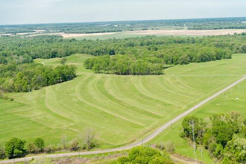
Haughton Cross (Church of the Cross), Haughton. In the NM:” Religious Monuments” series, this is the tallest cross in the US at 100 feet, 1 foot below the allowed limit of 200 feet, the limit permitted because of aircraft. It is pretty skinny and is anchored to the earth in the center of a giant Star of David, as if impaling it.
The Central Assembly of God – Church of the Cross began with 21 charter members on Aug. 10, 1961. It outgrew its facilities at 2101 US Hwy. 80, expanding to its current location at 700 US Hwy. 80 and shepherding more than 1,000 believers. The cross monument was erected in 2009.

SHREVEPORT (pop 190,000)
Shreveport ranks third in population in Louisiana after New Orleans and Baton Rouge. Shreveport extends along the west bank of the Red River (most notably at Wright Island, the Charles and Marie Hamel Memorial Park, and Bagley Island).
Shreveport was founded in 1836 by the Shreve Town Company, a corporation established to develop a town at the juncture of the newly navigable Red River and the Texas Trail, an overland route into the newly independent Republic of Texas. The city grew throughout the 20th century and became a national center for the oil industry after the discovery of oil in Louisiana. With economic problems, the city struggled with a declining population, poverty, drugs and violent crime. Still, the city began efforts to revitalize its infrastructure to end its population decline, revive the economy through diversification, and lower crime.
Shreveport is the educational, commercial and cultural center of the Ark-La-Tex region, where Arkansas, Louisiana, and Texas meet.
After Louisiana, I continued in Texarkana and onto Arkansas.
Monumental Earthworks of Poverty Point
This prehistoric earthwork was constructed by the Poverty Point culture in present-day northeastern Louisiana, though evidence of the Poverty Point culture extended 100 miles (160 km) across the Mississippi Delta and south to the Gulf Coast. The Poverty Point site has been designated as a U.S. National Monument, a U.S. National Historic Landmark, and a UNESCO World Heritage Site.
The site is 15.5 miles (24.9 km) from the current flow of the Mississippi River, and is situated on the edge of Macon Ridge, near the village of Epps in West Carroll Parish, Louisiana.
The Poverty Point site contains earthen ridges and mounds built by indigenous people between 1700 and 1100 BC during the Late Archaic period in North America. Archaeologists have proposed various possible functions for the site, including as a settlement, a trading centre, and/or a ceremonial religious complex.
The 402-acre (163 ha) property contains “the largest and most complex Late Archaic earthwork occupation and ceremonial site yet found in North America”. Euroamericans described the site in the 19th century. Poverty Point has been the focus of professional archaeological excavations since the 1950s. The earthworks are named after a 19th-century plantation on the property.
++++++++++++++++++++++++++++++++++++++++++++++++++++++++++++++
ARKANSAS (Little Rock, Fort Smith)
Arkansas’ name is from the Osage language. The state’s diverse geography ranges from the mountainous regions of the Ozark and the Ouachita Mountains, which make up the U.S. Interior Highlands, to the densely forested land in the south known as the Arkansas Timberlands, to the eastern lowlands along the Mississippi River and the Arkansas Delta.
The capital and most populous city is Little Rock, located in the state’s central portion. It is a hub for transportation, business, culture, and government. The northwestern corner of the state, such as the Fayetteville–Springdale–Rogers Metropolitan Area and the Fort Smith Metropolitan Area, is a population, education, and economic center.
The Territory of Arkansas was admitted to the Union as the 25th state on June 15, 1836. Much of the Delta had been developed for cotton plantations, and the state landowners largely depended on enslaved African Americans as workers. In 1861, Arkansas seceded from the United States and joined the Confederate States of America during the Civil War. On returning to the Union in 1868, the state continued to suffer due to its reliance on the large-scale plantation economy. Cotton continued as the leading commodity crop, although the cotton market declined. Because farmers and business people did not diversify and there was little industrial investment, the state fell behind in terms of its economy and opportunities for residents.
White rural interests dominated the state’s politics by disenfranchising African Americans and by refusing to reapportion the legislature.
Following World War II, Arkansas began diversifying its economy. In the 21st century, its economy is based on service industries, aircraft, poultry, steel, and tourism, along with important commodity crops of cotton, soybeans, and rice.
Crater of Diamonds State Park, Murfreesboro. This is a 911-acre (369 ha) Arkansas state park in Pike County with a 37.5-acre (15.2 ha) plowed field, the world’s only diamond-bearing site accessible to the public. Diamonds have continuously been discovered in the field since 1906, including the 17.6-carat Strawn-Wagner Diamond. The site became a state park in 1972 after the Arkansas Department of Parks and Tourism purchased the site from the Arkansas Diamond Company and Ozark Diamond Mines Corporation, who previously operated the site as a tourist attraction.
In August 1906, John Huddleston found two strange crystals on the surface of his 243-acre (98 ha) farm, and he sold an option on the 243 acres. After 1906, several attempts at commercial diamond mining failed. The only significant yields came from the original surface layer, where erosion over a long period had concentrated diamonds. Soon after the first diamond was found, a “diamond rush” created a boomtown atmosphere around Murfreesboro. In March 1956, a visitor found the Star of Arkansas, which weighed 15.33 carats (3.066 g). A significant diamond symbol has dominated the state flag since 1912. The Crater of Diamonds volcanic pipe is part of a 95-million-year-old eroded volcano. The deeply sourced lamproite magma, from the upper mantle, brought the diamonds to the surface.
HOT SPRINGS
Hot Springs National Park. Adjacent to the city of Hot Springs, the area obtained federal protection in 1832, and the city developed into a thriving spa town. It was made a national park in 1921. The hot springs flow from the western slope of Hot Springs Mountain, part of the Ouachita Mountain range.
The park includes portions of downtown Hot Springs, making it one of the most accessible national parks. There are numerous hiking trails and camping areas. The entire Bathhouse Row area contains the grandest collection of bathhouses in North America, including many outstanding examples of Gilded Age architecture. The row’s Fordyce Bathhouse serves as the park’s visitor center; the Buckstaff and Quapaw are the only facilities still operating as bathhouses in 2015. Other buildings in the row are being restored or are used for different purposes.
:max_bytes(150000):strip_icc():format(webp)/HotSpringsNationalParkWesleyHitt-571145215f9b588cc2eba7e7.jpg)
Garvan Woodland Gardens. Attractions include a waterfall on Lake Hamilton, several bridges, a bonsai garden and the spring tulip show. 
Joy Manning Scott Bridge of the Full Moon
LITTLE ROCK (pop 198,000, metropolitan 740,000)
Little Rock is the capital and most populous city. The city was incorporated in 1831, on the south bank of the Arkansas River close to the state’s geographic center. The town derives its name from a rock formation along the river, named the “Little Rock.”
Little Rock is a cultural, economic, government, and transportation center in Arkansas and the South. It is home to several cultural institutions, such as the Arkansas Arts Center, the Arkansas Repertory Theatre, and the Arkansas Symphony Orchestra. In addition to hiking, boating, and other outdoor recreational opportunities, the state government is a large employer, with many offices downtown.
Old State House
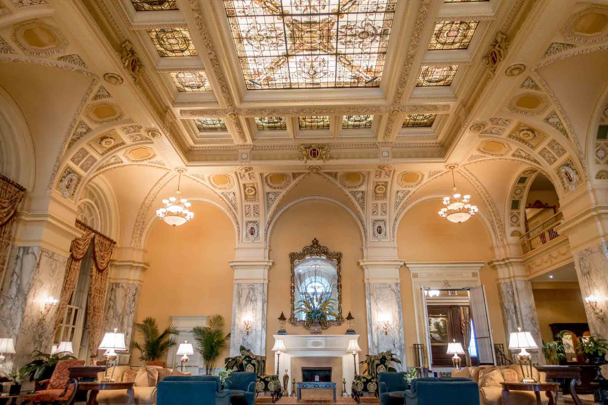
Capital Hotel. The Capital Hotel is a historic hotel in the NM “Hospitality Legends” series. It is a four-story brick building with an elaborately decorated Victorian front facade. Corinthian pilasters articulate its ground-level window bays, and the tall second and third-floor windows are set in round-arch openings with Ionic pilasters between. The fourth-floor windows are set in segmented-arch openings with smaller Corinthian pilasters. When it opened in 1877, the hotel was the grandest in the city, and the building is still a local landmark.

Big Dam Bridge. Opened in 2006, it spans the Arkansas River and Murray Lock and Dam between Little Rock’s Murray Park, while the northern end is at Cook’s Landing Park in North Little Rock. Little Rock is open only to pedestrian and bicycle traffic. At 4,226 feet (1288 m), it is the longest pedestrian/bicycle bridge in North America that has never been used by trains or motor vehicles.
++++++++++++++++++++++++++++++++++++++++++++++++++++++++++++++
TENNESSEE
Tennessee is the 36th largest but the 16th most populous. It is bordered by eight states: Kentucky to the north, Virginia to the northeast, North Carolina to the east, Georgia, Alabama, Mississippi to the south, Arkansas to the west, and Missouri to the northwest. The Appalachian Mountains dominate the eastern part of the state, and the Mississippi River forms the state’s western border. Nashville is the state’s capital and largest city, and Memphis is the second.
Tennessee was admitted to the Union as the 16th state in 1796 and the last state to leave and join the Confederacy at the outbreak of the American Civil War in 1861. Tennessee furnished more soldiers for the Confederate Army than any other state besides Virginia, and more soldiers for the Union Army than the rest of the Confederacy combined.
In the 20th century, Tennessee transitioned from an agrarian economy to a more diversified economy, aided by massive federal investment in the Tennessee Valley Authority and, in the early 1940s, the city of Oak Ridge. This city was established to house the Manhattan Project’s uranium enrichment facilities, helping to build the world’s first atomic bombs, two of which were dropped on Imperial Japan near the end of World War II. After the war, the Oak Ridge National Laboratory became a key center for nuclear research.
Tennessee’s major industries include agriculture, manufacturing, and tourism. Poultry, soybeans, and cattle are the state’s primary agricultural products. Major manufacturing exports include chemicals, transportation equipment, and electrical equipment. The Great Smoky Mountains National Park, the nation’s most visited national park, is located in the eastern part of the state, and a section of the Appalachian Trail roughly follows the Tennessee–North Carolina border.
MEMPHIS 651,000)
Located on the Mississippi River, the city is the anchor of West Tennessee and the greater Mid-South region. The town features a wide variety of landscapes and distinct neighbourhoods.
The first European explorer to visit the area was Spanish conquistador Hernando de Soto in 1541 with his expedition into the New World. The high Chickasaw Bluffs protecting the location from the waters of the Mississippi would then be contested between the Spanish, French, and English as Memphis took shape. Modern Memphis was founded in 1819 by three prominent Americans: John Overton, James Winchester, and future president Andrew Jackson.
Memphis grew into one of the largest cities of the Antebellum South as a market for agricultural goods, natural resources like lumber, and the American slave trade. After the American Civil War and the end of slavery, the city experienced even faster growth into the 20th century as it became among the largest world markets for cotton and lumber.
Home to Tennessee’s largest African-American population, Memphis played a prominent role in the American civil rights movement and was the site of Dr. Martin Luther King, Jr.’s 1968 assassination. The city now hosts the National Civil Rights Museum, a Smithsonian affiliate institution.
Since the civil rights era, Memphis has become one of the nation’s leading commercial centers in transportation and logistics. The city’s largest employer is the multinational courier corporation FedEx, which maintains its global air hub at Memphis International Airport, making it the second-busiest cargo airport in the world. The Port of Memphis also hosts the 5th busiest inland water port in America with access to the Mississippi River, allowing shipments to arrive by ship from around the world for conversion to train and trucking transport throughout the United States, making Memphis a multi-modal hub for trading goods for imports and exports in the United States despite its inland location.
The city has long had a prominent music scene, with historic blues clubs on Beale Street originating the unique Memphis blues sound during the early 20th century. The city’s music has continued to be shaped by a multi-cultural mix of influences across the blues, country, rock n’ roll, soul, and hip-hop genres. Memphis barbecue has achieved international prominence, and the city hosts the World Championship Barbecue Cooking Contest, which attracts over 100,000 visitors annually.
Graceland is a mansion on a 13.8-acre (5.6 ha) estate in Memphis once owned by the singer and actor Elvis Presley. His daughter, Lisa Marie Presley, has owned Graceland since her father’s passing. It is about 9 miles (14 km) from Downtown and less than 4 miles (6.4 km) north of the Mississippi border.
Graceland was opened to the public as a museum in 1982. With over 650,000 visitors a year, it is the second most-visited house in the U.S. after the White House.
The Peabody Memphis is a luxury hotel in Downtown Memphis. The hotel is known for the “Peabody Ducks” living on the rooftop and making daily treks to the lobby. The original Peabody Hotel was built in 1869 by Robert Campbell Brinkley, who named it to honour his friend, the recently deceased George Peabody, for his contributions to the South. The hotel was hugely successful with 75 rooms, private bathrooms, and numerous elegant public rooms. Among its guests were Presidents Andrew Johnson and William McKinley and Confederate Generals Robert E. Lee and Nathan Bedford Forrest. Jefferson Davis, the former President of the Confederacy, lived there in 1870 when he worked as president of an insurance company.[2] The hotel closed in 1923[1] in preparation for a move one block away. The building was demolished, and Lowenstein’s department store was constructed there.
The current Peabody Hotel building is an Italian Renaissance structure that opened in 1925. Before the mid-1960s, alcoholic beverages were sold in Tennessee only in sealed bottles in licensed liquor stores. A patron could bring a bottle acquired elsewhere into the hotel bar, The Creel, where the bartender would tag it and mix drinks from it at the patron’s request. The Creel went bankrupt in 1965 and was sold in a foreclosure auction to Sheraton Hotels.
As downtown Memphis decayed in the early 1970s, the hotel suffered. It closed in 1973, briefly reopened, and then closed again. Jack A. Belz then spent the next several years and $25 million renovating the landmark structure, reopening it in 1981. It became a significant catalyst for the Memphis downtown area’s ongoing revitalization.
NASHVILLE
Nashville is the capital and most populous city in Tennessee. Located on the Cumberland River, it was named for Francis Nash, a general of the Continental Army during the American Revolutionary War. It was founded in 1779 and grew quickly due to its strategic location as a port on the Cumberland River and, in the 19th century, a railroad center. Nashville seceded with Tennessee during the American Civil War; in 1862, it was the first state capital in the Confederacy to fall to Union troops.
A major center for the music industry, especially country music, Nashville is commonly known as “Music City. It is also home to numerous colleges and universities, including Tennessee State University and Vanderbilt University. It is sometimes called the “Athens of the South” due to the many educational institutions.[8] Nashville is also a major center for the healthcare,[9] publishing,[10] private prison,[11] banking,[12] automotive,[13] and transportation industries. Entities with headquarters in the city include Asurion, Bridgestone Americas, Captain D’s, CoreCivic, Dollar General, Hospital Corporation of America and LifeWay Christian Resources.
Schermerhorn Symphony Center. The NM “Modern Architecture Buildings” series is a concert hall in downtown Nashville that opened in 2006. It is named after Kenneth Schermerhorn, the music director and conductor of the Nashville Symphony from 1983 until he died in 2005.
The 2006 Symphony Center is a prominent example of 21st-century New Classical architecture.
The 1,844-seat Laura Turner Concert Hall is at the heart, home to the Nashville Symphony—natural lighting streams through 30 soundproof, double-paned clerestory windows. Intricate symbolic motifs include irises, horseshoes and coffee beans (representing Nashville’s Cheek family, who originally owned the Maxwell House Coffee brand. Seats are on three levels, including an exceptional choral loft for 146 chorus members behind the stage.
The center’s Neoclassical design blends elements of other Classical and Neoclassical structures in the city, such as the full-scale Parthenon replica and Nashville’s main public library.
The orchestra-level seats are mounted on motorized wagons that can be lowered through the floor, allowing it to be converted into a 5,700-square-foot (530 m2) ballroom in approximately two hours. Dozens of motorized acoustic drapes and panels can be quickly adjusted to accommodate many acoustic and amplified music styles.
A second 2,438-square-foot hall hosts smaller performances and serves as a venue for the symphony’s ongoing music-education initiative—
The Hermitage Hotel. In the NM “Hospitality Legends” series, this historic hotel was commissioned by 250 Nashville residents in 1908 and named for Andrew Jackson’s estate, The Hermitage, near Nashville and opened in 1910. It was built in the Beaux-Arts style and is the only remaining example of this style of architecture in a commercial building in Tennessee. In 1910, the new hotel advertised its rooms as “fireproof, noiseproof, and dustproof, rooms $2.00 and up. The hotel opened with every possible modern convenience, including a telephone and circulating ice water in all guest rooms.
The lobby was—and still is—the main focal point of the hotel. It is a spacious Beaux-Arts masterpiece graced with a profusion of ornamental plaster and a painted glass ceiling. From the street entrance, a grand staircase leads to the lobby, which has walls distinctively built of golden-hued Sienna Marble. The Main Dining Room (now the Grand Ballroom) was located off the lobby area and was richly detailed with Circassian walnut walls and an ornate ceiling, features that still exist today.
The hospitality was known for its high levels of elegant service and dining, as well as its distinctive architecture.
It closed in 1977 as the inner city had declined. It changed ownership and underwent a complete renovation, reopening in 1981. Originally offering 250 guest rooms a century ago, the hotel now has 122 rooms. A Forbes 5-Star rating was awarded in 2008.
John Seigenthaler Pedestrian Bridge. The Shelby St road bridge, built in 1907, was completely renovated in 2003. It was the first bridge in North America that used concrete arched trusses supporting a steel girder bridge. It is in downtown Nashville, connecting the area in front of the Symphony Center with Riverfront Park across the Cumberland River. Nissan Stadium, the home of the Tennessee Titans NFL team, is beside the park. It is about 13m wide with sidewalks on each side, a central bike lane, jut-outs with benches and elevators on each end.
For about one hour, I stood on the bridge and watched the construction of the Four Seasons Hotel just feet away.

CHATTANOOGA
Lookout Mountain Incline Railway
Chattanooga Market. This large covered open-air market is housed in the First Horizon Pavilion. It has steel girder sides.
Walnut Street Bridge. Once a road bridge, it is now a steel girder construction on stone piers in the Tennessee River. The bed is wood, with sidewalks on both sides, benches, and a wider middle section.
Ruby Falls is a series of underground cascading waterfalls totalling 145 feet (44 m) in Lookout Mountain, formed from limestone. Lookout Mountain Cave opened to the outside, but the upper Ruby Falls Cave didn’t, and the two were unconnected until developers joined them to create Lookout Mountain Caverns. It has stalactites, stalagmites, columns, drapery, flowstone, and columns, drapery, and flowstone.
The Falls are located at the end of the central passage of Ruby Falls Cave, in a large vertical shaft. The stream, 1,120 feet underground, is fed by rainwater and natural springs. It collects in a pool on the cave floor and continues through the mountain. By 1935, the lower of the two caves was blocked off due to Ruby Falls’ greater popularity. Public tours began in 1930. Electric lights were installed. Motorists travelling on I-75 in the 1970s and 1980s were subjected to dozens – maybe hundreds – of billboards along their route with the words “SEE RUBY FALLS” beginning hundreds of miles north and south of the falls.
 ++++++++++++++++++++++++++++++++++++++++++++++++++++++++
GEORGIA NORTH (Atlanta, Macon, Augusta, Athens)
ATLANTA
BAPS Shri Swaminarayan Mandir. This is a traditional Hindu temple built by the BAPS Swaminarayan Sanstha, a denomination of the Swaminarayan branch of Hinduism headed by Mahant Swami Maharaj for $ 7 million. It comprises an 11,500-square-foot, 73-foot (22 m) tall open-air temple and a 25,620-square-foot surrounding deck. The materials were carved out of Italian marble and Turkish limestone by 3,000 craftsmen in various parts of India, then shipped to Houston and built with mostly donated labour.
The grounds cover 22 acres and include a cultural center and the Understanding Hinduism exhibition. The mandir is open daily for worship and visitors.

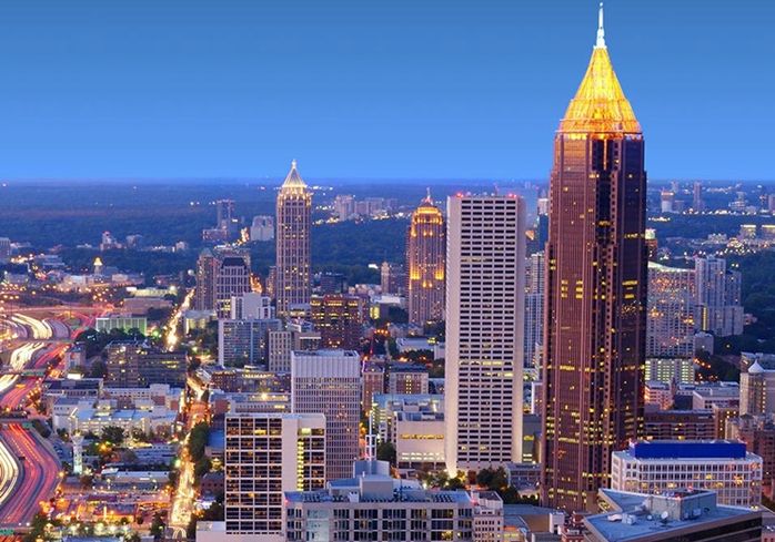
Bank of America Plaza. In the NM “Modern Architecture Buildings” series, this skyscraper is 311.8 m (1,023 ft), the 21st-tallest U.S. building, the tallest in Georgia, and the tallest in any U.S. state capital. It has 55 stories of office space and was completed in 1992.
Designed in the Postmodern style reminiscent of Art Deco, the dark colour of its exterior heightens its imposing presence. It soars into the sky with vertical lines that reinforce its height. The inhabited part of the building ends abruptly with a flat roof. On top of this is a pyramid of girders, which are gilded and blaze at night (the building is known to Atlanta locals as the Pencil Building because of how it glows at night. A 90 ft (27 m) obelisk-like spire is most covered in 23 karat (96 percent) gold leaf.
AUGUSTA (pop 199,000)
The city lies across the Savannah River from South Carolina at the head of its navigable portion—Georgia’s second-largest city after Atlanta.
Augusta was established in 1736 and is named for Princess Augusta of Saxe-Gotha (1719–1772), the bride of Frederick, Prince of Wales and the mother of the British monarch George III. During the American Civil War, Augusta housed the principal Confederate powder works. Augusta’s warm climate made it a central Eastern United States resort town in the early and mid-20th century. Internationally, Augusta is best known for hosting the Masters golf tournament each spring. The Masters brings over 200,000 visitors worldwide to the Augusta National Golf Club. Membership at Augusta National is widely considered the most exclusive in golf worldwide.
++++++++++++++++++++++++++++++++++++++++++++++++++++++++++++++
SOUTH CAROLINA (Columbia, Charleston, Greenville, Myrtle Beach)
South Carolina is the easternmost state of the Deep South. It is bordered to the north by North Carolina, to the southeast by the Atlantic Ocean, and to the southwest by Georgia across the Savannah River.
South Carolina became the eighth state to ratify the U.S. Constitution on May 23, 1788. It also became the first state to vote in favour of secession from the Union on December 20, 1860. After the American Civil War, it was readmitted into the United States on June 25, 1868. South Carolina is the 40th most extensive and 23rd most populous U.S. state.
South Carolina is named in honour of King Charles I of England, who first formed the English colony, with Carolus being Latin for “Charles”.
COLUMBIA (pop 134,000, metropolitan 768,000)
Columbia is the capital and second-largest city in South Carolina. Columbia is a poetic term used for the United States, originating from Christopher Columbus’s name. The town is located approximately 13 miles (21 km) northwest of the geographic center of South Carolina. It lies at the confluence of the Saluda River and the Broad River, which merge at Columbia to form the Congaree River.
Columbia is home to the University of South Carolina, the state’s flagship university and the largest. It is also the site of Fort Jackson, the largest United States Army installation for Basic Combat Training. In 1860, the city hosted the South Carolina Secession Convention, which marked the departure of the first state from the Union in the events leading up to the Civil War.
Riverbanks Zoo and Garden is a 170-acre (69 ha) zoo, aquarium, and botanical garden along the Saluda River in Columbia. The zoo has over 2,000 animals, including mammals, birds, reptiles, and fish. In 2002, additions included exhibits for African elephants, gorillas, and koalas. The Birdhouse at Riverbanks displays king, rockhopper, and gentoo penguins.
Riverbanks Botanical Garden, West Columbia. Riverbanks also has a 70-acre (28 ha) botanical garden with more than 4,200 native and exotic plants and some sculptures. A trail system lets visitors explore several kilometres of bottomland and upland mixed hardwood forests in search of the native wildlife that call the Zoo and Garden home.
John D. Long Lake is an 80-acre (32 ha) artificial lake in Union County. It is in the NM “Dark Side” series because of the number of deaths at the fishing pier/boat ramp. The lake is used for fishing, and it has largemouth bass, bluegill, shell cracker (red-ear sunfish), and catfish.
The lake is about 3 miles (4.8 km) west of Lockhart, the nearest town, and about 7 miles (11 km) northeast of Union, the closest city. The shores are mostly wooded, with poplars, black gum trees, and loblolly pines prevailing; cedar trees were planted in the 2010s. Hughes Creek feeds and drains the lake, running south into it and southwards to the Broad River. The elevation is 440 feet (130 m), and the depth exceeds 80 feet (24 m). Access to the lake’s western end, where the fishing pier and boat ramp are located, is via Black Bottom Road, which connects to Highway 9. Access to the eastern end is from John D. Long Lake Road, which connects to Highway 49. This gives out on a small parkland near the dam, where the boat ramp was formerly located.
The lake was created in the 1970s on the initiative of South Carolina state senator John David Long III and named after his father, John David Long, also a South Carolina state senator and Ku Klux Klan and Confederate flag champion. An earthen dam was built to fill a pasture on Hughes Creek.
Nine people have died at the lake’s old boat ramp. In 1994, Susan Smith drowned her two sons there, in a case which attracted national attention. Granite memorials were raised to the boys, and many visitors came. In 1996, seven died when their car rolled down the boat ramp into the lake, after which the memorials were moved and the boat ramp was dug up and grassed over.
In 2013, the lake was closed for two years, the bass were stunned and relocated, the lake was drained, trees were cut and planted, 635.7 short tons of gravel were laid down to create spawning grounds for bluegill and shellcracker and the lake was refilled.
+++++++++++++++++++++++++++++++++++++++++++++++++++++++++
NORTH CAROLINA (Charlotte, Raleigh, Greensboro, Durham)
North Carolina is the 28th-largest and 9th-most populous of the 50 United States. Virginia borders it to the north, the Atlantic Ocean to the east, Georgia and South Carolina to the south, and Tennessee to the west. Raleigh is the state’s capital. The state’s capital is Charlotte, and it is the largest city. The Raleigh metropolitan area is the second-largest metro area in the state, with an estimated population of 1,362,540 in 2018. It is home to the most extensive research park in the United States, Research Triangle Park.
North Carolina was established as a royal colony in 1729 and is one of the original Thirteen Colonies. It is named in honour of King Charles I of England, who first formed the English colony, with Carolus being Latin for “Charles.” In 1789, North Carolina became the 12th state to ratify the United States Constitution. In the run-up to the American Civil War, North Carolina declared its secession from the Union on May 20, 1861, becoming the last of eleven states to join the Confederate States.
On December 17, 1903, Orville and Wilbur Wright successfully piloted the world’s first controlled, sustained flight of a powered, heavier-than-air aircraft at Kill Devil Hills in North Carolina’s Outer Banks.
North Carolina is defined by a wide range of elevations and landscapes. From west to east, its elevation descends from the Appalachian Mountains to the Piedmont and the Atlantic coastal plain.
Mount Mitchell, at 6,684 feet (2,037 m), is the highest point in North America east of the Mississippi River. Most of the state is in the humid subtropical climate zone, with the western, mountainous part having a subtropical highland climate.
McAdenville (pop 651, 2010)
Known as Christmas Town USA, this small town is a suburb of Charlotte. A Christmas tradition in the city for many years has been decorating the entire village with Christmas lights – 375 lit trees, over 200 wreaths attached to city light poles, and buildings in the town covered in Christmas lights and some form of decoration. The lights attract 600,000 vehicles from all over the country and are one of the biggest light shows in the US. Begun in 1956 by the town’s largest employer and land owner, many trees are visited yearly. Volunteers from the community entirely maintain the lights, and no admission is charged.
Charlotte (pop 873,000, metropolitan 2,730,000)
From 2004 to 2014, Charlotte was the most populous city in North Carolina, and with 888,000 new residents, it was ranked as the country’s fastest-growing metro area. Charlotte is home to the corporate headquarters of Bank of America, Truist Financial, and Wells Fargo’s East Coast operations, which, along with other financial institutions, have made it the second-largest banking center in the United States since 1995.
It is located several miles east of the Catawba River and southeast of Lake Norman, the largest artificial lake in North Carolina. Among Charlotte’s many notable attractions, some of the most popular include the Carolina Panthers (NFL), the Charlotte Hornets (NBA), the NASCAR All-Star Race, the Wells Fargo Championship, the NASCAR Hall of Fame, the Charlotte Ballet, Children’s Theatre of Charlotte, Carowinds amusement park, and the U.S. National Whitewater Center.
Charlotte has a humid subtropical climate.
