
ROSSLAND 1023m (3356 feet)

Once one of the greatest mining camps on the Pacific Slope, prospectors first found ore bodies in the area in 1887. In 1890, several more magnificent ore bodies were found on the slopes of an extinct volcano called Red Mountain. This ignited a full-scale rush into the area and catapulted Rossland into instant fame.
The origin of the name Rossland comes from a miner, Ross Thompson, who staked a claim in 1890. He had tried to call the city Thompson, but he was advised that there was already a town with that name. It was changed from Thompson to Rossland in 1894 by postal authorities.
By 1900, mines like Le Roi, Centre Star, War Eagle, Nickle Plate and scores more were spewing out a seemingly endless stream of rich gold ore.
Rossland burgeoned into the cosmopolitan “Golden City” of over 7,000 people and the 4th largest city in British Columbia. It had all the amenities: 4 breweries, more than 40 hotels and saloons, two daily and three weekly newspapers, 6 churches, an opera house, an elegant private club and scores of other businesses.
Sourdough Alley was one of the most crooked thoroughfares in the province and along with Columbia Avenue, had legions of boomers, tinhorns, prospectors, women of easy virtue and a host of others. Some like Fritz Augustus Heinze, the 24-year-old millionaire mine owner from Butte, Montana, Oliver Durant, General Warren, lucky Patsy Clark, Colonel Redpath and a dozen or more financial sharpies from the Inland Empire.
Red Mountain was the key but South Belt mines like the Homestake, Bluebird, Lily May, Mayflower and at least 6 others produced a steady stream of gold and silver ore. OK Mountain mines like the Midnight, Snowdrop and IXL occasionally had spectacular findings.
Inside the plush confines of the prestigious Rossland Club, bona fide mining men, promotors and tycoons intermingled and dealt million-dollar properties. Rossland was a magic name and any claims in the region, even worthless properties, had the stock markets of the world, including London, in a tizzy.
1900-1910 proved decisive in Rossland’s history. In 1901, a bitter strike at the mines slowed production. A year later, the business section was gutted by the first of the great Rossland fires. In December 1905, the powder house at the Center Star Mine exploded with such force that it was heard more than 10 miles away, but miraculously, only one life was lost.
Also in 1905, the Centre Star and War Eagle mines, the Trail Smelter, the rich St Eugene Mine at Moyie and the Rossland Power Company merged under the name of the Canadian Consolidated Mines. Within a decade, with the acquisition of the incomparable Sullivan Mine in Kimberley and the once unwilling Le Roi Mine, and a name change to Consolidated Mining and Smelting Company of Canada (C.M.&S), it emerged as one of the mining giants of the time.
Between 1901-16, the Red Mountain mines produced 50% of the entire gold production of BC.
Decline. By the end of WWI, the mines started to show signs of depletion and in 1920, the Great Northern Railway had abandoned the Red Mountain line. In 1929, the C.M.&S. closed its Rossland operations and by 1930, no mining was occurring. The 1929 fire was the last great fire and it destroyed many businesses on Columbia Avenue. With the depression, the population dipped to 1500 and it was predicted that Rossland was doomed to ghost town status. The 1932 increase in the price of gold opened old Red Mountain mines to leasers. Soon 100s of men were reworking old dumps, mining pillars and looking for new veins. Some spectacular pockets of ore were found and almost all mines resumed shipping. But by the beginning of WWII, even these became exhausted and all the mines lay idle.
Salvagers removed most of the mine workings and visible landmarks leaving only tunnels, shafts and ore dumps. Columbia Avenue, once so elegant, is a shadow from former years. The impressive courthouse has been unchanged since 1900 (designated a National Historic Site of Canada in 1980), the original Montreal Hotel and Miner’s Union Hall still stand. The older parts of town still have much turn-of-the-century architecture. Many of the street names like Butte, Spokane and Washington reflect the once predominant American accent in the old city.
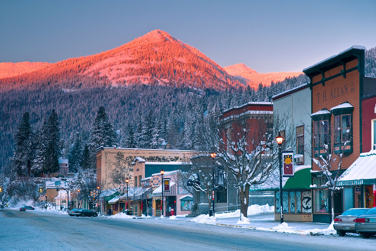
Today its population is 3729, though it fluctuates with the season being at its peak during the winter because of the great powder skiing at the multi-peak ski hill, Red Mountain Resort. The Black Jack Ski Area is a well-known cross-country ski club. The mountains around Rossland serve as the base of one of Canada’s best mountain biking areas. It was recently made famous by the 7 Summits Trail.
Rossland primarily serves as a bedroom community for Trail. It must have the greatest concentration of physician residents of any place in Canada.
GEOLOGY
Rossland is most well known for the gold that was mined during the town’s boom years in the late 1890s to 1920s. Rossland is, in fact, BC’s second-largest producer of gold to date, with a total of $300 million worth of gold extracted. During this time, copper and silver were also extracted in small amounts. Later on, lead, zinc, and molybdenum were also mined.
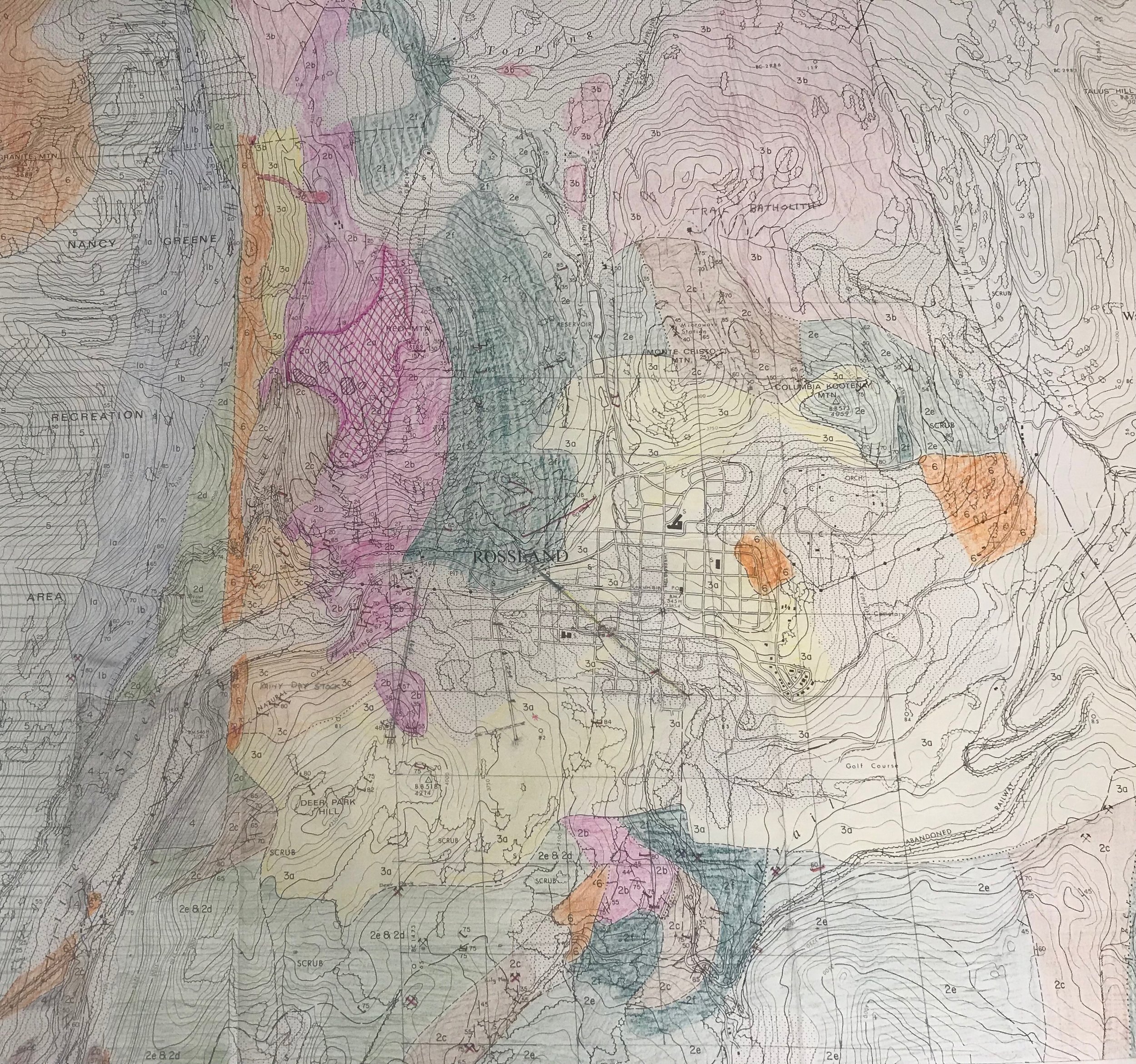
Colour-coded map of the Rossland area, showing different geological features. Map created by Cominco (now Teck Trail Operations) See key below. (click for a closer look)


Photo 2305.0010: The Le Roi Mine Shaft House, c.1904.
300 million years ago (The Palaeozoic Period). The earliest rocks which remain in the Rossland Range were formed during the Pennsylvanian Period of the Palaeozoic era, around 300 million years ago. This rock was formed as mud and slime sediments settled at the bottom of an ancient semi-tropical sea. This formed the base of the geological layout of the area, known as the Mount Roberts Formation. The rock thus formed can be seen today after rains, glinting as polished granite on the middle third of Mount Roberts.
200 million years ago (The Jurassic Period). In the early Jurassic Period, the region that would later become Rossland experienced a stretching of the earth’s crust known as an extension, which caused large bodies of rock to break. This caused a fault-bounded section to form at the bottom of the sea, lifting the area and making it an ‘undersea high’. The Rossland Range now runs on either side of this fault break, leading to some interesting geology. While both sides of the break mountains have an extrusive form, Red Mountain lies on one side of this break, leading to its top being composed of marine sediment, while the Kootenay Columbia Mountain top on the other side of the fault is composed of volcanic material. It is thought that this fault led to the formation of a chain of volcanoes, including the stratovolcano known as the Rossland Volcano, which then rose out of the sea, creating the beginning of the Elise Formation. This Formation along with the Roberts Formation are the basis of the Rossland area’s geology and topography.
During the latter part of the Jurassic Period, the Mount Roberts Formation was lifted above the sea. As such, the area became a volcanic high-point referred to as the Rossland Paleohigh.
190 million years ago. It is thought that 190 million years ago, the hot liquid magma of the Rossland Monzonite intruded the Roberts formation. This rock cooled below the surface and the cracking that occurred as the monzonite cooled caused it to become the ‘host rock’ for the copper-gold deposits that later formed. As the cracks and fissures formed, they allowed space for the minerals to enter and create veins of mineral deposits.
180 million years ago. It was about 180 million years ago that the ancestral North America, where the Mount Roberts and Elise Formations lay, and the Intermontane Superterrane began to collide. This collision caused the Intermontane Superterrane to wedge into the side of North America, and push eastward over the Rossland area and beyond, leaving an imprint known as the Kootenay Arc. This arc is a belt of folding and faulting rock caused by the collision. For the Rossland Range, this meant folding and faulting of the Elise and Roberts Formations and leaving the Rossland Range on the inner fold of the Kootenay Arc.
155 million years ago. About 25 million years after the intrusion of the Rossland Monzonite, the area was invaded by liquid granite magma known as the Trail Pluton. This heat caused the thermal metamorphosis of siltstone in the Roberts formation, creating molybdenum. Molybdenum, although not as flashy as gold, was an important mineral mined in the area between 1966 and 1972.
What About the Volcano? Ask a Rosslander about the geological history of our town and there is a good chance they will tell you it lies in the crater of an old, now dormant volcano. Although a very exciting story and once perpetuated by geologists, this, unfortunately, is not the case! Although the area was formed by volcanic activity, including that of the Rossland stratovolcano, the site itself is not in the crater or caldera of a volcano. This legend has its roots in original assumptions of the geological situation. In 1915, the first Canadian Geological Surveys of Rossland were conducted, and it was deduced that 200 million years ago, a continental volcano was present about where Red Mountain currently sits. More recent studies have unfortunately revealed this is not the case, as can be seen in the history outlined above.
The result didn’t go as well as we might have hoped!
