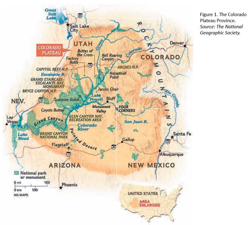
Colorado Plateau. This area is the uplift through which the Colorado River flows. It covers the SW corner of Colorado, NW New Mexico, South Utah and North Arizona. 300 canyons enter the Colorado River giving an almost endless variety of natural adventures, mainly hiking, kayaking and rafting.
The Anasazi (1000-1350 AD) left the area after a prolonged drought. They travelled through Chaco Canyon to be the forerunners of the Pueblos in New Mexico. They left an astonishing number of ruins and petroglyphs
NATIONAL PARKS
ESCALANTE GRAND STAIRCASE NM
CEDAR MESA
PARIA
COYOTE BUTTES
LAKE POWELL
SECRETS OF THE CREATIVE BRAIN A leading neuroscientist who has spent decades studying creativity shares…
Let Your Kids Fail Early exposure to setbacks can help children confront later disappointments without…
BAMBOO SHOOTS A popular ingredient in Asian cuisine, bamboo packs a powerhouse of nutrition. Here’s…
The Truth About Dentistry It’s much less scientific—and more prone to gratuitous procedures—than you may…