
CANADA – ONTARIO EAST (Toronto, Ottawa, Sault Ste. Marie, Windsor, Sudbury)
Fort Henry, Kingston. Located on Point Henry, a strategic, elevated point near the mouth of the Cataraqui River where it flows into the St. Lawrence River at the east end of Lake Ontario, the original fort was constructed during the War of 1812 to protect the Kingston Royal Naval Dockyard (the site of the present-day Royal Military College of Canada) on Point Frederick from a possible American attack during the war and to monitor maritime traffic on the St. Lawrence River and Lake Ontario. The original fort was replaced by a much larger construction in the 1830s to maintain protection of the naval dockyard and protect the southern entrance to the Rideau Canal. The fort was restored in the 1930s and is a significant tourist attraction.
Cornwall Island is in the Saint Lawrence River, directly south of Cornwall. It is located entirely within Canada but is also part of the Akwesasne Mohawk reserve, which straddles the Canada–United States border and the Quebec—Ontario border. The Seaway International Bridge, with a channel crossing on each side of the island, provides road access to Cornwall Island from Canada and the United States.
The area has been the scene of several disputes by Akwesasne residents on their rights to cross the border unimpeded, as provided under the 1795 Jay Treaty. Canadian authorities have been increasingly concerned about large-scale cigarette, liquor, drug, and migrant smuggling along this route.
Violence has broken out within the reserve, and many residents left in 1990 because of the general unrest. The Warrior Society, a self-appointed security force, used assault rifles and bats to break up anti-gambling roadblocks at the reservation entrances. They threatened to shoot any outside law enforcement officials if they entered the reservation.
TORONTO (pop 2,731,571, metro 5,928,040)
Toronto is the provincial capital of Ontario, the most populous city in Canada, and the fourth most populous city in North America. It is the anchor of the Golden Horseshoe, an urban agglomeration of 9,245,438 people (as of 2016) surrounding the western end of Lake Ontario. Toronto is an international centre of business, finance, arts, and culture, and is recognized as one of the world’s most multicultural and cosmopolitan cities.
People have travelled through and inhabited the Toronto area, located on a broad sloping plateau interspersed with rivers, deep ravines, and urban forest, for more than 10,000 years. After the broadly disputed Toronto Purchase, when the Mississauga surrendered the area to the British Crown, The British established the town of York in 1793 and later designated it as the capital of Upper Canada. During the War of 1812, the town was the site of the Battle of York and suffered heavy damage from American troops. York was renamed and incorporated in 1834 as the city of Toronto. It was designated as the capital of the province of Ontario in 1867 during Canadian Confederation. The city proper has since expanded past its original borders through annexation and amalgamation to its current area of 630.2 km2 (243.3 sq mi).
The diverse population of Toronto reflects its current and historical role as an important destination for immigrants to Canada. More than 50 percent of residents belong to a visible minority population group, And over 200 distinct ethnic origins are represented among its inhabitants. While most Torontonians speak English as their primary language, over 160 languages are spoken in the city.
Toronto is a prominent centre for music, theatre, motion picture production, and television production, and is home to the headquarters of Canada’s major national broadcast networks and media outlets. Its varied cultural institutions, which include numerous museums and galleries, festivals and public events, entertainment districts, national historic sites, and sports activities, ITonto attracts over 43 million tourists each year. It is known for its many skyscrapers and high-rise buildings, particularly the tallest free-standing structure in the Western Hemisphere, the CN Tower.
The city is home to the Toronto Stock Exchange, the headquarters of Canada’s five largest banks, and the headquarters of many large Canadian and multinational corporations. Its economy is highly diversified with strengths in technology, design, financial services, life sciences, education, arts, fashion, aerospace, environmental innovation, food services, and tourism.
Leslieville’s Crazy Doll House. In the NM Bizzarium series, this ordinary 2-story house is covered in dolls attached to a rough lattice over the porch, on sticks stuck into the ground and covering the fence. Most are plastic and able to withstand the elements.
St. Lawrence Market is a major public market located along Front Street East and Jarvis Street in the St. Lawrence neighbourhood of downtown Toronto.
St. Lawrence Market was first established in the early 19th century, originating from a proclamation that established a designated area near King Street and New Street (later renamed Jarvis Street) for a public market in 1803. The first buildings erected for the market emerged in 1814, and the first permanent structures were built in 1820. The first permanent market building was replaced in 1831 with the first St. Lawrence Market North building. The building was damaged after the Great Fire of Toronto in 1849 and was replaced with a new building in 1851. The market was expanded in the early 1900s, with portions of the former city hall of Toronto being integrated into a new building, opened as St. Lawrence Market South in 1902, and a new matching building erected to replace the north building in 1904. The north building was later replaced with a new building in 1968. 2016 the North Building was demolished to make way for a new building.
Cathedral Church of St. James is an Anglican cathedral in downtown Toronto. It is the church of the oldest congregation in the city, with the parish established in 1797. Construction began in 1850 and opened for services on June 19, 1853. The cathedral was one of the largest buildings in the city at the time and was designed as a prime example of Gothic Revival architecture.
The church building is designated under the Ontario Heritage Act, and it is the episcopal seat of the Anglican Church of Canada’s Archbishop of Toronto. Royal St. George’s College, on Howland Avenue, is the church’s choir school open to boys in grades 3 through 12.
Bay Adelaide Centre is an office complex in the Financial District of Toronto. The first phase, a 51-storey skyscraper known as Bay Adelaide West, was completed in July 2009. The 44-storey Bay Adelaide East’s second phase was completed in October 2016. A third tower, Bay Adelaide North, is planned. a height of 218 metres (715 ft) or 51 storeys. It is located on the northeast corner of Bay Street and Adelaide Street West.
Both Bay Adelaide West and Bay Adelaide East are designed in a modernist style. However, the historic north and west facades of the former National Building at the corner of Bay and Temperance Streets, completed in 1926, have been incorporated into Bay Adelaide West.
The towers of the Bay Adelaide Centre are connected by an underground concourse, which extends under Temperance Street and is connected to the PATH network. The underground concourse has PATH connections to Scotia Plaza to the south and Hudson’s Bay Queen Street to the north.
The PATH Skywalk is an approximately 500-metre post-modern curved metal and glass enclosed walkway connecting Union Station to the CN Tower and the Rogers Centre (SkyDome). Part of Toronto’s PATH network, the SkyWalk passes above the York Street subway and the Simcoe Street Tunnel and runs roughly parallel between Front Street and Bremner Boulevard. Opened in 1989 as a predominantly indoor connection from Union Station to the SkyDome, the primary purpose of the SkyWalk is to reduce the need for additional parking spaces near the stadium by providing a direct transportation link to the subway and GO Transit regional trains.
Toronto–Dominion Centre is an office complex in the Financial District of downtown Toronto owned by Cadillac Fairview. It serves as the global headquarters for its anchor tenant, the Toronto-Dominion Bank, and provides office and retail space for many other businesses. The complex comprises six towers and a pavilion covered in bronze-tinted glass and black painted steel. Approximately 21,000 people work in the complex, making it Canada’s largest commercial office complex.
The towers were completed between 1967 and 1991. The complex, as a whole and in its details, is a classic example of his unique take on the International style and represents the end of Mies’s North American period.
Fairmont Royal York Hotel, formerly and commonly known as the Royal York, is a large historic luxury hotel located along Front Street West in Downtown Toronto’s southern end of the Financial District. The Royal York was built by the Canadian Pacific Railway company and is currently managed by Fairmont Hotels and Resorts.
Opened on 11 June 1929, the Châteauesque-styled building is 124 metres tall (407 ft), and contains 28 floors. It is considered one of Canada’s grand railway hotels. After its completion, the building was briefly the tallest building in Toronto and the tallest in the country and the British Empire until the nearby Canadian Bank of Commerce Tower was built the following year. The building has undergone several extensive renovations since it first opened, with its first significant renovation in 1972. An underground walkway linking the hotel with the Royal Bank Plaza and Union Station form part of the Toronto’s PATH underground city system.

Eaton Center is a shopping mall and office complex in Downtown Toronto owned and managed by Cadillac Fairview (CF). It was named after Eaton’s department store chain, which was once anchored there before the chain became defunct in the late 1990s.
The Toronto Eaton Centre attracts the most visitors of any of Toronto’s tourist attractions. It is North America’s busiest shopping mall due to its extensive transit access, downtown location, and tourist traffic. With 48,969,858 visitors in 2015 alone, the centre sees more annual visitors than the two busiest malls in the United States (Mall of America and Ala Moana Center) or Central Park in New York City. The number of visitors to the Toronto Eaton Centre in 2015 exceeded the total 2015 passenger counts at Toronto Pearson International Airport, Canada’s largest and busiest airport.
Yonge–Dundas Square is a public square at the southeast corner of the intersection of Yonge Street and Dundas Street East in the city’s downtown core. The square was conceived in 1997 as part of revitalizing the intersection. Since its completion in 2002, the square has hosted many public events, performances and art displays, establishing itself as a prominent landmark in Toronto and one of the city’s prime tourist attractions. Central to the Downtown Yonge entertainment and shopping district, the city owns the square and is the first public square in Canada to be maintained through a public-private partnership. The intersection is one of the busiest in Canada, with over 100,000 people crossing the city’s first pedestrian scramble daily.
Surrounding the square are other significant landmarks, including the Toronto Eaton Centre, Ed Mirvish Theatre, and the Citytv building. The square is accessible by the Toronto subway at Dundas station and is connected to the PATH. Large billboard screens and corporate logos continuously illuminate the square, which has led to comparisons with Times Square in New York City and Piccadilly Circus in London.
The South African War Memorial is at University Avenue and Queen Street West. It was commissioned in 1910 to commemorate Canada’s participation in the Boer War and consists of three bronze figures at the base of a granite column and another bronze figure at the top. The memorial was restored in 2001.
For two decades after the war, Canadians gathered on February 27 (known in Canada as “Paardeberg Day”) around the South African War memorials to say prayers and honour veterans. This continued until the end of the First World War, when Armistice Day (later called Remembrance Day) began to be observed on November 11.

St. Michael’s Cathedral Basilica is the cathedral church of the Roman Catholic Archdiocese of Toronto and one of the oldest churches in Toronto. It is located at 65 Bond Street in Toronto’s Garden District. St. Michael’s was designed by William Thomas, who also designed eight other churches in the city. The cathedral was primarily financed by Irish immigrants who resided in the area. It has a capacity of 1600.
St. Michael’s Cathedral is a significant building of faith in downtown Toronto. It was originally constructed away from the city’s centre, but the city has grown to encompass it over time. It was erected to better serve the growing Roman Catholic population of Toronto. It is a prime example of the English Gothic Revival style of architecture.
Trinity-St. Paul’s United Church is a church belonging to the United Church of Canada located at 427 Bloor Street West, just west of Spadina Avenue in the city’s downtown core. The church is formed of a mix of three different former congregations and houses a fourth independent congregation within its building.
Today, Trinity-St. Paul’s has a reputation for being an activist church on several social justice issues. The church has strongly advocated for same-sex marriage, fair trade and improved conditions for the homeless. Former United Church moderator and noted activist Bill Phipps was minister from 1974 to 1983. Cheri DiNovo, a former Ontario New Democratic Party politician, became minister effective February 4, 2018.
The CN Tower is a 553.3 m-high (1,815.3 ft) concrete communications and observation tower in Downtown Toronto. It was completed in 1976 on the former Railway Lands. Its name, “CN,” originally referred to Canadian National, the railway company that built the tower. Following the railway’s decision to divest non-core freight railway assets before its privatization in 1995, it transferred the tower to the Canada Lands Company, a federal Crown corporation responsible for real estate development.
The CN Tower held the record for the world’s tallest free-standing structure for 32 years until 2007, when it was surpassed by the Burj Khalifa, and was the world’s tallest tower until 2009, when the Canton Tower surpassed it. It is now the ninth-tallest free-standing structure in the world and remains the tallest free-standing structure on land in the Western Hemisphere. In 1995, the CN Tower was declared one of the modern Seven Wonders of the World by the American Society of Civil Engineers. It also belongs to the World Federation of Great Towers.
It is a signature icon of Toronto’s skyline and attracts more than two million international visitors annually.
The Leslie Dan Faculty of Pharmacy is a pharmacy school and an academic division of the University of Toronto. It is located on the northwestern corner of College Street and University Avenue, across from the Ontario Legislative Building and at the entrance to Queen’s Park station. It is also 1-2 blocks away from four internationally renowned hospitals: The Hospital for Sick Children, Princess Margaret Cancer Centre, Toronto General Hospital, and Mount Sinai Hospital. It is part of Toronto’s Discovery District.
The Faculty of Pharmacy Building is particularly notable for its two orb-shaped classrooms, called the “pods”, which are suspended lecture halls. The pods are lit at night with coloured stage lights visible from afar, giving the building a “Star Trek feel”. Likened to giant glowing pills, the pods are reason #113 to love Toronto, and have been deemed “something of a local landmark.” The Pharmacy Building has received international coverage and awards, in part because of its design team, which includes world-famous Sir Norman Foster and Claude Engle, as well as its high-profile sponsor Leslie Dan.

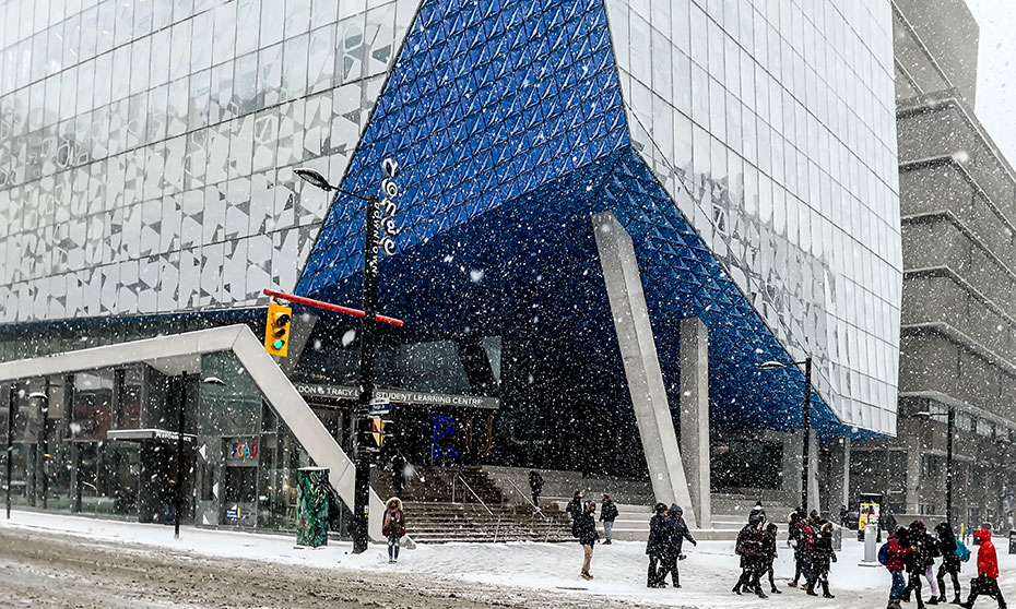
Ryerson University is a public research university in Toronto. Its urban campus surrounds the Yonge–Dundas Square, located at one of the busiest intersections in downtown Toronto. Most of its buildings are in the blocks northeast of the Yonge–Dundas Square in Toronto’s Garden District. Ryerson’s business school, Ted Rogers School of Management, is on the southwest end of the Yonge–Dundas Square, located on Bay Street, slightly north of Toronto’s Financial District and is attached to the Toronto Eaton Centre. The university has expanded substantially in recent years with new buildings such as the Mattamy Athletic Centre, in the historical Maple Leaf Gardens arena, the former home of the Toronto Maple Leafs. The university comprises 44,400 undergraduate students, 2,950 graduate students, and 12,000 continuing-education students. Ryerson is ranked 4th in Ontario and 10th in Canada by student enrollment.
In addition to offering full-time and part-time undergraduate and graduate programs leading to Bachelor’s, Master’s and Doctoral degrees, the university also offers part-time degrees, distance education, and certificates through the G. Raymond Chang School of Continuing Education.
The Black Bull Tavern. Established in 1833, it is undoubtedly one of the oldest watering holes in the city. However, it cannot claim to be the oldest continually serving tavern in Toronto, as the building was not employed as an ale house for several decades. The Wheat Sheaf at King and Bathurst outranks the Black Bull.
In the 1830s, the Black Bull was typical of the structures of the period — a wood-frame, two-storey building, with a steep-pitched roof. York was a hospitable place in the old days, for the areas of entertainment in every section of town were very much more numerous, when compared to the population, than they are now. The Black Bull was a favourite stopping place for farmers on their way to town from the west and north-west. In 1895, the establishment possessed 50 guest rooms. In 1910, the Black Bull was again extensively renovated, and red-brick cladding was employed to encase the entire building. The latest and most popular addition to the Black Bull is the patio, on its west side on Soho Street. It opened c. 1981, and is one of the city’s most popular outdoor drinking venues.
The Junction is a neighbourhood in Toronto near the West Toronto Diamond, a junction of four railway lines. The neighbourhood was previously an independent city called West Toronto, which was also its own federal electoral district until amalgamating with the city of Toronto in 1909. The main intersection of the area is Dundas Street West and Keele Street. The Stockyards is the northeastern quadrant of the neighbourhood.
The area was primarily rural until the 1870s. From 1857 to 1876, the Carlton Race Course dominated the neighbourhood’s southeast.
The Junction was a manufacturing community that rose quickly during the late 19th century. Foundries, mills, furniture assembly, meat processing, nail and wire factories were established. Notable companies, such as Canada Packers, Canadian Cycle & Motor Co., Campbell Milling Company and the Heintzman piano company, were set up in the area. Other firms came because land, labour and taxes were cheaper than in Toronto, and the Canadian Pacific established a major operation there, establishing yards from Keele Street as far west as Scarlett Road. These factors also attracted many immigrant or second-generation Irish Catholics to the area, many of whom moved there from the poor, crowded tenement housing in areas of the city such as Cabbagetown and Brockton Village during the 1880s. Many also came from working-class English industrial cities such as Birmingham and Manchester. They were soon followed by many from non-English speaking countries, including Italians, Poles, Macedonians and Croatian immigrants, many of whom worked in the meat industry.
The Junction was prone to booms and busts during its tumultuous history. While the period between 1888 and 1890 was prosperous, the period between 1893 and 1900 saw significant poverty due to an economic recession. The Long Depression saw the closing of factories and the end to construction in the area, and the municipality could not support its citizens because of a large civic debt.
Pubs and taverns became permanent fixtures in The Junction, as with many railway and factory workers’ towns. By 1904, the behaviour of the Junction workers was so out of hand that it led the residents, led by Bill Temple, to vote for banning the sale of alcohol until 1998. It was a long and tough fight led by Vesuvio Pizzeria and Shoxs Sports Saloon to regain the right to serve alcohol in the area again, and it was not until 2001 that the first drink was poured east of Keele Street at Shoxs Sports Saloon. This, along with the burial of electric distribution lines and other street and sidewalk improvements, is credited by many as the beginning of the revitalization of the Junction.
Much of the land has been redeveloped for housing and retail use. The leading Stockyards site is now the location of a large block of big-box stores, including Metro, Home Depot, Canadian Tire, Future Shop (became re-branded as Best Buy in 2015), Rona, Staples, and Nations Fresh Foods, an Asian supermarket, along with several smaller stores.
Since the early 1920s, the area by Dundas and St. John’s Road has been known as Little Malta (getting signs to that effect in the 1990s) with several Maltese-Canadian businesses present, as well as a distinctly Maltese church.
Rapid gentrification has meant that new chic restaurants and bars have opened up along Dundas Street, attracting young people. Lower rents make the neighbourhood appealing to artists. Some see The Junction as the next big “hip place to live” with a surplus of vacated industrial space and warehouse loft conversion possibilities.
High Park is a municipal park, a mixed recreational and natural park, with sporting facilities, cultural facilities, educational facilities, gardens, playgrounds and a zoo. One-third of the park remains in a natural state, with a rare oak savannah ecology. High Park was opened to the public in 1876 and is based on a bequest of land from John George Howard to the City of Toronto. It spans 161 hectares (400 acres) and is the second-largest municipal park in Toronto, after Centennial Park.
High Park is located west of Downtown Toronto, north of Humber Bay, and is maintained by the City of Toronto. It stretches south from Bloor Street West to The Queensway, just north of Lake Ontario. It is bounded west by Ellis Park Road and Grenadier Pond and east by Parkside Drive.
Ontario Place and Cinesphere is an entertainment venue, event venue, and park located on three artificial landscaped islands off-shore in Lake Ontario, south of Exhibition Place, and southwest of Downtown Toronto. It opened on May 22, 1971, and operated as a theme park centred around Ontario themes and family attractions until 2012, when the Government of Ontario announced it would close for redevelopment. It has since reopened as a park without admission but without several old attractions. The Budweiser Stage operates during the summer season. The Cinesphere, the original IMAX theatre, reopened with new projection equipment and shows films regularly. Trillium Park and the William Davis Trail opened on the East Island in 2017. A marina, sheltered by three sunken lake freighters, operates seasonally at the site.
Amsterdam Bridge is a steel/cable footbridge that crosses the Simcoe Street Slip from York Quay to Rees Street Slip. Below the bridge is a docking facility for boats. The Amsterdam Bridge commemorates the twinning of Toronto and Amsterdam in 1974. Similarly, a bridge that crosses the Amstel River in Amsterdam was renamed Torontobrug. The Toronto Bridge is a bascule bridge built in 1970 and carries pedestrian and vehicular traffic.
Humber Bay Arch Bridge is a pedestrian and bicycle bridge completed in the mid-1990s over the mouth of the Humber River, the start of the “Toronto Carrying Place” trail, an ancient aboriginal trading route leading north. The bridge forms an essential link between pedestrians, recreational cyclists, and commuter cyclists. It carries the Waterfront Trail, a multi-use pathway that will eventually parallel the entire north shore of Lake Ontario. The Toronto section is known as the Martin Goodman Trail and is one of the city’s most popular pedestrian and cycling routes.
It is 139 metres (456 ft) long and has a clear span of 100 metres (330 ft). It is constructed of two 1,200 millimetres (47 in) diameter high-strength steel pipes bent into twin arches that rise 21.3 metres (70 ft) above grade. The deck is suspended by 44 stainless-steel hangers, each 50 millimetres (2.0 in) in diameter. The foundation consists of concrete-filled caissons that go down 30 metres (98 ft) below grade to the bedrock.
Square One Shopping Centre, Mississauga, is the largest shopping centre in Ontario and the second largest in Canada, after the West Edmonton Mall. It has over 2,200,000 square feet (200,000 m2) of retail space and more than 360 stores and services. On average, the mall serves over 24 million customers each year.
Square One is adjacent to Highway 403 and the Hurontario Street interchange. Located within the mall grounds is the main terminal of the MiWay (formerly Mississauga Transit) bus network, which opened in 1997, and a Peel Regional Police station, which opened in 2002.
Built between 1969 and 73, the four original anchors included Woolco, Sears at the time Simpson-Sears, The Bay, and Dominion.
Georgian Bay Islands NP consists of 63 small islands or parts of islands in Georgian Bay, near Port Severn, Ontario. The total park area is approximately 13.5 km2 (5.2 sq mi). Before Fathom Five National Marine Park was created, Flowerpot Island was also a part of the park. The islands blend the exposed rocks and pines of the Canadian Shield with the hardwood forests found further south. The park can only be reached by boat; there are limited camping facilities on the largest island, Beausoleil Island.
St. Joseph Island is in the northwestern part of Lake Huron. The island is 30 kilometres (19 mi) in length and 20 kilometres (12 mi) in width at its widest point and 365 km2 (141 sq mi) in area. It is the sixth-largest lake island in the world; the second-largest island on Lake Huron, following Manitoulin Island; and the third largest of all the islands on the Great Lakes, trailing Manitoulin and Lake Superior’s Isle Royale. The circumference of the island’s coastline is 145 km (90 mi).
The island is approximately 45 km (28 mi) southeast of Sault Ste. Marie is 225 km (140 mi) southwest of Sudbury.
St. Joseph Island played an important role for First Nations and Europeans in the early fur trade and as a staging point for the first victory for British North America in the War of 1812. Today, it is a destination for tourists and cottagers in northeastern Ontario.
French River Provincial Park offers a river of national historic significance (the French River is the first designated Canadian Heritage River), paddle the route of Indigenous people, French Explorers, fur traders and Voyageurs, a 105 kilometre canoe route of interconnected lakes, gorges and rapids from Lake Nipissing to Georgian Bay, Georgian Bay coastal kayaking is available through the French River Delta and a variety of experiences ranging from wilderness paddling to motor boating, fishing and private lodges.
Mississagi River Provincial Park is a protected area on the Mississagi River in Algoma and Sudbury Districts. It has an Ontario Parks designation of Waterway Class. The park encompasses the river and lakes from Mississagi Lake to Bark Lake, and further downstream to just above Ricky Island Lake and portions of the upper Spanish River system.
+++++++++++++++++++++++++++++++++++++++++++++++++++++++++++
CANADA – ONTARIO WEST (Thunder Bay, Marathon, Red Lake)
Lake Superior is the largest of the Great Lakes of North America, the world’s largest freshwater lake by surface area, and the third largest by volume (behind Lake Baikal in Siberia and Lake Tanganyika in East Africa). It is shared by the Canadian province of Ontario to the north, the U.S. state of Minnesota to the west, and Wisconsin and the Upper Peninsula of Michigan to the south.
The farthest north and west of the Great Lakes chain, Superior has the highest elevation of all five Great Lakes and empties into Lake Huron via the St. Marys River and the Soo Locks.
Lake Superior has a surface area of 31,700 square miles (82,103 km2), which is approximately the size of South Carolina or Austria. It has a maximum length of 350 statute miles (560 km; 300 nmi) and a maximum breadth of 160 statute miles (257 km; 139 nmi). Its average depth is 80.5 fathoms (483 ft; 147 m) with a maximum depth of 222.17 fathoms (1,333 ft; 406 m). Lake Superior contains 2,900 cubic miles (12,100 km³) of water. There is enough water in Lake Superior to cover the entire land mass of North and South America to a depth of 30 centimetres (12 in). The shoreline stretches 26 miles (4,387 km) (including islands).
Annual storms on Lake Superior regularly feature wave heights of over 20 feet (6 m). Waves well over 30 feet (9 m) have been recorded.
Lake Superior is fed by more than 200 rivers, including the Nipigon River, the St. Louis River, the Pigeon River, the Pic River, the White River, the Michipicoten River, the Bois Brule River and the Kaministiquia River. Lake Superior drains into Lake Huron via the St. Marys River. Rapids are at the river’s upper (Lake Superior) end, where the river bed has a relatively steep gradient. The Soo Locks enable ships to bypass the rapids and to overcome the 25-foot (8 m) height difference between Lakes Superior and Huron.
The Severn forms part of the inland canal system known as the Trent-Severn Waterway, which links Port Severn on Georgian Bay with Trenton on Lake Ontario via the Trent Canal. From the middle of the 19th century until the canal’s completion in 1920, the Severn transported logs to sawmills downstream. Two hydroelectric stations are located at the falls on its course.
The central Ontario Severn River is only 30 km (19 mi) long. The river services seasonal cottagers, as many properties are accessible only by boat. Some year-round residents live on the Severn. The river sees many yachts/cruisers travelling from Lake Couchiching to Georgian Bay, or vice versa.
Pukaskwa NP is located south of Marathon. Established in 1978, it is known for its Lake Superior and boreal forest vistas. The park covers an area of 1,878 square kilometres (725 sq mi) and protects part of the longest undeveloped shoreline anywhere on the Great Lakes.
The Hattie Cove Campground is located at the park’s north end and can be accessed via Highway 627, the only road to the park. There are also a number of backcountry campsites located along the 60 km Coastal Hiking Trail, which follows the north shore of Lake Superior. The Coastal Hiking Trail has two suspension bridges: one across the White River at Chigaamiwinigum and one across the Willow River. The Coastal Hiking Trail is part of the long-distance Voyageur Hiking Trail. Backcountry campsites are also located along the Coastal Paddling Route, the White River, and the Pukaskwa River.
Pebble Beach, Marathon, is a 2km stretch loaded with deposits of giant, rounded pebbles and driftwood. Smoothed by wave action, the large rocks are piled on the steep shoreline, making walking difficult. However, the beach is beautiful and worth stopping to go rock hunting.
Nipigon Lake is part of the Great Lakes drainage basin and the largest lake entirely within the boundaries of the Canadian province of Ontario. Lying 260 metres (853 ft) above sea level, the lake drains into the Nipigon River and Nipigon Bay of Lake Superior. The lake and river are the largest tributaries of Lake Superior. It lies about 120 kilometres (75 mi) northeast of Thunder Bay, Ontario.
Lake Nipigon has a total area (including islands within the lake) of 4,848 square kilometres (1,872 sq mi), compared to 3,150 square kilometres (1,220 sq mi) for Lake of the Woods. The largest islands are Caribou Island, Geikie Island, Katatota Island, Kelvin Island, Logan Island, Murchison Island, Murray Island, and Shakespeare Island. Maximum depth is 165 metres (541 ft).
The lake is noted for its towering cliffs and unusual green-black sand beaches composed of the fine particles of a dark green mineral known as pyroxene. The lake basin provides an important habitat for woodland caribou.
In 1943, Canada and the United States agreed to the Ogoki diversion, which diverted water into Lake Superior that would normally flow into James Bay and then into Hudson Bay. The diversion connects the upper portion of the Ogoki River to Lake Nipigon. This water was diverted to support three hydroelectric plants on the Nipigon River. The diversion is governed by the International Lake Superior Board of Control, established in 1914 by the International Joint Commission.
The aboriginal population (primarily Ojibwe) include the Animbiigoo Zaagi’igan Anishinaabek (Lake Nipigon Ojibway) First Nation, the Biinjitiwaabik Zaaging (Rocky Bay, whose name changed in 1961 from McIntyre Bay Indian Band) Anishinaabek First Nation, the Bingwi Neyaashi (Sand Point) Anishinaabek First Nation, the Red Rock (Lake Helen) First Nation and the Gull Bay First Nation. Formerly, the Whitesand First Nation was also located along the northwestern shores of Lake Nipigon until they were relocated in 1942. The membership of these six First Nations totals about 5,000. Additionally, along Lake Nipigon, there are three Indian Reserves: McIntyre Bay IR 54 (Rocky Bay First Nation), Jackfish Island IR 57 and Red Rock (Parmachene) IR 53 (Red Rock First Nation).
Lake of the Woods occupies parts of the Canadian provinces of Ontario and Manitoba and the U.S. state of Minnesota. It separates a small land area of Minnesota from the rest of the United States. The Northwest Angle and the town of Angle Township can only be reached from the rest of Minnesota by crossing the lake or travelling through Canada. The Northwest Angle is the northernmost part of the contiguous United States.
The Rainy River, Shoal Lake, Kakagi Lake, and other smaller rivers feed Lake of the Woods. It drains into the Winnipeg River and then into Lake Winnipeg. Ultimately, its outflow goes north through the Nelson River to Hudson Bay.
Lake of the Woods is over 70 miles (110 km) long and wide, contains more than 14,552 islands, and has 65,000 miles (105,000 km) of shoreline.
