
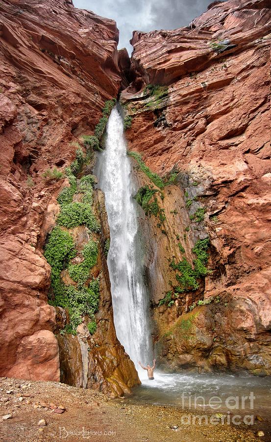
I’m sure rafting the Grand Canyon is on everyone’s bucket list. It had been on mine for years, possibly ever since I read Colin Fletcher’s The Man Who Walked Through Time, when he walked a portion of the Grand Canyon. Reading Edward Abby’s Monkey Wrench Gang and Hayduke Lives increased the yearning. Since 1980, I have visited the South Rim several times, watched the condors fly up the updrafts, and hiked down the South Kaibab Trail twice, camped at the NP Campground, visited Phantom Ranch, and returned up the Bright Angel Trail. I once walked the 22 miles from the North Rim to the South Rim in a day. Backpacking the 10 miles down Havasu Canyon and then 14 more down to the Colorado and back remains my all-time favourite backpacking trip. I’ll also never forget sleeping on the edge of the north rim at Toroweap through a massive thunderstorm.
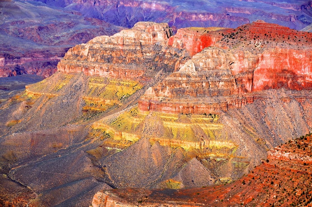
At 277 miles long, no other canyon in the world approaches the Grand Canyon’s length. Unlike other canyons claiming to be deeper, they are all measured from the top of surrounding mountains – the Grand Canyon’s severe depth is surrounded by broad, featureless plateaus, 5,000 to 9,000 feet above sea level. The canyon drops vertically as a gaping hole in the earth, most of it a mile deep. Sheer escarpments rise to 3,000 feet high, spanning an average width of 10 miles. Clearly, when measured from its rim, the Grand Canyon is the deepest canyon in the world.
One of the original Seven Natural Wonders of the World, it was omitted from the New Seven Natural Wonders poll due to nationalistic fervour that influenced the outcome. The marvellous display of rocks and the Earth’s history they reveal makes the Canyon a perfect geologic classroom. It may have been best described as “the most splendid exposure of stratified rocks in the world”. Visitors commonly find it strange, are shocked and dwell for a time with a sense of oppression and perhaps horror. But it soon appears beautiful and noble.
It is hard to appreciate the massive scope of the canyon by visiting the viewpoints along the South Rim in Grand Canyon National Park. Only tiny snippets of the river aren’t obscured by the 1,000-foot-deep inner gorge. Only a few percent step more than 50 yards off the rim. But not everyone can walk down or ride a mule. Of the 5 million visitors to Grand Canyon NP per year, 27,000 see the canyon by river. There is marvellous hiking throughout the canyon. This was a highlight for me.
There are many ways to see the canyon from the river. Half of all trips are private, determined by a yearly lottery. Before the lottery, the waiting list was 10 years long. To be private, no one can be paid any money to guide. The only requirement is that at least one person has previously made a river trip. That’s right, he does not have to have rowed a boat! The remaining trips are allocated to concessions issued to approximately 14 companies that cater to customers of all abilities, taking them down the river.
Motorized boats consist of two large pontoons connected by a metal frame and powered by a 25-30HP outboard. Full river trips last only 10 days instead of 15 and are cheaper.
Dories are fibreglass and flat-bottomed – the ‘speedboats’ on the river. They are much more responsive to rowing, but they are much easier to tip and don’t bounce off rocks. A day trip typically requires a built-in day for repairs and is thus more expensive.
Rafts are generally 16-18 feet long and hold four passengers, two in the front, the oarsman in the middle and two in the back facing inwards. Webbing is strung for grab holds. O.A.R.S. bought Grand Canyon Dories and runs more dory trips than most other companies.
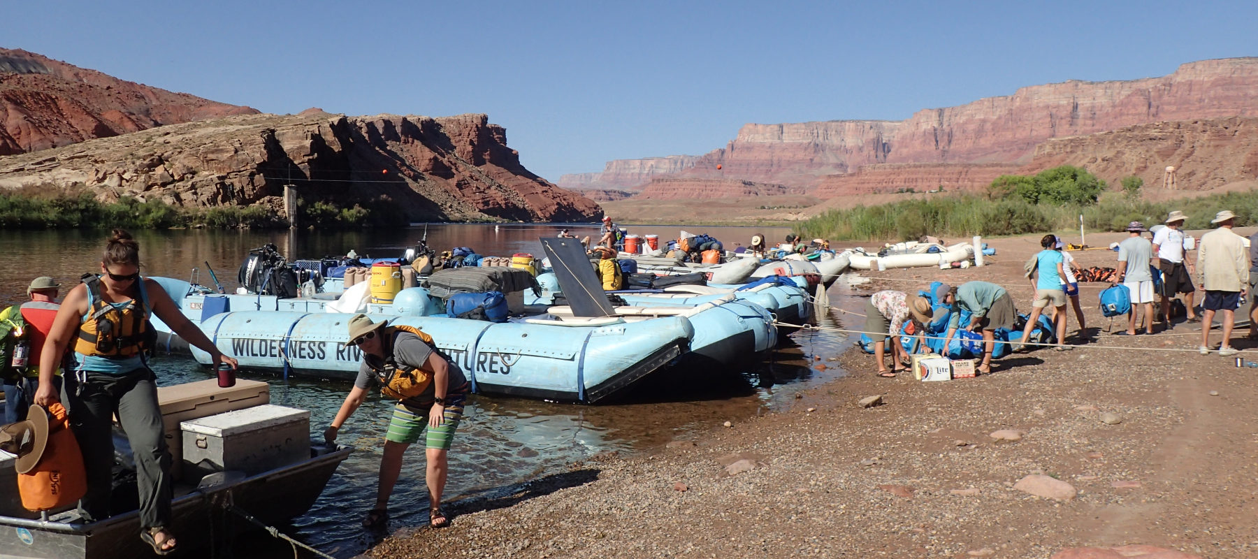
It is not an easy trip to arrange. The cost is also an issue, especially when paying in Canadian dollars. I had tried to book a trip for the previous two years, but I never started early enough. I contacted O.A.R.S. in August 2015, a full 14 months before a hoped-for October trip in 2016 – and got the last spot on their October 6-21 trip to raft the entire Grand Canyon from Lees Ferry to Diamond Creek, a river distance of 224 miles. Few companies go past Diamond Creek. It is still three days to Lake Mead, but the Pearce Ferry Rapid prevents us from going all the way.
This would be my 34th trip to the desert southwest of the USA. I always drive down. I had a lot of time and left home on Vancouver Island on October 1. I followed the US West Coast to San Francisco. My son lives there, and after a short visit, I continued to Yosemite, Mono Lake, and camped at Eureka Dunes, located at the north end of Death Valley, the highest dunes in California. One of the few things I have always wanted to see was the Race Track (rocks moving across a playa leaving their tracks), but the road defeated me. After the obligatory tour of the Las Vegas Strip (I watched the entire Blue Jays-Baltimore game with a lovely lady from eastern Ontario on a massive multiscreen TV at a casino), I arrived in Flagstaff on the 5th for the pre-trip meeting at the DoubleTree Hotel at 7 pm. I stayed at a much cheaper place down the street.
Curtis, our head guide, gave a rundown of the trip and distributed two massive and one medium dry bag. Six were leaving after six days at Phantom Ranch to be replaced by four new rafters. We all chatted and promptly forgot everyone’s name, then hit the sack as we were leaving at 6:45 am.
We drove in large vans to Lees Ferry, making an obligatory tourist stop at the Cameron Trading Post. Just past Cameron, the Little Colorado was muddy brown instead of turquoise. Lees Ferry is 13 river miles downstream from the Glen Canyon Dam. Built in 1963, the dam has, at least for its life, drastically changed the nature of the river. It can’t last forever, and when viewed over the 6 million years it took the Colorado to carve the Grand Canyon, it is a blip in its history. Except for a massive water year in 1983, the river is no longer subjected to the large floods necessary to deepen the canyon, change beaches, clear the enormous invasion of tamarisk, or alter rapids. The canyon has been gutted. It is also relatively sterile now, as only cold water with little sediment passes through the dam.
With 16 passengers, we had four guides. Interestingly, the four were all best friends, living together in the same house when in Flagstaff, and surprisingly, this was the first time they had all worked together. Curtis considered the three women his first, second and third “sister-wives” – Billie, Chelsea and Andrea. All had between 50 and over a hundred Grand Canyon trips, both in rafts and dories. Guides are allowed to have one guest come on a trip per year, and Andrea’s brother, Stephen, from Edmonton, was on the first 7 days to the Phantom Ranch. These “guests” are expected to put in a full day of work.
We also had two gear boats with no passengers on board. This was Peter’s fourth trip to the Grand Canyon and Lee’s first. Both had accurate atlases with notes. Serious rapids are scouted first. But both were experienced on other rivers. The Grand Canyon is not where one breaks in. Many companies don’t pay the gear boat drivers and expect them to volunteer – part of the induction process to become a guide with people in your boat. O.A.R.S. pays its baggage guys.
Most paying customers were over 50 and hailed from a cross-section of America, including Jackson, Boulder, Dallas, Madison, Tucson, Santa Fe, Whitefish, Washington, D.C., and Portland. Six got off at the Phantom Ranch and were replaced by an Australian couple and a couple of hospital executives from southern Georgia who had rafted the first part previously. It was a congenial group.
One condition of coming was the ability to sleep in a tent and rough it. No soap was allowed in any of the creeks emptying into the Colorado, so bathing was in the cold river. I slept outside every night (as did a few others). Except for some sprinkles one day and minor dust storms at night, the weather was perfect. The night skies over northern Arizona are the darkest in the lower 48. The moon was full on October 15th, but the stars were still spectacular. Everyone saw several comets.
Any hardships were more than made up for by the incredibly hardworking, attentive crew and the delicious, copious food. Eighty pounds of dry ice kept the choice cuts of salmon, prawns, steak, tuna, pork, and chicken fresh until the end of the two weeks. Cakes made in a Dutch oven were a treat. Breakfasts and lunches were equally superb. Bacon was common. O.A.R.S. has a reputation for running the highest-quality trips. Someone was up at 5:30 to start brewing coffee for the early risers at 6:15. We attempted to be off by 8:00 or 8:30. There was an extensive library of books.
Over the week, we were in all the individual guides’ rafts. They rowed for almost the entire 224 miles. When power is needed, they row backward and use their legs. Their control of the rafts was a joy to watch – how they read the current to use the river to its maximum and how they could often keep us dry or wet at will. For several of the rapids, there was the option of having a more action-filled ride.
The guests could row on flat water, and I took advantage of the opportunity as often as the guides would allow. The long ash oars feel clunky and awkward, and it took me a long time to develop a minimally fluid style. It’s all in the wrists. The stroke ends with a forced flexion of the wrists that feathers the blade of the oar and gives a thrust to the end of the stroke as it smoothly exits the water. The feathered oar can be left in the water. A key is using the oars individually if necessary – rowing backward with one oar and forward with the other – and feeling the effect of the moving water around the raft to stay in the best current. Pushing an oar in an eddy is easier than if you are in a current, so the goal is to have your oars pulling equally, both in the current. It is much more complicated than it sounds. It is also essential to set your angles so that you enter rapids aiming in the direction of safety. I didn’t get to run any rapids. The other guests would have revolted.
Best Season. From the guides, it became apparent that October trips are their favourite—all hate working in June and July when the heat is oppressive. Bugs are more common. The August monsoon is also less of a favourite for the same reasons. April and May are very windy. It is already hard work rowing for 233 miles without having to deal with the wind. There aren’t many winter trips, but one of the women has been working on scientific trips, which are more common in the winter. Generally, many people work in the ski industry during the winter or have other seasonal jobs. In those hot summer months, some guide in Idaho or northern Utah.
River Miles. These are based on the 2002 US Geological Survey. The starting point is the gauging station cable at Lee’s Ferry. Distances measured along the river center line provide greater accuracy than the previous method, which used the shoreline.
Rapids.
All of the Canyon’s rapids, except for Bedrock at mile 131, are formed by a special type of flood called a debris flow. A thick slurry of roughly equal parts water and sediment, a debris flow can easily move car-sized boulders. They can instantly transform the river into a challenging rapid. These usually occur at the mouths of side creeks that deposit large amounts of boulders, rock and sediment during floods.
Landslides and lava flows, although much less commonly, are the source of the material causing the rapid. These obstruct the river, causing a constriction and drop, which increases water flow rates and yields fast water.
In the pre-dam days, large floods on the river would disperse the smaller boulders downstream, lessening the severity of the rapid. As recurring side canyon debris flows bring more boulders into the channel, rapids may continue to grow in size and difficulty. In effect, man’s damming of the river has increased the adventure of river running.
The Belknap Grand Canyon River Guide rates them on a 1-10 scale, with 10 being the most difficult. The guides rate them on a scale of 1-5. Ratings are based on river flows of between 5,000 and 25,000 cubic feet per second (c.f.s.). About half of the rapids in the canyon are more difficult at higher water levels (tight constrictions) and half are more difficult at lower water levels (lots of rocks), so the difficulty ratings can be random. Rating rapids by difficulty is useful, especially for beginners to understand some basic concepts. Still, it is relative and dependent on water levels, a boater’s ability, and the boat’s type and size.
Getting wet is a routine part of running rapids. You get the wettest riding the bow of the boat; actually, it’s quite a safe position. The front seats get wet on most significant rapids. Staying dry is quite possible at the rear, especially when the ass lift technique is perfected.
Dressing for getting wet varied from bare skin (the fastest dry) to kayaking tops and rain pants. I forgot my rain pants and was happy as your ass still gets wet with them on. Dress depends on the temperature and sun exposure. I most often wore a short-sleeved polyester top, a long-sleeved UV-protective shirt, hiking shorts, and a wide-brimmed sun hat. To dry my rear the fastest, I went commando almost every day. I wear flip-flops nearly 12 months of the year, and they function the best. That is the only thing the guides wore on their feet.
I preferred the rear seats. Besides being the driest, they allowed me to examine the rowing technique and follow the currents and eddy lines. In the second half of the trip, with only 14 guests, it was possible to have the rear to oneself.
Holes: Churning water downstream from a submerged rock. The big ones are the primary cause of turnovers.
Tongue: The V-shaped smooth water at the head of the rapid.
Sleeper: Smooth ‘pillow’ of water hiding a shallow rock.
Eddy: Water running upstream behind an obstacle.
Safety. Snuggly fitting life jackets are mandatory whenever on the raft. Helmets are worn for the more significant rapids. Standing was discouraged in the rapids.
Camp Routine
Campsites. There are 257 campsites officially listed in an inventory compiled by the National Park in 2014. This is a reference only as campsites change with water levels, side canyon floods and sandbar formation. All camping must be located below the historic high-water zone. They are rated by size.
Toilet Procedure. Urination directly into the river is encouraged. All trips must provide a portable toilet (groover) for feces and toilet paper (but absolutely no urine). Chlorox powder is used to control odour. Only one boat got heavier as the trip proceeded.
Water was produced en route using a pump operated by one deep-cycle battery, three filters and an Ultraviolet light. A small amount of chlorine was also used. With the Little Colorado flooding and adding a considerable amount of sediment to the water, the water remained coloured for the duration of the trip. It was allowed to settle overnight before filtering and UV treatment.
Hand washing and hygiene. Rules were strict to prevent cross-contamination and the spread of disease. Hand washing stations at the toilet and food consumption areas were to be used before serving food. A four-station dishwashing station produced sterilized dishes.
Soap for bathing could only be used in the river (cold) and was best done in the heat of the day. Solar showers were not as helpful as they too had to be used over the river.
All food was well-cooled using 80 pounds of dry ice. The meat had to be thawed before use on day 14. Most food not eaten at each meal was discarded (meat left over from dinner was often breakfast or lunch the next day).
Every meal had standard components. Breakfast included cereals, bread, fresh fruit, jams, honey, peanut butter, orange juice, tea, hot chocolate, and all the coffee you could drink (with half-and-half, 2%, almond, and rice milk). This was in addition to entrees often including bacon, sausage, pancakes, French toast, eggs, breakfast burritos and Egg McRivers (breakfast muffin, ham, egg, cheese). No detail was missed. Dinner always had a salad and some form of dessert. Soft drinks were free. A variety of alcohol could be purchased pre-trip. It was cooled with river water.
I’m sharing a day-by-day guide to our trip here.
MARBLE CANYON – Lee’s Ferry to the Little Colorado River.
Day 1. Thursday, October 6.
After the drive from Flagstaff northeast to Lees Ferry, we waited excitedly for the put-in. This was a critical Colorado River crossing, as it provided good road access to a gentle sloping beach.
Lees Ferry was named after John D. Lee who operated a ferry service here from 1870 to 1928. It is the only place to cross the Colorado River for over 300 miles up or downstream. Initially used by pioneers heading west, it later gained prominence as a transportation hub for early settlers in the region. Today, remnants of the old ferry crossing and the nearby Lonely Dell Ranch offer visitors a glimpse into the past. After completion of the Navajo Bridge in 1929 the ferry stopped running.
It is the embarkation point for all Grand Canyon trips.
The geology lesson starts almost immediately. The rock layers that eventually form the top of the canyon rim, over a mile above the river, begin to appear within the first mile. The Moenkopi Formation (240m years – sandstone and shale formed in river floodplain, forms slope) appears at river level at mile .8, the Toroweap (272m years – limestone, sandstone, gypsum and chert formed in warm shallow sea, marine fossils, forms cliff and slope) at 2.2 miles, Coconino Sandstone (275m years – crossbedded dunes in semi-arid coastal environment, forms cliff) at 4.5 and the Hermit Shale (280m years – siltstone and sandstone formed in river floodplain) at 5 miles. The Esplanade Sandstone (280m years – sandstone, siltstone, conglomerate and limestone formed in coastal tidal flat and dunes) and the start of the Supai Group appeared at mile 11.7 with the Wescogame Formation (310m years – limestone, sandstone, and dolomite formed in shallow warm sea and coastal tidal flat, forms cliff and slope) at mile 15.1.
The Paria River adds its sediment-heavy water at mile 1. I backpacked the Paria about 20 years ago. It is a fantastic 4-day trip with highlights including Buckskin Gulch, deep canyons, hundreds of cold river crossings, rock formations, and infrequent water sources from springs.
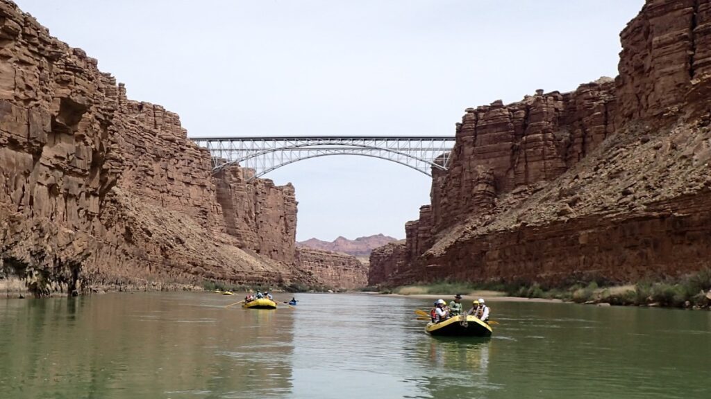
At 4.5 miles, we passed under Navajo Bridge, where the original 1929 bridge (located upstream) is now reserved for pedestrians, and the 1995 Marble Canyon bridge is for vehicles. They are 470 feet above the river and the last car crossing until Hoover Dam, 350 miles downstream.
We got our first taste of rapids. Little did we realize how many we would eventually encounter and how routine they would become as an integral part of everyday life. It’s necessary to take care. It would be too embarrassing to go for a swim. After that, the primary goal of rafting is to keep your ass dry. This is quite possible when sitting in the back, especially as one gets adept at a quick lift.
Camp. Hot Na Na: mile 16.6 – river left.
Day 2. Friday, October 7.
Geology: At mile 18.6, the rim is 1,855 feet above the river. Manakacha Formation (part of Supai Group, 320m years, sandstone, dolomite and limestone formed in shallow warm sea and tidal flat, forms cliff and slope) appears at 18.3 miles, the Watahomigi Formation (325m years, limestone, siltstone, conglomerate and chert formed in shallow sea and coastal mudflat, forms slope) at 20.5 and the Redwall Limestone (335 m years, limestone, dolomite and chert formed in shallow and deep-sea, forms cliff, many caves) at 23.3 miles. The Redwall is the major cliff formation layer in the canyon, which most often serves as a barrier to reaching the rim from the river.
Hike: North Canyon – Mile 20.5 – river right. This is the first “classic” GC hike.
From the river, bypass a fall at .3 mile on the right. Most stop at a pool backed by trickling water and a slide (that looks like a vagina). One can swim in the pool, climb the slide, and continue 200 yards to a vertical 40-foot wall, 0.6 miles from the river.

Tamarisk. The tamarisk tree is an exotic invasive species first introduced from Eurasia in the 1800s to control riverbank erosion. It has invaded the stream banks of every water source in the Colorado Plateau and reached the Grand Canyon by the 1930s. It expanded after the Glen Canyon Dam was built, as major floods were prevented. It can produce impenetrable thickets along the shore and has copious numbers of seeds. Many attempts at control have been made, but few have had much success. The most recent was the introduction of the Tamarisk Beetle – Diorhabda carinulata – which disrupts water and nutrient transport, causing defoliation, browning, and death of the tree. First introduced upstream in Utah, it reached the Grand Canyon in 2009; however, success is limited due to the large seed load of the tamarisk, and it is also expensive. It is hoped that native plant species will expand into the former tamarisk patches.
Desert Bighorn (Ovis canadensis). We frequently see their prints on the beaches and start to notice sporadic animals only on the north side of the river in Marble Canyon. This occurs after the rut, when most are single or small groups of males. They rarely swim because they don’t float well due to their heavy horns and dense muscle mass. They are increasing in number since their major food competitors, wild burros, were removed from the canyon by the National Park Service.
As the trip progressed, there were many bighorns on both sides of the river.
Bats are typically found on the river and in side canyons. There are 20 bat species in the Canyon.
Great Blue Herons (Ardea herodias), the largest North American heron (4 feet tall), are the most common bird on the river. It is a patient hunter who makes lightning strikes at crustaceans and fish with its long, knifelike beak.
Camp: Sandpile – mile 30.7, river right. Big sand beach.
Day 3. Saturday, October 8.
Vasey’s Paradise – mile 32.1, river right. This spring’s flow is variable due to seasonal fluctuations. Springs burst from the rock high overhead. The rocks are covered with mosses, ferns and beautiful flowering plants. Vasey was the botanist who travelled with Powell in 1868. The endangered Kanab amber snail thrives in the oasis of vegetation here.

Redwall Cavern – mile 33.3, river left. This deep undercut is a common tourist stop. We played Frisbee in the vast space. Powell thought it would hold 50,000 people. No camping or fires are allowed.

Marble Canyon Dam Site: Located between miles 30 and 40, this site was proposed in the 1920s and investigated in the 1940s, but was ultimately abandoned as a project. The dam site was incorporated into Marble Canyon National Monument in 1968 and subsequently merged with Grand Canyon National Park in 1979.
Bert Loper boat: mile 41.6, river right on the delta of Royal Arch Canyon. He made his first run through the canyon at age 69 and died a decade later on his second trip while running 24 ½ Mile Rapid. His boat was found 16 miles downstream. The battered hulk remains.
Geology: Unclassified dolomites (400m years, dolomite, limestone, shale and siltstone from a shallow sea in brackish water, forming cliff and slope) first appear at mile 35.4. A joint system forms eroded caves in the Redwall Limestone at 36 miles. Muav Limestone (505m years, dolomite, limestone, shale and siltstone from the shallow sea with brackish water, forms a cliff) first appears as part of the Tonto Group at mile 37.3. The Temple Butte formation (370 million years, dolomite, limestone, and sandstone from an interchanging estuary tidal flat and shallow sea in brackish water, forming cliffs and ledges) fills old river channels in Marble Canyon and becomes a mostly continuous feature in the Grand Canyon. Bright Angel Shale (515m years, siltstone, shale, limestone and sandstone from a shallow muddy sea, forms the slope for the Tonto Plateau) appears at mile 47.
Hike: Saddle Canyon – Start up a dry, initially steep climb, then traverse high above the creek for great views back to the delta and river. Drop down to the creek, ensconced in giant Redwall cliffs. Hackberry, box elder, and Woodhouse toads are in the canyon. Enter the Muav Limestone narrows with a tiny creek. A 5th-class boulder move is required to ascend a moss-backed 30-foot waterfall. 3 hours return. The guides were curious to see this canyon following a colossal flood that produced significant changes in the canyon.
Camp: Lower Saddle – mile 47.6, river right

Day 4. October 9.
We started the day with a short 6-mile ride to the Main Nankoweap Canyon campsite to start another of the four “classic” Grand Canyon hikes.
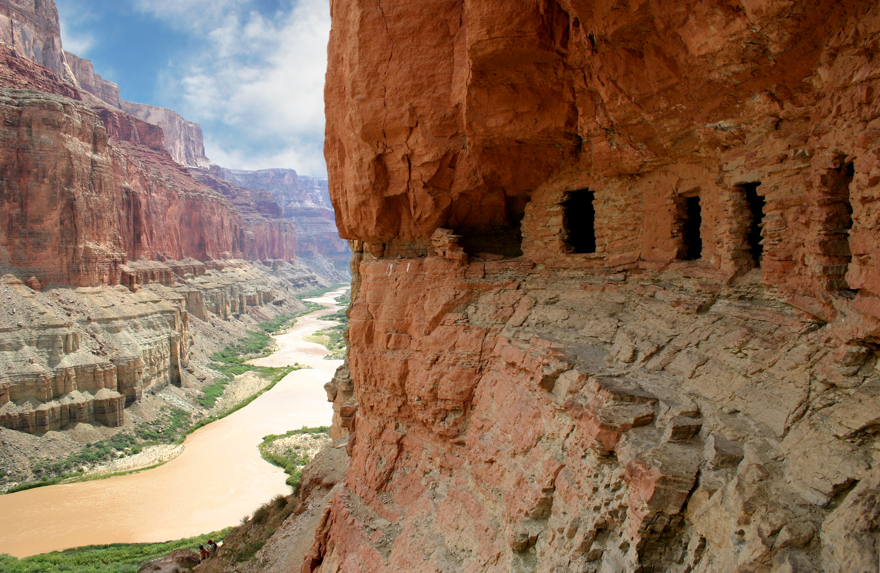
Hike: Nankoweap Granaries. Mile 52.6 – river right
This short but steep hike ascends a well-built trail constructed in the 1990s by several groups over several seasons. Many large rocks have been moved to form significant steps. The trail ends at four granaries at the base of the Redwall. The local natives damaged one, but it has been repaired. Granaries were used to store beans and squash seeds for next year’s crop. This is one of the GC “classic” hikes, famous for its photogenic downstream view of the Colorado in Marble Canyon.
There is a shorter, flat hike from the river to a ruin on the delta of the creek.
At mile 52.3, downstream of Nankoweap Rapid, the rim is 3,200 feet above the river.
Geology: Tapeats Sandstone (525 million years, conglomerate, sandstone, and shale from coastal beaches and shallow seas, forming a cliff) appears at mile 58.5.
The Colorado River follows the Butte Fault for 10 miles in Marble Canyon from Nankoweap Creek to the Little Colorado River. This proves that the fault preceded the river and is the only place in the GC where this happens. The Butte Fault is the eastern edge of the Kaibab upwarp. This is also where the South Rim (located on the east side here) has the least setback from the river compared to anywhere else. All strata are visible from the river to the rim.
Grand Canyon Escalade: This is a proposed 1.5-mile-long gondola descending from the rim upstream to the confluence of the Little Colorado. Owned by the Navajo Nation, the proposal includes a tram station, an elevated walkway, a gift shop, an amphitheatre, and a restaurant. See www.savetheconfluence.com for more information on its status.
The Navajo do not believe they originated in the canyon but do believe that its rugged topography forms the protective western boundary of their people. Offerings and prayers are made to the Canyon, and water from the Colorado River is used during Navajo ceremonies.
Little Colorado River. Mile 61.8, river left. When we crossed the bridge over the LCR at Cameron, the river was in flood and a chocolate brown. As a result, we rowed into the mouth of the river and watched the clear Colorado turn brown. As the main attraction of hiking up the river is the turquoise colour and swimming in it, we didn’t go hiking; instead, we camped across the Colorado. The Colorado remained a silty brown with a slight improvement towards the end of the trip.|

The Little Colorado is only 50 miles long, originating from a spring with a regular flow of 200 cfs. The spring is Sipapu, part of the creation myth of the Hopi. The water is rich in dissolved calcium carbonate, producing a rich turquoise colour and travertine ledges. Whenever there is rain and flooding in the headwaters, the water turns a chocolate-brown, and few hike.
Walk on the sidewalks of Tapeats Sandstone on the left side for 200 yards, then follow a trail to a swimming hole at .4 miles. The water is temperate. There are trails on both sides for a few miles, but they eventually fade, and walking is challenging through the tamarisk.
Helicopters buzzed the skies over the LCR area. They are thankfully not allowed to fly below the level of the South Rim.
There is no camping on the left bank around the LCR from mile 60.9 to mile 65.5.
Camp: Above Little Colorado – mile 61.5, river right.
GRAND CANYON From the Little Colorado to the Grand Wash Cliffs.
Day 5. Monday, October 10.
Just after the LCR, Colorado takes an acute 90° turn and mysteriously cuts into the higher Kaibab Plateau, the formal start of the actual Grand Canyon.
At mile 61.9, downstream from the mouth of the Little Colorado River to Chuar Butte, there is full exposure of the Paleozoic sequence from the Kaibab Formation to Tapeats Sandstone. The rim is 3,700 feet above the river.
Hopi Salt Mines. Between miles 63 and 64, there are several salt seeps. This is a no-visitation site.
Geology: At mile 64, the Dox Sandstone first appears, and the Great Unconformity appears. At mile 66.1, Cardenas Basalt appears. Shinumo Quartzite appears at mile 75.5. These three are from the Unkar Group, part of the older Grand Canyon Supergroup of rocks, which formed between 1.15 billion and 900 million years ago.
Hike: Carbon-Lava Loop. Mile 64.5-65.5 – river right.
This 2-hour loop hike starts at the mouth of Carbon Creek and goes up a boulder-strewn creek bed with a short 4th-class scramble around a fall. At .7 miles, climb a rockslide on the left to a ‘pass’ with a lovely rock bench. Turn left 90° into a pretty Tapeats Narrows. It’s a great walk, 0.5 miles up the canyon to the Butte Fault (a wide valley here) and Tapeats Sandstone, which is bent vertically. 25,000 feet of sediment were removed here
Cross over into the Chuar Valley, where you’ll find great colours, and continue into Lava Creek. Walk down to the river just above the Lava-Chuar Rapid.
The guides made this happen without us having to walk the 1 mile back upstream to the rafts. The three youngsters rowed three boats down to Lava Creek, hiked the loop in reverse and then brought the other three rafts down.
Hike: Tanner Trail – 68.5 – river left (I didn’t do this, but am including in this post all the trails that go from the river to the rim)
This is the first commonly used trail down to the river from the south rim. A steep 7.6 miles to the rim, it’s a good route for those who must leave the canyon before Phantom Ranch. There is a good campground by the river.
There is an early junction with the Beamer Trail that goes north along the river to the Little Colorado. The Tanner makes a long ascending traverse up the western slopes of Tanner Canyon. The higher you go, the better the view, so if day hiking, the turnaround point is arbitrary. It is a steep climb through the Redwall, which flattens and then contours across two large bowls below Carderas and Escalante Buttes, before a 2-mile ascent to the rim.
Temple Butte Airplane Crash: An airliner collision here claimed 128 lives in 1956. Wreckage fell on Temple and Chuar Buttes.
Desert View Watchtower on the South Rim is visible from a long distance along the river. It was built by the famed architect Mary Jane Coulter for the Fred Harvey Company in 1932.

Camp: Neville Camp – mile 76.1, river left.
Hike: 75 Mile Canyon, a short canyon just upstream from Neville camp, has some nice narrows. A good trail leads from the camp.
Day 6. October 11
At mile 77 above Hance Rapid, all formations visible (other than the just appearing Vishnu Shist) are part of the Grand Canyon Supergroup. The South Rim is 4,700 feet above river level.
Geology: The Hakatai Shale (1.2 billion years old, an older layer of the Unkar group of the GC Supergroup) first appears at mile 76.5. Basalt dike is visible in the Hakatai Shale at mile 77.2. The Bass Formation (1.25 billion years old, the oldest layer of the Unkar Formation) appears at mile 77.7. Hotauta Conglomerate, Vishnu Shist (black) and Zoroaster Granite (pink) first appear at mile 77.7. These are metamorphic rocks that formed approximately 1.8 billion years ago deep within the Earth’s crust.
Hence Rapid. Mile 77.2, 7-8, drop 30 feet. A massive basalt dike marks the entrance. Enter Upper Granite Gorge at the bottom of the rapid at mile 78.8.
Hance Mine and Trail: right bank, mile 77.7 (trail start) to mile 78.7 (mine). No visitation due to an asbestos hazard.
By mile 80, all formations in the Grand Canyon rock sequence have appeared except the lava flows downstream of mile 179.
All camps between mile 77.6 and mile 87.6 should only be used for trips with passenger exchanges at Phantom Ranch.
Phantom Ranch: After debarking at the boat beach at 3 pm, we had an hour and a half to walk to the Ranch in Bright Angel Canyon. Most had lemonade or a lemonade/tea blend (an Arnold Palmer) and bought postcards, postmarked “Mailed by Mule at the Bottom of the Grand Canyon – Phantom Ranch.”
Six passengers left, and four joined the trip. All hiked up or down the Bright Angel Trail and stayed at the Phantom Ranch. We passed under the two-foot bridges here – the Kaibab Suspension Bridge, built in 1928 (accessed via a tunnel on the south side), and the Bright Angel Suspension Bridge, built in 1970.
Zuni. Although they reside in a pueblo in western New Mexico, they believe their ancestors emerged from the earth near Ribbon Falls, six miles up from Phantom Ranch in Bright Angel Canyon. They think that the Havasupai and Hualapai emerged with them. Many Zuni prayers, stories, and ceremonies are closely tied to the Grand Canyon. To satisfy the obligations of their religion, the Zuni make pilgrimages here to collect plants, water and minerals.
On my second trip down into the canyon from the South Rim, I hiked the six miles to Ribbon Falls and back on my first day, covering a total of 19 miles. The flow was truly a ribbon and not quite worth the effort.
Camp: Trinity Camp – mile 92, river right
Hike: Trinity Canyon – I woke up early to hike into this beautiful canyon, which features running water after the canyon opens up, and stunning formations of Zoroaster Granite in the Vishnu Shist.
Day 7. October 12.
Rapids: The guides thought this was the best section of the river for good rapids. Salt Creek – 2, 5’, Granite – 94 mile, 7-8, 18’ (half ran this rapid while the others took pictures and videos of the fast and then reciprocated for Hermit), Hermit – 7-8, 15’, Boucher – mile 97, 4-5, 13’, Crystal – mile 99, 7-10, drop 17’ (a 1966 storm tumbled boulders into the river and overnight, Crystal became a major rapid with two massive holes), Tuna Creek – 5-7, 10’, Lower Tuna – mile 100, 4, 10’ (a tuna is the fruit of the barrel cactus), Agate, Sapphire – mile 102, 6, 8’, Turquoise – 2-4, 12’, 104 Mile – 5, 4’, Ruby – 4-5, 11’, and Serpentine – mile 106.6, 6, 12’.
Camp: Hotauta, mile 108, river right.
Day 8. October 13.
Ross Wheeler. At mile 108.3, there is a boat abandoned in 1915 and still sitting in the rocks at the bottom of the South Bass Trail.
Hike: North Bass Trail. Mile 108.2, river right
An easy 2.5 miles from the river to Bass Camp and the usual turnaround. Climb north to a pass 650’ above the river and have great views in 30 minutes. Then go down to Shinumo Creek and walk along the creek, crossing it several times (which can be difficult or even impossible in high water). Reach Bass Camp (in 1890, William Bass established a tourist camp and guided hunters mined asbestos and copper and later built a trans-canyon trail and cable car across the river). The creek is a trickle with lovely narrows. In 2 more miles is White Canyon. Or continue up Shinumo Creek to Flint Creek or Modred Abyss, or 12 miles to the rim.
Hike: South Bass Trail. Mile 107.8, river left.
From the old metal boat (abandoned in 1915) at the river, follow the steep cairned trail to the top of the river gorge and meet a trail parallel to the river, turn left and walk upstream about 1 mile to the creek bed of Bass Canyon. Follow this for a few miles by passing several falls. The turnaround point is arbitrary as the farther you go, the better the views—8 miles to the rim.
Bass Mine in Hakatai Canyon at mile 111.5, river right. Asbestos hazard.
Hike: Shinumo Creek – mile 109.5, river right. This is an easy wade upstream to a waterfall 75 yards from the river.
From Bass Camp, travel downstream over a 200’ ridge to a Y at 100’ above the creek. The right side goes up steeply, gradually descending over 0.3 miles. Left drops straight down a 4th-class rock face and then another 10-foot jump into a pool or a 5.5 boulder down climb into a pool behind the falls. This is not possible in April or May due to high water levels.
Geology: At mile 116.5, travertine bluffs were formed by spring water from the base of the Muav Limestone. They are now covered with travertine, a freshwater limestone.
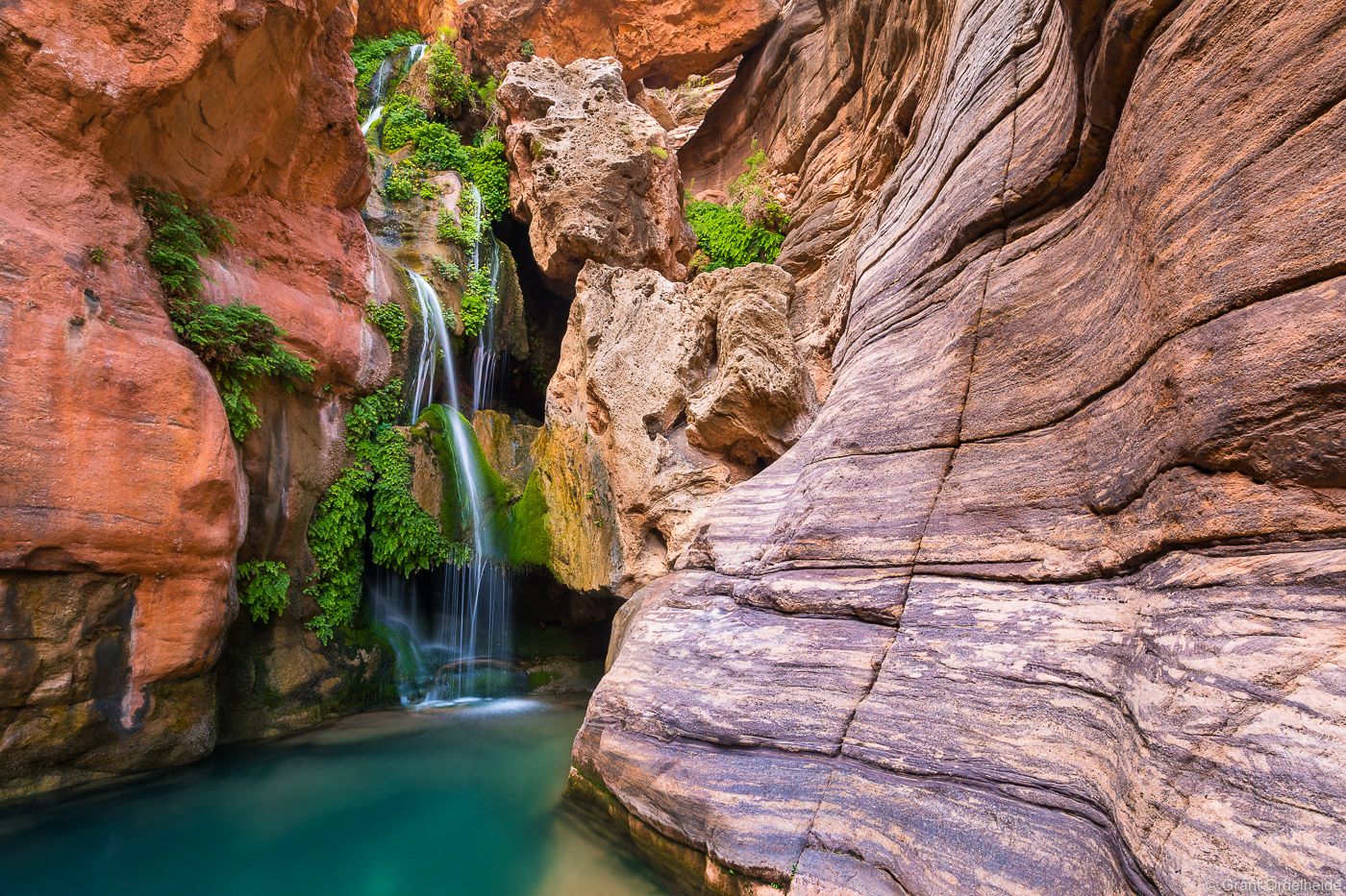
Hike: Elves Canyon. Mile 117.5, river left. This is a steep, boulder-choked canyon with easy scrambling and boulder hopping up the creek on the left side. Passing two smaller waterfalls, it is 45 minutes to a big 60-cascade falling through fern-fringed boulders. Climb behind the falls onto two possible jumping areas into the deep pool.
Can pass this on the left and then six climbs, all on creek left, some 5th class, others 3rd with considerable exposure until the canyon boxes out at a 100’ trickling waterfall, .4 miles from the river.
Hike: Blacktail Canyon. Mile 120.8, river right. Hike 20 minutes of easy, dry walking through Tapeats Sandstone. It has a good demonstration of the Great Nonconformity.
This was my 64th birthday. I told no one. It was a perfect day with lots of hiking.

Camp: Below Foster – mile 123.6, river right. A vast flat beach that felt like Waikiki.
Day 9. October 14
Geology: entered the Middle Granite Gorge at mile 128.
Bedrock Rapid: Mile 131, (6-8), drop 8’. The only rapid on the entire river not formed by debris flows from a creek is a large square chunk of rock in the middle, left of the river. Most of the water flows to the left into this narrower portion, which features several sharp turns. Curtis’s comment was “No good comes from going left”. Lee went left, and as we were the first through the rapid, we saw his misadventure unfold before us. Lee’s raft first became high-centred up on a vast flat rock on river left, was swept off it with the next wave and shot straight across the rapid to slam into a pocket in the side of the central rock. His boat immediately went vertical, and Lee frantically tried to high-side. The raft overturned and became wedged in the pocket. Lee didn’t appear for about 30 seconds. Fortunately, the raft finally emerged from the pocket and was rescued. One oar was missing and never found. The overturned boat was positioned sideways on a sandy beach.
Righting a 2500-pound non-rigid raft is a challenging task. Three ropes were tied to the frame on the outside. Everything on the beach side of the raft prevents it from rolling over. With at least 16 people pulling with all their might, it was finally righted on the fourth attempt. Significantly, Lee’s boat was the only boat getting heavier as the trip progressed. He eventually filled 10 groovers and had all the garbage.
Dubendorff Rapid. Mile 132.4, (6-8) 15’ drop. We scouted this rapidly. Avoid the big rocks at the bottom.
Camp: Stone Creek – mile 132.6, river right. A big sand beach at least 150m long.
Hike: Stone Creek. Mile 132.6, river right
Could you take the trail to the first waterfall at the head of a box canyon? A good trail bypasses this waterfall on the right. Walk on an intermittent trail or in the creek by the second fall to the third fall with three cascades. There are many pools bypassed on a trail on the right. The canyon closes in and eventually boxes out at the base of the Redwall at a lovely ribbon waterfall sluicing down a mossy slide between narrow canyon walls. 3-4 hours to the upper falls and back.

Day 10. Saturday, October 15.
Hike: Thunder River. Mile 133.7, river right

It is about 5 hours to Thunder River Springs and back. It is a wet hike with three crossings of Tapeats Creek, accessible via the easiest and standard route. It can be dangerous and even impossible to cross if the flow exceeds the base levels. If you start on the left side of the creek, it is possible to reach Thunder River with dry feet, but the trail is hot and much worse. However, it would be necessary if the water is high.
This hike is a Grand Canyon “classic”. From the river, start on the right, downstream side of the creek, and soon cross it to the left side. Climb a steep, rocky gully 200 feet and then contour on a Tapeats ledge, returning to the creek. Cross again to a scrambly trail on the right side. Below where Thunder River joins Tapeats Creek, cross the creek again and climb 1000 vertical feet in a mile to the roaring springs.
A considerable volume of water pours out of a cave at the joint of the Redwall and Muav Limestone strata (the cave extends 1,000’ into the cliff). It cascades down a cliff and then falls over several huge drops to the valley below.
The trail continues past the springs to Surprise Valley and on to Deer Creek or the North Rim. This requires a boat shuttle.
There were many frogs in the river. Geckos are not hard to snare.
Camp: Owl’s Eyes – mile 135.2, river left.
Day 11. October 16.
This was a welcome day off, and we camped at Owl’s Eyes again. The wind blew at night, producing minor dust storms. Tents provided little protection, instead simply sieving the dust into a fine, talcum powder-like consistency. I had luckily camped behind some rocks for good protection.
Hike: Granite Narrows. Mile 135.5-136.7, river left.
From the Owl Eyes Campsite, walk downstream into the narrows. With water shoes and minimal scrambling, it is possible to stay on the beach almost all the way. Or walk above all the low cliffs on a minimal sandy trail. Continue past the narrow constriction (76’ wide and the entire canyon’s narrowest point). The deepest pool in the river (100 feet) is just before the constriction point enters the narrows. Reach a viewpoint with a good view down the entire 1.5-mile-long gorge. This viewpoint may only be at about 15-20% of the length of the gorge.
There is a large stack of old wood high above the constriction point, most likely from the 1983 flood.
The rapid at the beginning of the gorge is very dangerous at high water. One gets swept against alternate walls with little chance at control.
Camp: Owl Eyes mile 135.2, river left—a second night in the same place.
Day 12. October 17.
It was a short 1½ mile row to Deer Creek.
Hike: Deer Creek. Mile 136.1, river right
Deer Creek Falls is a 100-foot cascade that falls into a pool at river level. A short trail goes to the base of the falls and loops back through the creek.
To go to the Patio, cross the creek to the downstream side of Deer Creek Falls and immediately access a steep trail that switchbacks up to a river overlook at the top of the falls. Upstream from the falls, Deer Creek runs perfectly down the middle of a rock amphitheatre. The trail winds along a ledge high above the spectacular twisting Deer Creek narrows – an incised gorge in the Tapeats Sandstone. A fall would be lethal. The narrows relent as you arrive at the Patio, wide soothing sidewalks of Tapeats Sandstone – one of the Grand Canyon’s most beautiful places and a “classic’ GC hike. You are sure to share the space with a variety of backpackers and trail runners.
Upstream is a backpacker’s campsite with many cottonwoods for shade. After .3 miles, take a spur trail to a waterfall and the “Throne Room”, an arc of artificial rock thrones adjacent to the spring. To continue, the trail fords the creek 0.5 mile from the Patio, climbs uphill to the east, heading for Surprise Valley, Thunder River, and Tapeats Creek.
Camp: Upper Ledges – mile 151.9, river right. It was lovely camping on the flat Muav ledges that line the river. At night, the crew lit a fire with a watermelon and floated it down the river to the group camped at the Ledges campsite downstream.
Day 13. October 18
After an hour-plus float, Havasu is accessed via an eddy just above the rapid. After letting off passengers, the rafts are parked in a long line along the inside of the canyon.
The Havasupai or “people of the blue-green water” are the only Native Americans still living within the Grand Canyon. They reside in this side canyon, a narrow oasis of green fields, red cliffs and stunning waterfalls. Along with their close relatives, the Hualapai, believe they came into existence at Spirit Mountain west of the Grand Canyon. Historically, they farmed in the canyon during the summer, growing corn, beans and squash using creek water for irrigation. After the August harvest, they moved to the high plateau south of the canyon, where they hunted and gathered antelope, deer, bobcats, rabbits, turkeys, porcupines, and seasonal plants.
Havasupai lands are adjacent to the Grand Canyon National Park. The village, called Supai, has a small café, a tourist lodge, a post office, a school, a church, a clinic, a police station, and a general store. It is only accessible on foot, via an 8-mile trail from the rim, or by helicopter.
After the village, reach the iconic twin Havasu Falls, then the campground and finally climb down through the travertine tunnels using chains to below the 200’ high Mooney Falls.
Hike: Havasu Canyon. Mile 156.8, river left.
Havasu is a large drainage area that frequently floods. This is such a popular hike in the summer that it is called “Havazoo”. The large creek has turquoise-blue water spilling over travertine ledges and inviting pools. There are four large waterfalls in the canyon.
It is 3½ miles to Beaver Falls, and few river hikers go past as a Havasupai Tribal hiking permit is required. It is 6 miles to Mooney Falls, making for a long and challenging day. It is 8 miles to the twin Havasu Falls and the village of Supai. There are good trails and multiple river crossings. Navajo Falls, originally the uppermost waterfall, was bypassed in a flood and replaced by several cascades.


After crossing the river four times, the Beaver Falls area is reached. Before Beaver Creek enters on the right, look for cairns leading up the steep ledges to a trail high above Havasu Creek and good views of the actual Beaver Falls. A sign announces the boundary between Grand Canyon National Park and Havasupai Tribal Lands. Climb down the cliff using a rope or return and continue upstream along the creek to a large swimming pool, often populated with large numbers of backpackers and river runners.
On the return, float through the final canyon narrows near the river.
After Havasu, a different climactic zone, the Mojave Desert, is entered and continues to Lake Mead. Barrel cactus, ocotillo, and creosote bush are the predominant plant species. Tamarisk still lines the river banks.
Shaman Pictograph Panel. This is an arduous 6-mile hike up Tuckup Canyon.
Camp: Fern Glen Canyon – mile 168.7, river right. A large beach is just below the rapid downstream from the canyon.
A large desert bighorn ram walked through the middle of camp just as we were loading the rafts. He paid little attention to us. I think he has done this before.
Hike: Fern Glen Canyon – Mile 168, river right. The GC is spectacular here with gigantic cliffs of Muav and Redwall Limestone from Havasu to Fern Glen.
From the river, it takes 5 minutes to reach the limestone walls. At the head of the narrows are an emerald pool, a boulder, and a 4th-class scramble up the water slide. The right wall is draped in maidenhair ferns and travertine. Scramble around a second fall up ledges and a good trail that bypasses on the left. Scramble around a pool with luxuriant growth. A travertine fall at .5 mile prevents further progress.
Day 14. October 19.
Geology: At mile 171.7, the Mohawk Fault perfectly lines up Stairway Canyon on the north and Mohawk Canyon on the south side of the river. They are both vast canyons. The river cuts through the fault at right angles.
Hualapai Indian Reservation. At mile 173, all land on the south side of the river is Hualapai. The National Park continues on the north side.
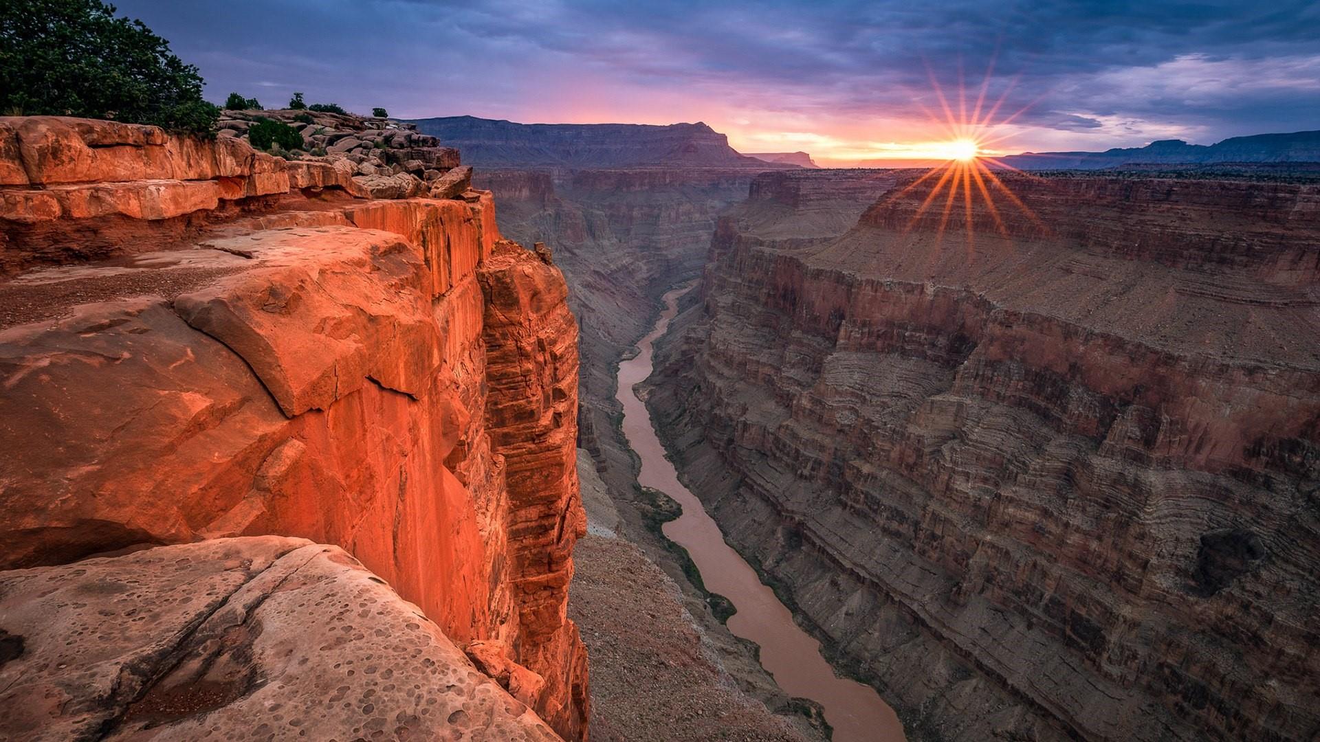
Toroweap Overlook: Having spent a night sleeping on the edge of the rim during a dramatic thunderstorm, Toroweap has fond memories. Photography was my life back then, and we woke to great light. The photo I took won the most awards of any picture I have ever taken.
Lava flows poured into the canyon between 830,000 and 100,000 years ago. From mile 178 down to Lake Mead, volcanic activity is a constant feature of the canyon. Several high-side canyons have large plugs of lava filling them. Lava flows spill down walls, and vast walls of lava columns line the shores. Ancient lava flows extend downriver for at least 74 miles. The last remnant of the basalt lava flow from the Toroweap area is located at mile 254.8.
Vulcan’s Anvil: At mile 178.3, this 50-foot lava plug signals the approach to Lava Falls. It is the remains of a volcano that erupted more than 200,000 years ago.
Lava Falls (Vulcan) Rapid: mile 179.7. Rated 8-10 with a 13-foot drop, Lava Falls is the most notorious rapid on the river. Everyone scouted the fast from a pullout on the river right. Andrea provided a great description of the issues caused by rocks and sand on the beach. Three of us rode in the front, the most seaworthy method. The approach is like an infinity pool with no tongue. The main hazard is the Ledge, a vast, wide hole that spans the middle of the river. Entering it would ensure a capsize. Equally dangerous is the Hole to China, a small but similarly deadly hole on the far right. Following that is a massive V wave, with a large wave driven off a rock that enters from the right. The best line is to go just to the right of the ledge and hit the V on its left side. We hit the right side of the V wave particularly hard, and as I was on the right, I almost went in. Chelsea lost her oars and also nearly swam. After the V wave are several huge waves in a train.
Just below is Lower Lava Rapid, rated 3-4, with a 14-foot drop.
Lava Falls was successfully piloted going upstream using four jet boats during the 1960s upriver of the Colorado. The skipper was Jon Hamilton, the son of jet boat inventor Sir William Hamilton.
Whitmore Helipad. Mile 187.6. Used to fly guests from the Bar 10 Ranch and Las Vegas for 3-day trips down the river. O.A.R.S. has a policy that if changes to the guest list are made here, the entire list must be updated. These short trips most often cater to families with children.
Whitmore Trail switchbacks 1000’ down a lava flow to the river at mile 188.5, the site of the Whitmore lava dam 200,000 years ago.
Camp: Lower Whitmore – mile 188.7, river right.
Day 15. October 20.
We left early with many miles (25) to cover today to finish the trip.
World’s largest barrel cactus: I didn’t write down the mile, so I can’t tell you where to find it. It is about 9 feet tall and sits on the far edge of a wash. As they grow about 1 inch per year, this one is over 100 years old. It was big.
The Hurricane Fault crosses the canyon at right angles at mile 196.7.
Hike: Parashant Wash.. Mile 198.5, river right. This is a significant drainage area with a history of large floods and a relatively flat creek bed, making for a challenging hike. There is no instant beauty, but a place to explore. The narrows are about 1 mile from the river. Beautiful Redwall Narrows are 7 miles up.
We scrambled up the creek bed over two minor falls and looked at some pictographs under an overhang on the right side. Simple and using dark red paint, they were of little interest.
Camp: Opposite Three Springs – mile 216.2, river right
Day 16. October 21.
On our last day, we launched at 7:55 to do the previous 10 miles and take out.
Geology: At mile 216.4, the Lower Granite Gorge is characterized by shist and granite.
Granite Springs is a new and significant rapid that appeared in 2016 at mile 220.7, following a large flood in Granite Springs Canyon.
Diamond Peak fills the west skyline for most of today’s float.
Diamond Creek – mile 225.9.
The first motor car to reach the depths of the Grand Canyon, a Ford, reached the river at Diamond Creek in 1912. The primitive road out of the canyon now traverses 21 miles of Hualapai lands to reach Route 66 and pavement. This is a busy launch site for motorized boats run by the Hualapai Tribe. Arrivals before 10 am are restricted.
We had an early start to arrive at Diamond Creek at 10 am. Waiting were a whole crew from O.A.R.S. with two large trucks and two passenger vans.
Everything was unloaded, including the huge coolers that form the base of the rower’s seat, and placed on the back of the largest truck. The two-part metal frames were removed and stowed in their place. The boats were washed with soap, moved onto land, and all air was removed with a vacuum cleaner and a generator. After rolling up, the job was done.
We then had lunch, had a hug fest with the crew piled into the vans and drove the rough road and Route 66 to Seligman for snacks. This is home to the Road Kill Café and lots of quaint Route 66 stuff.
Arriving at the Doubletree at 2:30 pm, we had another hug fest, paid the tip, unloaded all our dry bags and went our separate ways. Some had driven, but many also had flights via Phoenix to their homes.
I tried to buy some size 11 Chaco flip-flops in Flagstaff (they are no longer sold in Canada and are the ONLY flip-flops to wear on long-term travel). But this was the end of the season, and even online, it was virtually impossible to find a pair.
I then had less than 48 hours to drive the 2800 kilometres home. I needed to cross the border to mail my Ghana visa application. I had no problem and picked a fast route through Vegas and up eastern Nevada to join I-84 at Twin Falls, Idaho. It was drive and sleep in the back seat of my truck, fast food, large espressos and a lot of cigarettes. In Vancouver, I spent 42 hours, then made the obligatory trip to Mountain Equipment Co-op, had lunch with my daughter, and caught the 7 pm ferry to Vancouver Island. I arrived home after 11 pm and, due to my apartment’s noise bylaw, could not have a shower.
This was easily the number one adventure trip of my travel life. Nothing like it exists in the world. The geology, river, and rapids, marvellous hiking along the river, and excellent company and companions made for a memorable trip.
