
I’ve owned my expedition sea kayak for 22 years. In that time I have done many big trips, but because of travel, the last was in 2016. Then I went crazy for a few months: 280kms through the Broughtons off the northeast coast of Vancouver Island; 375kms in Haida Gwaii (Moresby Camp to Ninstints and back); and 200kms around Cape Scott, the north tip of Vancouver Island.
Because of Covid, all the national parks in Canada were closed in 2020, but were open in 2021. So after 15 months of being home bound, I was itching for a trip and the southern part of the Gulf Islands was one of the few places I had not kayaked. In 2014, I circumnavigated Gabriola, Valdes and Galiano Islands camping one night in James Bay on Prevost Island, the most northerly part of Gulf Islands NP.
Even though the park was not formally open until May 15, all parts could be visited with no need for reservations or fees. The forecast for the week starting Thursday, April 15 was hot weather. By coincidence, I had met a new woman on a dating site and we had agreed to go on an adventure. We met on Thursday, and shopped and packed with a view to starting on Friday the 16th.
We drove to Island View Beach south of Sidney, unloaded and parked the truck. The adventure begins.
ISLANDS of SERENITY
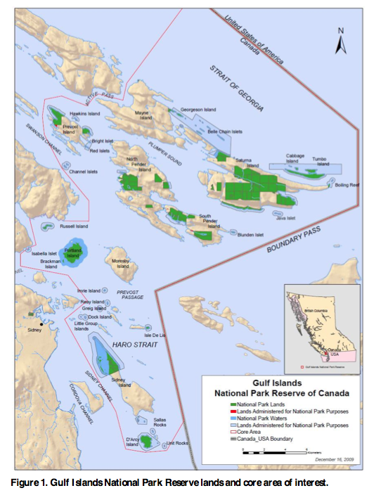
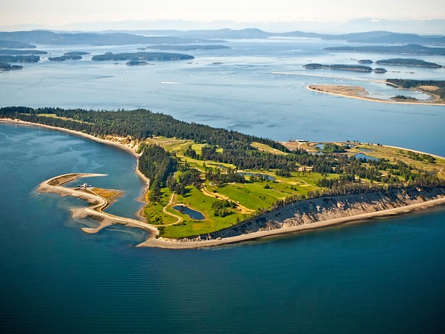
This national park is located on Vancouver Island’s southern Gulf Islands in British Columbia, Canada. It is possibly the most idyllic kayaking destination in the world. Located on 16 islands and more than 30 islets, reefs and surrounding waters, this is the only place in Canada with a Mediterranean climate of dry, sunny summers and mild, wet winters. This results from a rain shadow effect from surrounding mountains, the Olympic Mountains to the south west in Washington State and the mountains running down the spine of Vancouver Island.
The wild west coast of Vancouver Island has demanding kayaking. The inner waters of the Gulf Islands can be highly protected, getting none of the ocean swell and considerably less wind that can embattle other passages in the area such as Haro and Juan de Fuca straits. The relatively calm and sheltered southeast coast of Vancouver Island is much more inviting and relaxing. With so much less rain than the many nearby urban centres such as Vancouver, it’t not unusual to paddle here in sunshine while clouds linger over south Vancouver Island and the mainland BC mountains.
However it is not placid all the time. The long passages create strong currents that in turn create some of the strongest tidal rapids on the coast, such as Dodd Narrows, Porlier Passage and Active Pass. Cross any of these during peak periods at your peril. Or enjoy as part of an adventure, or cross at slack current.
There’s no need to take risks. Simply pick your adventure: placid day trips to picnic and tide pool, energetic day trips to a distant island or multi-day adventures through largely unpopulated wilderness.
The park was created in 2005 as the fortieth national park covering only 36 square kilometres (14 sq mi) of area making it the sixth smallest national park in Canada. The islands lie within the Strait of Georgia Lowlands natural region, the smallest and most urbanized natural region in the country including the Fraser Lowland and the valleys and islands along the Strait of Georgia. It has similar dominant vegetation as the Pacific Northwest including the northern extent of drought tolerant Garry oak and Arbutus.
The Gulf Islands
Howe Sound Islands: Anvil, Bowen, Defence Islands, Hutt, Bowyer, Gambier, Keats, Passage
Northern Gulf Islands. Major: Ahgykson, Denman, Hardy, Hornby, Lasqueti, Nelson, Texada, Thormanby Islands. Minor: Jedediah, Mitlenatch, Musket.
Southern Gulf Islands. Major: Gabriola, Galiano, Mayne, Moresby, North and South Pender*, Penelakut, Prevost*, Salt Spring, Saturna*, Sidney, Thetis, Valdes.
Minor: Belle Chain Islets*, Brethour, Chain Islets, Chatham Islands, Curlew, D’Arcy*, Dayman, De Courcy*, Discovery, James, Jemmy Jones, Mudge, Newcastle, North Secretary, Parker, Piers, Portland*, Protection, Ruxton, Samuel, Skull, Trial Islands, Wallace*.
History
More than 75% of the land on the Gulf Islands was private properties. In the 1960s and 70s, the provincial government was promoting tourism to the Gulf Islands and establishing provincial parks, such as D’Arcy Island Marine Park and Princess Margaret Marine Park (Portland Island), they also established the Islands Trust whose mandate was to preserve and protect the gulf islands.
The park was formally announced in 2003 and the province in 2004 donated nine provincial parks (Beaumont Marine Park, Cabbage Island Marine Park, D’Arcy Island Marine Park, Isle-de-Lis Marine Park, Princess Margaret Marine Park, Sidney Spit Marine Park, Winter Cove Marine Park, Prior Centennial Park and McDonald Park), as well as the Saturna Island Ecological Reserve and the Brackman Island Ecological Reserve. These former-provincial parks included almost all of the new National Park’s recreational facilities (e.g. camping sites, anchorages, etc.). More land on Saturna and Pender Islands was added, as well as Reay Island, Greig Island, Hawkins Island, Imrie Island, the Belle Chain Islets, the Channel Islets, and the Red Islets, among other islets.
Many of the islands outside the national park are private. Some, like Piers Island is subdivided into postage stamp sized properties hemmed in with homes. Other islands are exclusive retreats fro the very rich. Due to Canadian law, intertidal areas are public domain meaning any beach can be enjoyed by anyone – up to the high tide line only of course.
Many of the islands have a fascinating history, great nature and wonderful paddling. Add a good chance of seeing killer whales, bald eagles, seals, sea lions and otters, and a grand wildlife outing is possible. Launch sites are infrequent and few allow overnight parking.
Climate
The park, along with the Strait of Georgia Lowlands natural region, is situated in a low-lying coastal area surrounded by mountains. While the area experiences the warm air from the Pacific Ocean jet stream, the surrounding mountains of Vancouver Island and the Olympic Mountains strips that air of moisture creating a rain shadow effect. The summers are consequently dry with only a few cloudy days which is classified as a Mediterranean climate. The winters, however, are influenced by Arctic air mixing with Pacific air flows resulting in heavy precipitation and cool temperatures. The area experiences an average of 838 mm (33 in) of precipitation each year, with over half of that falling in the four-month period between October and February.
Use VHF channel 3 (Haro Strait) for weather information.
Ecology
The terrestrial portion of the park lies within the Coastal Douglas-Fir Biogeoclimatic Zone based on the climax vegetation. Coastal Douglas-fir is the most common tree species and is accompanied by western red cedar and grand fir in wetter soils and Arbutus and Garry oak in drier soils. Also present are red alder, shore pine, Pacific dogwood, bigleaf maple, and bitter cherry. In the shrub layer are salal, dull Oregon-grape, oceanspray, baldhip rose, bracken fern, sword fern, lady fern and spiny wood fern. In wetter areas salmonberry, false lily of the valley, vanilla-leaf, and skunk cabbage may be present.
In the sea waters swim orcas, porpoises, seals, salmon, lingcod, shiner perch, saddleback gunnel and three-spined stickleback, among others. The largest land animal in the park would be the black-tailed deer. Fallow deer are also present but are an introduced species from some of the island’s history as private hunting grounds. Other terrestrial animals include mink, river otters, raccoons and deer mice. Birds that be seen in the park include cormorant, bald eagle, red-tailed hawk, falcon, turkey vulture, rhinoceros auklet, Brant geese, great blue heron, Hermann’s Gulls, and oystercatcher.
Geography
The park consists of 31 km2 (12 sq mi) of land and 6 km2 (2 sq mi) of water scattered over and around 16 islands and more than 30 islets and reefs at the southern end of the Gulf Islands archipelago in the Strait of Georgia, Haro Strait and Boundary Pass on the Canadian side of the international border with the United States. The islands have a northwesterly-southeasterly alignment which is partly the result of sedimentary folding within the Nanaimo Basin. Also partly responsible for the shape of the land is the effects of the last ice age when 1.5 km of ice was top off the land and the erosive force carved out softer deposits as the melting water drained into the Pacific Ocean via the Strait of Georgia. Also, the land continues to experience post-glacial rebound which has lifted certain lands higher.
COMPONENTS of the PARK
No Fires. Gulf Islands NP has a strict no fire policy, even below the high tide line (the only place fires should be burned on the ocean). When the park was formed, the local communities were active partners. A fire ban was crucial for them.
Boat Wakes. Some boats produce larger wakes than others. A police boat with jet engines has minimal wake while other small boats produce a breaking wave with steep troughs. The largest wakes are produced by the large ships in Haro Strait and Boundary Pass. The stern wake of container ships are the worst as they travel across the entire passage usually as a breaking wave with steep troughs. Around Swarz Bay, the large BC Ferries boats also produce large breaking waves – beware of your boats left on the edge of the water.
McDonald Campground. The park’s most accessible feature is the McDonald Campground in North Saanich on Vancouver Island, just north of the Town of Sidney. While it covers a 10 ha (25 acres) area consisting of second-growth forest, the site is divided by the Highway 17 and the Swarz Bay Road overpass and surrounded by urban and agricultural development. The campground had been operated as a provincial park since 1948 before being transferred to Parks Canada in 2004. The campground includes 49 drive-in, front country campsites with potable water, pit toilets, and picnic tables.
The park can serve as a convenient centre for exploring the park on several day trips.
Day 1. Island View Beach to D’Arcy Island. 8kms
Island View Beach. South of the city of Sidney, this is the most popular beach on the Saanich Peninsula and the best launch site to access D’Arcy Island. Parking is difficult on weekends. Frequent signs state that overnight parking is not possible and vehicles will be towed. It is also not possible to park on any nearby residential streets as this involves a significant walk.
Overnight parking permits are available for use by kayakers and canoeists planning to launch from the park for overnight excursions. Obtain ($10/night) from the District of Central Saanich: https://www.centralsaanich.ca/our-community/parks-recreation-culture3/island-view-beach-overnight-parking-permit. Phone 250.652.4444.
A staff member will contact you for payment options (credit card over the phone is preferred), once complete you will receive a permit by email.
Launch at the far south end of the beach. It is possible to drive on a wide, old boat launch to get near the water.
D’Arcy Island. 83-ha island in Haro Strait, south of Sidney Island and the southernmost of the Gulf Islands. 8kms from Island View Beach to a beach and campsite on the NE side facing Little Darcy Island (private). 7 marine-accessible backcountry campsites each with a picnic table and tent pad, pit toilets, no water. There is no docking or mooring facilities for motorboats.
There is reasonable trail on the south, from the colony to the campground cutting across the island and around the camp area. To walk around the island involves beach walking and finding the minimal trail usually just above the water.
History. The island was used as a leper colony for Chinese immigrants from 1891 to 1924, when the inhabitants were moved to Bentinck Island, closer to Victoria. The colony is one of the darker aspects of Vancouver Island’s history, as residents were secreted here against their will and essentially left as outcasts to survive as best they could.
Ruins of the buildings built during that time are still visible. The bare cement shell of a caretakers cottage lies on the south tip. The foundations of 2 buildings are on the southeast.

Chinese lepers on D’Arcy Island in the 1890s
D’Arcy was declared a marine park in 1961, and included as part of the Gulf Islands National Park Reserve in 2003.

Day 2. D’Arcy Island to Rum Island. 11kms.
We walked around the D’Arcy in the morning, leaving in the afternoon for the easy paddle to Rum Island. Sidney Island lies on the left for the entire paddle.
Sidney Island. The Sidney Island portion of the national park comprises the northern 400 ha (988 acres) of the island along with another 220 ha (544 acres) of foreshore area. Its most prominent features are two spits which create long, sandy beaches. Sidney Spit extends for more than 2 km (1 mi) to light beacon at its point. Hook Spit is situated partly down the island and creates a sheltered lagoon with beds of eelgrass and great blue herons common. Located off the coast of Town of Sidney, in the Haro Strait, it is accessible only by private boat, foot passenger ferry during the summer or small plane via an airstrip further down the island. A campground, dock, and moorings were developed as a provincial park.
History. This area had been used by First Nation people for clam harvesting, before being subjected to a failed residential subdivision by the Hudson’s Bay Company in 1860, clay extraction for a brickworks between 1906 and 1915, logging of old growth trees, and the introduction of non-native animals like deer and peacocks from farming operations and its use as a private hunting ground before the province used the area in the late-1950s to test the concept of a marine park. Formalized as a provincial park in 1961, it added mooring buoys and an anchoring area, an on-shore dock for passenger ferries, a campground, pit toilets, and water taps.
Halibut Island (Low Island). On the way to Rum in Haro Strait, pass Halibut Island on your right. This 9.67acre property was registered to Hilton Clarence Burry, self-employed, of Sidney who died in 2019 and listed on the market for $1,995,000, the first time it had come up for sale in 50 years. Halibut Island is unique in that it’s far enough away from things that it’s very private but still accessible to Victoria. 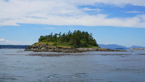 Despite living full-time on the off-grid property for more than three decades, the owner never built a permanent structure on the island and lived in an old travel trailer on his own in relative isolation. He would go to town, get his supplies, do his business and return to the island. He had several holly trees on the property and earned money selling the plants – small storage buildings or tents were used for the holly operation. Two solar panels are visible on the west side.
The property features a fine-gravel beach on its north end with a breakwater, tidal pools to the east, an old-growth forest and views of Mount Baker – much more variety than many private islands. The island falls within the jurisdiction of the Islands Trust federation and any construction on the property would be subject to the group’s regulations and bylaws.
In February 2021, the island was purchased by the W̱SÁNEĆ Leadership Council representing Tsartlip, Tseycum, and Tsawout First Nations and The Land Conservancy of British Columbia (TLC) for $1.55 million with the support of one major unnamed donor. The name was changed back to its original indigenous name, SISȻENEM (roughly translates to ‘sitting out for pleasure of the weather’). The return of the island marks a meaningful step in reconciling Aboriginal and non-Aboriginal issues. TLC acquired the island to protect its cultural, ecological, and geological and ensure its stewardship and protection for generations to come.
When we passed by, a house had been constructed.
Mandarte Island. This 700m long and 100m wide rock in Haro Strait presents differently – a treeless, white rock (from guano, mainly on the west side) and lots of bird noise. The island supports a large seabird colony with approximately 8000 sea birds nesting on this island – glaucous-winged gulls, pelagic and double-crested cormorants. pigeon guillemots, red-winged blackbirds, harlequin ducks, fox sparrows, hummingbirds, and of course song sparrows (the song sparrow study on Mandarte Island was begun by Frank Tompa in 1960 and re-kindled by many dedicated grad students. They have built one of the most detailed databases available for a wild bird population, including a detailed social pedigree of all breeding birds from 1975 to present. All nestlings from 1993-present were genotyped to create a genetic pedigree to facilitate analyses of individual performance, inheritance and inbreeding in the context of demographic and micro-evolutionary processes).
The island is a First Nation reserve and overgrown with grass, native and Himalayan blackberries, snowberry, rose plants and elderberry. The shrub can reach up to 2-3m height and narrow trails lead to most places. Only four little cabins and one outhouse are available for the researchers during the field season. During spring time, beautiful camas lilies are blooming on the whole Island.
Many bird species will fly by or stay for shorter time – bald eagles, owls, peregrine falcons, savannah sparrows, Caspian terns and more. Marine mammals include: Steller’s and California sea lions swim by the island in the early season, harbour seals and river otters are in the intertidal zones, and humpback whales, minke whales and killer whales will be around.

Rum Island (Isle-de-Lis). East of Sidney Island, and connected by a narrow isthmus to the privately owned Gooch Island, is the 5 ha (12 acres) Isle-de-Lis, formerly known as Rum Island as it was used by rum-runners during prohibition in the United States, being less than one mile from the international border. Isle-de-Lis was a private island until 1978 when it was bequeathed to the province for park purposes and renamed to Isle-de-Lis. Like D’Arcy Island, the province made it into a marine park primarily accessible by sea kayakers on a multi-day trip, with no docking or mooring facilities for motorboats, and added pit toilets but no potable water. 3 backcountry campsites sit on a headland on the south side, a significant carry from the beach. Campsites are first come, first serve and are not reservable. Approach the campsite on a minimal trail above the landing beach, not via the toilet area.

The campsite here is easily the nicest on any of the islands as it sits on the edge of a cliff. Walk on the minimal trail to the east side to see the current as Haro Strait is narrowed by the Gooch/Rum combination. Seals are here frequently.
On the way pass a narrow beach and good landing with lovely grassy bluffs above. The carry is much less than the standard route to the campground.
Gooch Island. It was named after Thomas Sherlock Gooch, a lieutenant in the Royal Navy who served aboard the HMS Satellite during its time in BC, from 1857 to 1860.
Gooch Island is privately owned. It features a watchtower and a house on its northwest edge. On September 16, 1995, the Artificial Reef Society of British Columbia scuttled the HMCS MacKenzie north of Gooch Island to function as an artificial reef for divers to explore.
Day 3. Rum Island to Beaumont Marine Park, South Pender. 13kms
The original destination was Narvaez Bay on Saturna Island, but this was a complicated destination as a bit of the USA was in the way. The Canada/US border runs NNW up Haro Strait and then makes a 90° turn EEN up Boundary Pass. From Rum, we paddled due north to circle around the border turn. Going into a weak current out in the middle of the shipping lane resulted in a long uninteresting day. However the view was spectacular – we were pointed at Mount Baker and the North Cascades most of the day. We were also heading directly towards the half moon, high above Mt Baker.
Rum to Narvaez Bay Saturna via Turn Point on Stuart Island, San Juans WA – 4.5kms; Turn Point to Narvaez Bay – 16kms all over open water in Boundary Pass. Success would depend on a flood current and no wind over such an exposed distance. It would also be highly illegal and in a busy shipping lane.
A much safer and recommended route would be to paddle north to Pt Fairfax on Moresby Island, follow the coast to Palorus Pt and then cross Swanson Channel, a 4km crossing.
Tides on April 18 were very unusual. High tide was 9.5′ @23:47 on April 17, low tide was 2.3′ @15:28 on April 18, and the next high was 9.8′ @00:46 on April 19. The explanation for one tide in a day lies in the combination of the half moon, the counteracting weak effect of the sun and the peculiarities of the Georgia Strait Basin.
The Penders—North and South. The Penders were once one island connected by a narrow strip of land. A canal between the islands was dredged in 1903 to allow boats to make a speedier passage to the outer Gulf Islands. Rejoined again with the building of a one-lane bridge in 1957, the two islands are now home to a combined population of around 2,000 permanent residents, the majority of whom live on North Pender.
North Pender
Shingle Bay Campground. Accessible by water or walk-in trail. 10 reservable primitive campsites. Pit toilets. No potable water
Prior Centennial campground. drive-in campsites.
Hiking: trail up Mount Menzies through Loretta’s Wood and another trail through Tyndall Wood to cliffs which overlook Plumper Sound and Saturna Island.
Roe Lake. 1.2km (45 minutes one way) from Shingle Bay Rd. Loop Trail (55 minutes) – 1.4 km loop – (.5 km from Shingle Bay Road trail access or .4 km from Magic Lake Estates). This trail leads into the uplands above Shingle Bay to Roe Lake, then steeply descends to the Magic Lake Estates subdivision. The loop trail allows you to hike around the lake where you can enjoy stunning views of tranquil Roe Lake.
Roesland park is a third campground accessed from Shingle Bay by kayakers or boaters, an anchoring area, sandy beach, dinghy dock. Loop-trail around Roe Lake.
Roesland. 0.5km (15 minutes one way) from parking lot to viewpoint. Quick access to a former cottage resort dating back to the early 1900s. To the right of Ella Bay, a short rustic trail on Roe Islet leads to a viewpoint (accessible during low tide).
South Pender
Beaumont Marine Park. Backcountry campsites (most reservable) are in two parts: south with 2 pads separated by an area of restoration then 6 pads accessed from a small peninsula with access on both sides. No potable water.
Hiking.
Mount Norman. 244-metre (800-foot) shore-to-sky trek from the campsites at Beaumont to the summit of Mount Norman. The panoramic views from Mt. Norman are worth the effort.
Gowlland Point Road to Greenburn Lake.
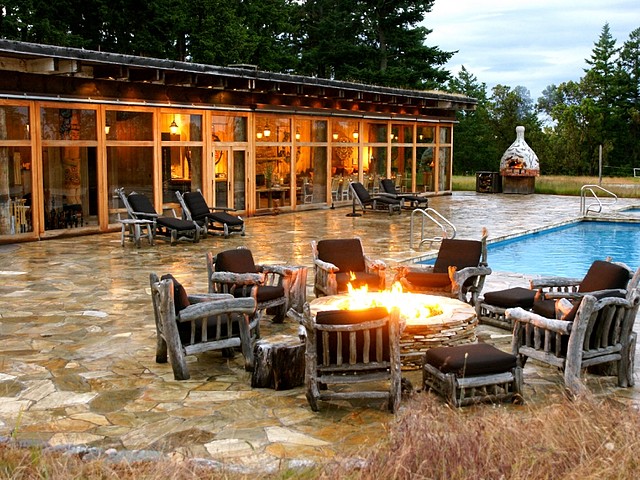
Poets Cove Resort & Marina, Bedwell Harbour. Syrens Marine Pub, Pools and Hot Tub, Laundry Facilities, Tennis Courts, Café and Liquor Store. Closed due to Covid-19: Aurora Restaurant, Susurrus Spa, Kayaks Rentals. Free wifi.
110 deep water slips for boats up to 100′.
Onsite Canada Customs Office. Guests arriving from U.S. waters are required to report directly to Canada Customs before docking at our marina or proceeding on their journey. Canada Customs is located within Bedwell Harbour from May 1 to September 30. American guests will require a Nexus pass from October to May.
Day 4. Beaumont Marine Park to Narvaez Bay, Saturna. 15kms
With another day of windless sunny weather in the forecast, we had another late start. We paddled through the marina of Poet’s Cove Resort into a light SE wind. After rounding Tilly Point, we were again paddling into light current. Minor tidal rapids at Gowiland Point were avoided by paddling out from shore to the inside of Blunden Islet. We crossed Plumper Sound in a diagonal to Taylor Point. Behind the point is a superb sand beach backed by old growth Douglas firs, arbutus and garry oak. Old farmhouse on the point.
Java Islets. Seal haul out and nesting area for glaucous winged gulls, black oystercatcher and puffins.
Monarch Head is a dramatic high cliff. Great erosional patterns in the sandstone occur along the base of the cliff. A 1.5km trail leads from Narvaez Bay.
I had the campsite in Narvaez Bay marked incorrectly on the peninsula beside Echo Bay. As a result we unloaded, but then camped illegally on the edge of the cliff over the cove. It would have been a kilometre walk to the official campsite.
On the way to climbing Monarch Head, we deviated to visit the lovely campground on the bay and met Eric, a 30-ish local out walking his greyhound. Living on the island required several jobs but he self described himself as a troubleshooter for many of the elderly islanders living in homes built without building inspectors. Dressed in full Crawford clan tartan and with long hair, a black bone nose ring and a javalina tooth necklace, he was an imposing guy. We walked to the campground and then back up towards the head before he left to ascend Brown’s Ridge.
Saturna Island is a mountainous island, about 31km2 situated approximately midway between the Lower Mainland of B.C. and Vancouver Island, and is the most easterly of the Gulf Islands. It is surrounded on three sides by the Canada–United States border. To the north is Point Roberts, Washington, and to the east and south are the San Juan Islands. Approximately half of the island is in the Gulf Islands National Park Reserve (GINPR) that was formed in 2003 from a gift of ecologically sensitive land by Ulla Ressner and John Fry, existing provincial parks, an Ecological Reserve, and other Crown land.
There is also a large First Nations reserve on the island. The island has a permanent population of around 350, although that number increases significantly during the busy summer season.
History. The island was first used by indigenous people who called the island “Long Nose,” due to the island’s long north-eastern tapering shoreline that ends at East Point. The name Saturna comes from the Spanish naval schooner Santa Saturnina captained by pilot José María Narváez, that explored the island’s coast in 1791. The name was initially applied only to East Point. The contraction to “Saturna” applied to the whole island was first made by Dionisio Alcalá Galiano in 1792.
The first European settlers came in the 1800s, but the island was slower to develop than the neighbouring Southern Gulf Islands due to its relative isolation and mountainous topography.
Attractions.
East Point is a place popular for onshore whale watching. The resident J, K and L orca pods pass by almost daily in the summer months, with transient orca visiting year round. East Point Day Use Area has a museum inside the old Fog Alarm Building, and sandstone shoreline. East Point is the site where Moby Doll, the first orca ever live-captured for aquarium display, was harpooned in 1964.
Saturna has many species of terrestrial, aerial and aquatic animals. Saturna is a popular destination for geocachers, with approximately 60 caches available on the island. Over half of the island is park, with the majority being the Gulf Islands National Park Reserve (GINPR).
Ferries. Saturna is accessible via BC Ferries, which offers daily sailings from Swartz Bay on Vancouver Island and Tsawwassen on the Mainland to Lyall Harbour on Saturna. Daily floatplane service from Vancouver International Airport and downtown Victoria to Lyall Harbour is available. There are a number of excellent anchorages and moorages for private vessels, including Lyall Harbour Government Wharf. In the high season (June–September), the Saturna Shuttle is available at no cost to visitors.
The national park covers approximately 43% of Saturna Island’s land base. The middle of the island is a large park area that covers land from the valley bottom of Lyall Creek to the plateau of Mt. David and Mt. Elsford to the north and to the plateau of Mount Warburton Pike and Brown Ridge to the south.
Hiking.
Lyall Creek trail 2 km (1 mi) follows one of the only salmon bearing creeks in the Southern Gulf Islands to a waterfall.
Mount Warburton Pike the tallest mountain in the Outer Gulf Islands with a communication tower used by a variety of radio and television services, including Chek TV. From the end of Staples Road, follows the grassy ridgeline for 3.5kms along Brown Ridge at a height of 400 metres overlooking the Taylor Point trail along the southern coast of the island and Plumper Sound, Pender Island and the San Juan Islands. There are some goat trails running along the ridge that can be hiked.
Mount Fischer. The height of land (the 7.8 hectare Ressner-Fry property west of Mount Warburton Pike) is also included within the park, though it is not accessible.
Taylor Point trail is a 9 km (6 mi) trail along coastal bluffs, from the end of Trueworthy Road, past an abandoned sandstone quarry to Taylor Point where there remains the ruins of a settler’s house, constructed of sandstone in 1892.
Narvaez Bay Park area includes several connected hiking trails.
A 1 km (0.6 mi) trail separates the two beaches at Echo Bay and Narvaez Bay campsite in Little Bay. Monarch Head trail. 1.5kms from both bays. Great views to Boundary Pass and the San Juan Islands.
Narvaez Bay campground is only campground within the island’s park boundaries and is accessible by kayak, or from an off-shore anchoring area or by walking in from a parking lot. 7 walk-in (or kayak-in) backcountry campsites that can be reserved. There is no potable water at Narvaez Bay, and no campfires are permitted.
Two private campgrounds, Breezy Bay Bed & Breakfast’s Clifftop Camping and The Lighthouse Pub’s Arbutus Point Campground, offer year-round camping. Neither campground permits fires. Both offer access to potable water.
Day 5. Narvaez Bay to Cabbage Island. 9kms
East Point. This is a short paddle but with a big obstacle at East Point. Tumbo Channel runs east regardless of tide and meets where Boundary Pass meets Georgia Strait. Boiling Point refers to the rips, overfalls and eddies, conditions that are moderate even in calm conditions. Stay next to the shore.
At the end of the northern peninsula is a small park area with a sandstone beach that surrounds the East Point Light Station and Fog Alarm Building with the Boiling Reef just off-shore.
Shell Beach. On the outside of the point. Possible to land.
Tides determine the ETA at Cabbage Island as large mud/sand flats are exposed. Cross Tumbo Channel to Tumbo Island, paddle along the north shore and land to do bits of the 3.5km trail.
Tumbo Island – Cabbage Island. Located off Saturna Island’s northeastern shore, Tumbo Island and Cabbage Island are connected to each other by a reef, exposed at low tide.
Tumbo, 121 ha (299 acres). Named in reference to a tombolo, was acquired by the province in the Pacific Marine Heritage Legacy program from a Californian for $3.7 million with the provision that he was able to keep his cottage and care-taker suite on the west tip of the island. Prior to its use as private property (since 1877) for timber harvesting, coal mining, mink farming, and recreational living, it was used by the Coast Salish people when crossing or working in the strait. Tumbo is only accessible by boats via Reef Harbour and its beach accesses. No campground. Easy 3.5 km loop trail with multiple ocean view opportunities of Cabbage Island across from Reef Harbour and the San Juan Islands, as it wanders through Garry oak, Arbutus and coastal Douglas Fir forest, and marshes. (NOTE: A life tenancy agreement is in place for the house. Please respect the resident’s privacy).
Cabbage Island. 4.5 ha (11 acres). Purchased by the Nature Conservancy from private owners in 1976, was developed as a provincial marine park between 1978 and 2004 with anchorage and moorage areas in Reef Harbour and a campground. Campsites are first come, first serve and are not reservable.
Day 6. Cabbage Island to Beaumont Marine Park, South Pender. 18km via Boat Pass, 24kms via Gorgeson Passage.
Much of this day’s long paddle depends on current – riding the flood to Boat Pass or around Samuel Island and then ebb the rest of the way would be perfect timing.
Boat Pass. Currents to 7 knots. Flood 15 minutes before Active Pass. Ebb 45 minutes before Active Pass.
Winter Cove day use area is the most visited park area on Saturna Island. It surrounds a cove with a sheltered moorage area and a dinghy dock. On land the day use area includes a picnic area and a trail through a variety of landscapes such as forested uplands, open meadows, salt marshes, shell midden, and sandstone beaches, to a viewpoint at Boat Pass at the western end of the park, strong tidal currents providing a shortcut for small boat operators.
Samuel Island. About 328 acres in size, is located between Mayne Island and Saturna Island creating two large tidal channels on each side. The narrow gap of Boat Passage separates it from Saturna Island. Boat Passage is only navigable during slack water by small boats. It is reported that Boat Passage was a favourite escape route for rumrunners during US Prohibition. Named after Surgeon Samuel Campbell of the H.M.S Plumper in 1859. In the 1960’s, there was a very short lived plan to join Mayne Island and Saturna Island with a bridge via Samuel Island. Never happened.
Samuel has had several owners including: a relative of Earl Grey, Governor General of Canada from 1904 to 1911; A.J.T. Taylor, a Vancouver engineer, who developed the British Properties, and the Lions Gate Bridge; also once owned by George Weston, the foodstore magnate; and once owned by Charles A. Lindberg’s daughter, who reportedly paid $48,000 for it circa late 1940’s.
Good beach on outside of NW tip.
Belle Chain Islets. Part of the NP, this group of small islets is off limits. It is possible to land only on Anniversary Islet on the east end of the chain.
Campbell Point (Bennett Bay) on the eastern end of Mayne island, the 10 ha (25 acres) Campbell Point portion was acquired as a private land purchase. There is a 1.5 km (0.9 mi) hiking trail from a sandy beach, suitable for swimming and launching kayaks, to Campbell Point where there are views of Georgeson Island’s old-growth forest on a sandstone ridge. Georgeson Island, along with the seal and sea lion haulouts of the Belle Chain Islets and Anniversary Island, and the small unnamed islands off Samuel Island’s coast, make for a kayak route between Mayne and Saturna islands, within the national park boundaries.
Gorgeson Passage. Pass on either side of Curlew Island – there is more current on the east side.
Mayne Island. Mayne has is probably best as a starting point only; it has little in the way of wilderness. The exceptions are Georgina Point, Deacon Hill, Helen Point and Active Pass. Largely undeveloped land on the part of Mayne paddled by makes for interesting exploration in Horton, Bennett, and Campbell Bays.
There are two national park sites on Mayne Island.
Georgina Point on the island’s northwestern end. The Georgina Point Heritage Park is a 1.5 ha (4 acres) site that looks upon the Strait of Georgia and the entrance of Active Pass. It has been the site of the Active Pass Lighthouse since 1885, though that original light was replaced in 1940 with a lightkeeper’s residence that included a lantern room above, and then in 1969 by an octagonal metal lantern mounted on a cylindrical concrete tower. The light function was also replaced, in 1997, by an automated navigational aid. As the historical structures remain, as well as the active radio building and aeronautical beacon maintained by the Coast Guard, it is listed as a historic place and heritage lighthouse. With the site transferred from Fisheries and Oceans Canada to Parks Canada it was further developed with picnic and washroom facilities.
Active Pass. The narrow and twisting passage combined with high boat traffic (the two large BC ferries between Vancouver and Victoria pass each other in the pass), encourages one to stay well to the sides. Helen Point Is an unoccupied First Nations reserve with a nice beach, while Galiano Island is highly mountainous and scattered with provincial and regional parks along much of the Active Pass Shore.
Plumper Sound. Cross to Razor Point on North Pender.
Day 7. Beaumont Marine Park to Portland Island. 16kms
This was another longer paddle, again with no wind but finally with current at our backs all day, making for a fast paddle.
Moresby Island. The island is 3.7 km long by 2.2 km across, a total land area of 3.22 sq. miles and a peak elevation of 148m, the largest private island in the southern Gulf Islands.
The island was first settled in 1863. It was named for Rear Admiral Fairfax Moresby R.N., who was the naval commander-in-chief of the Pacific Station of the Royal Navy between 1850 and 1853, as was also Fairfax Point at the island’s southern tip. During the 1880s, land was cleared by Capt. H. J. Robertson, then owner, and had extensive apple orchards and vegetable gardens that supplied produce to Vancouver and Victoria grocery stores. It has a very rich history, including a ghost story, the remains of a long-gone mansion, and evidence of First Nations people using the island as a resting place when traveling.
It has had several other interesting owners. One was Merchant in China, who returned to Canada, and had a reputation for mistreating his Chinese servants. Between 1909 and 1914, it was owned by a Lt. Governor of British Columbia. In 1910, a dairy farm was established on Moresby Island. In 1940, the island again changed hands.

The island has been logged three times by separate Chinese logging companies. The evidence of this logging is nearly gone, traces of the trails built for the machines can still be found.
A Hong Kong-based family that bought the island in the 1990s put the property on the market last summer for $50 million. It is currently a privately owned island, has a three-bedroom residence occupied by a caretaker who manages a 60-hectare farm with about 120 head of beef cattle, along with a few horses and sheep. There is a sheltered dock, a barn, storage sheds, a fresh water supply and power supplied by a diesel generator. The island is not open to the general public. Its current population is 3 persons.
Portland Island. This 575 ha (1,421 acres) island is located at the northern end of Haro Strait – west of Moresby Island, off the south tip of Saltspring Island, adjacent to the main BC Ferries route just offshore from the terminal at Swartz Bay at the tip of the Saanich Peninsula. It was named after HMS Portland, the flagship of Rear-Admiral Fairfax Moresby, Commander in Chief of the Pacific Station 1850–1853.
Portland Island is separated from North Pender Island to the northeast by Swanson Passage, Moresby Island by Moresby Passage to the east, Piers Island and Coal Island to the southeast by Shute Passage, and Saltspring Island to the west and north by Satellite Channel. It is accessible by private watercraft only. Dinghy docks are available at Princess Bay and Royal Cove.
History. Archaeological sites in the form of midden deposits remain on Portland Island from a long-abandoned First Nation village. Similarly, evidence remains of its use as a private island, including agricultural development and logging, though it reverted to the provincial government after the owner’s bankruptcy in the Great Depression. The island was given to Princess Margaret to commemorate her 1958 visit to British Columbia and she donated it back to the province for park purposes in 1967. The province subsequently operated it as the Princess Margaret Marine Park with anchorages, an artificial reef suitable for scuba diving, hiking trails around the island and three campgrounds with pit toilets but no potable water, until it was transferred to Parks Canada.
Campsites. Total of 24 marine-accessible backcountry campsites: 6 sites at Shell Beach, 12 sites at Princess Bay, and 6 sites at Arbutus Point. Facilities on Portland are limited to pit toilets and no campfires are permitted.]
Hiking. A 6.5-kilometre (4 mi) loop trail follows the shoreline of Portland Island, and is accessible from any of the three camping areas. This hike requires approximately three hours to complete, but can be shortened to about one hour by taking one of the cross-island forest trails.
Brackman Island was an ecological reserve prior to its inclusion into the national park as a Special Preservation Area.
There are two islands part of Gulf Islands NP that are north of Portland Island and included here for completeness sake.
Prevost Island
There are two park areas on Prevost Island. The north park site, acquired by private land purchases, extends from Peile Point around James Bay to Selby Cove, though the land on Selby Point remains privately owned. There is a campground, with a pit toilet but no potable water, on the shores of James Bay with a hiking trail to and Selby Cove. While the camping is suitable for kayakers, there are anchorage areas in James Bay and Selby Cove for boaters. On the east end of the island, the park site extends from Portlock Point around Richardson Bay to the Bright and Red Islets. This site includes the Portlock Point Lighthouse and a beach access but no campground. Between these two park sites, the national park also includes the small area of Hawkins Island off the northern coast of Prevost Island.
Russell Island
Located in the Satellite Channel off the southern coast of Salt Spring Island, Russell Island includes an anchorage area and a small dock with a 1 km (0.6 mi) loop trail for recreational use. As a cultural heritage sites, there is a foreshore clam garden developed by First Nations people and the Mahoi House developed when Russell Island was a private island owned by a Native Hawaiian family between 1886 and 1959 (and also inhabited by subsequent owner). It remained a private island until 1997 when it was purchased in the Pacific Marine Heritage Legacy program for park purposes.
A 1km loop trail goes around the island. A spur off the loop leads to one of the last surviving Hawaiian homesteads in the region. The historic house dates back over a century.
Day 8. Portland Island to Island View Beach. 18kms
Despite a wind warning with gales on the west coast and northwesterly winds to 15knots, the day was little different than the previous with sunny, relatively calm weather. The minimal breeze was from the south.
Piers Island was our view from Shell Beach on Portland. We paddled Stranger Passage between Knapp and Pym Islands marvelling at the large homes. I had a nice view of the Swartz Bay ferry terminal. A mammoth 8000 ft2 home was being constructed on Curfeis Point. We continued south next to the mainland of the Saanich Peninsula looking at all the great homes on the water. We ventured into the Port of Sydney but there was nothing for kayakers. Just after was a small beach that gave access to downtown Sidney. I had lunch. It was then a long paddle back to Island View Beach and my truck (which had neither been towed nor broken into).
Piers Island is located south of Salt Spring Island, near Portland Island. Piers is 97 hectares in size, and is named after Henry Piers, a British Royal Navy surgeon on the H.M.S. Satellite, who served on the coast between 1857 and 1860.
Between 1932 and July of 1935, Piers was a special prison camp for the Doukhobor. The inmate population reached a high of 570. Doukhobor means “Spirit Wrestlers”, and is the name of a sect of Russian Christians, whom date back to the 18th Century. They are known for their pacifism, and an austere communal lifestyle. The first Doukhobors arrived in Canada in 1899, making their way to British Columbia in 1908. Today, there are about 15,000 Doukhobors in British Columbia.
Today, Piers Island has many residential homes on it, and is well named as the island is surrounded by the piers of its residents.
Knapp Island. The natural course from Portland island to Sydney is via Stranger Pass between Knapp and Pym. Knapp has an equally large house on the south point with a large boat behind a breakwater on the east.
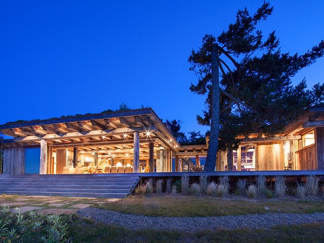
Pym is located between Portland Island and the Saanich Peninsula of Vancouver Island. Named after Lieutenant Frederick Whiteford Pym, Royal Navy. Pym was a mate on the Artic exploring vessel Assistance under the command of Captain Sir Edward Belcher. The Assistance accompanied Captain Richards in the polar regions in search of Sir John Franklin 1852-1854. The Assistance had to be abandoned after being trapped in ice. The crew returned home on other vessels in 1854. Island named by Captain Richards, H.M.S Plumper, circa 1858. Pym Island is 5 acres with easy care landscaping, meadow areas, stands of majestic Fir, Cedar plus Arbutus and Garry Oak groves. The exceptional 9,143 sq ft, 4 bedroom, 4 bath, custom home is on sale for $5,988,000.. The home offers entertainment size living room, formal dining, library, games room, his & hers masters with study and ensuites, a cook’s kitchen, breakfast room off, self-contained guest wing (or nanny suite?), atrium feature, marble floors, soaring ceiling treatments and indoor Pool
 There are 4 separate guest cottages, tennis court, caretaker’s residence, a “lake”, lowbank foreshore with lovely swimming cove. Dock is in place — arrive by floatplane or by private boat. The Island is connected to power, via cable from Canoe Cove, near Sidney, and also has a back up generator system.
  Coal Island. Private. No info available.
Goudge Island. The 13-ha island was farmed in the 19th century by Tom Kamaree, a Hawaiian Islander or Kanaka, who received a Crown grant for it and adjacent Fernie I in 1889. Goudge and Fernie were owned for many years by Nelson Paul Whittier (1904–91), a fabulously wealthy California oil tycoon.
Sidney (pop 11,583). Sidney is located just east of Victoria International Airport, and about 6 km (4 mi) south of BC Ferries’ Swartz Bay Terminal. The town is also the only Canadian port-of-call in the Washington State Ferries system, with ferries running from Sidney to the San Juan Islands and Anacortes. Sidney is located along Highway 17, which bisects the town from north to south. It is generally considered part of the Victoria metropolitan area.
The majority of the town is located east of Highway 17. There is a large boating and marine industry in the area, ranging from marinas to boatbuilders and marine suppliers.
Sidney takes its name from nearby Sidney Island. In 1859 Captain Richards named that island for Frederick W. Sidney, who, like Richards served in the survey branch of the Royal Navy.
James Island. It lies in Haro Strait between Sidney Island and 2.4kms from the coast of Vancouver Island near Sidney. it is 145 km from Seattle, Washington. It is 145 metres (476 feet) above sea level at its highest point,[1] and has a total land-mass of 315 hectares (780 acres) in size. There are sea-cliffs on the Southern, Western, and Eastern shores of this island.
The island was “Named by the early settlers, circa 1853, after … James Douglas …”. Douglas was a chief factor of the Hudson’s Bay Company and was second governor of the Colony of Vancouver Island.
History. Within the traditional territory of the Tsawout First Nation, it is not within a Douglas Treaty area. In the early 1900s, the island was used as a private hunting ground for Victoria sportsmen including then British Columbia Premier Richard McBride, (1903-1915). In 1913 a dynamite plant was established on the island. The plant was owned by a company that merged into Canadian Explosives Ltd, which in turn changed its name to Canadian Industries Limited (CIL) in 1927. From the outset of World War II, the plant was operated by Defence Industries Ltd, a subsidiary of CIL. The plant, and many of its workers’ cottages, had been moved to the island from Nanaimo. At its peak, the plant employed 800 people, most of whom lived in a small, traffic-free village on the opposite end of the island. During World War II, the plant produced 900 tonnes (990 short tons) of TNT per month. The TNT plant closed in 1977, and it and the village were disassembled and removed from the island in 1979. The island has literally miles of white sand beaches, grassy dunes [and] a diverse ecology.
James Island was purchased by Craig McCaw in 1994 for $19 million. He is a Seattle-based U.S. telecommunications exec and billionaire who formed the wireless business that would grow into U.S. giant AT&T Wireless among other successful endeavours in the U.S. mobile business dating back to the early 1990s. He now sits on several boards, and mostly spends money. In 2012, he bought the most expensive car on record, a 1962 Ferrari 250 GTO for $35 million. McCaw, said to be a deeply private individual, purchased the island in 1994 for $26 million.
The island was the property with the highest assessed value in the Capital Regional District in 2009, at almost $76 million. It appears he tried to sell the property in 2012 and 2014, but failed to find a buyer. It is reportedly no longer for sale. Since then there was repeated legal action taken against ICI (formerly CIL) as the new owner was unable to turn over the property to residential use as per his intention due to its industrial history, a status which had been well-documented as of the sale. Recent luxury resort development on the island includes a 5000 square food personal residence, six guest cottages, private docks, yacht moorage, an airstrip, seaplane ramp, pool house and manager’s residence. And a Jack Nicklaus-designed golf course.
McCaw has reportedly established an environmental regime on James Island where insecticides are not allowed, power lines are underground and electric cars and golf carts are used for transportation.
After finishing the trip, it felt surreal that we had just paddled for a week in possibly the best kayaking destination in the world and saw virtually no one. The weather was perfect with hardly a breath of wind and hot and sunny days. All 7 campsites were used on the first Friday night on D’Arcy Island. After that, we had one other camper at two campsites and none at any of the other four.
This is despite being within 100 kilometres of 2 million people. As the crow flies, the distance to English Bay in Vancouver was 78kms from our put in at Island View Beach and 58kms from Narvaez Bay on Saturna.
